The India notebooks
India, read as many landscapes.
A nationwide atlas of states and union territories, built around geography, season, movement, living culture and the practical decisions that shape a respectful journey.
- States
- 28
- Union territories
- 8
- Curated places
- 442
How to use this atlas
Choose a region first. Let distance, season and pace shape the route.
India is too geographically and culturally varied for one national checklist. The atlas begins with complete administrative coverage, then opens each state or territory through a carefully selected mix of cities, landscapes, heritage, nature, craft, sacred places and everyday regional character.
These notebooks provide durable context rather than live operating promises. Weather, permits, closures, transport and local rules can change. Each regional page identifies those boundaries and asks readers to confirm material details through the relevant local or official channel before travel.
Regional collection 01
North India
9 states and territories
 CH
CHUnion territory · Chandigarh
Chandigarh
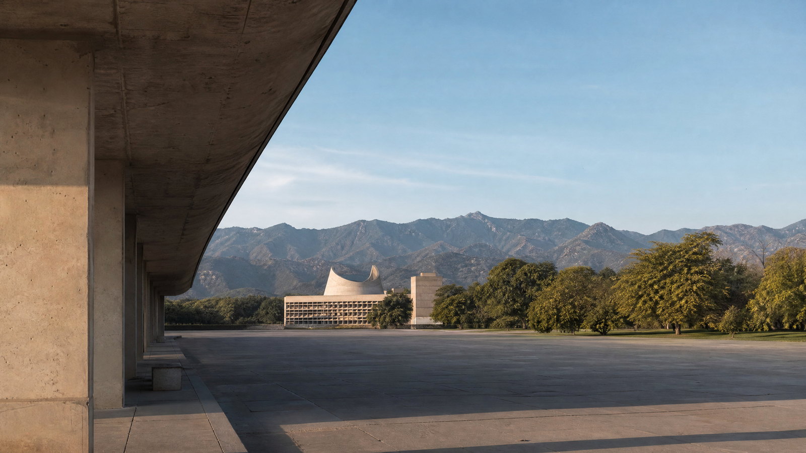
Chandigarh is India’s compact Union Territory and the shared capital of Punjab and Haryana, set where the Shivalik foothills meet the northern plains. It is unusually legible as a destination: a mid-twentieth-century planned city whose sector grid, shaded avenues, gardens, civic precincts and cultural institutions form one connected urban landscape. The Capitol Complex offers the monumental, civic scale of Le Corbusier’s plan; Sector 17 and the Leisure Valley show its everyday pedestrian and green-space logic; and the Rock Garden gives the city a more improvised, handmade counterpoint. Sukhna Lake, the forested sanctuary and Sarangpur Botanical Garden widen the visit from architecture into water, bird habitat and the fragile foothill edge. Chandigarh works especially well for a two- or three-day, low-transfer itinerary built around walking and short local rides. It is not a hill station or a vast historic city: summer heat, monsoon downpours and access controls at protected areas shape the experience. The most rewarding approach is to pair architecture and museums with gardens and the lake, while leaving space for the city’s lived public realm.
 DL
DLUnion territory · New Delhi
Delhi
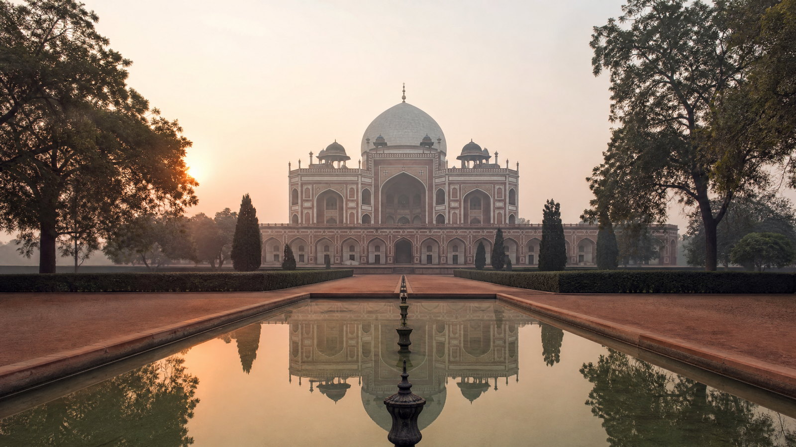
Delhi is India’s National Capital Territory, a dense metropolis where imperial capitals, colonial planning, national institutions and living neighbourhoods share a compact plain. Its strongest visit is a sequence of contrasting districts: early Indo-Islamic stonework at Mehrauli; Mughal Shahjahanabad; the garden-tomb and Sufi precinct at Nizamuddin; and the ordered avenues of New Delhi. Ridge woodland and restored Yamuna floodplain parks offer ecological counterpoints, though not wilderness. Delhi rewards unhurried mornings, short district-based days and indoor pauses between monuments. Its heat, monsoon disruption, traffic and seasonal air quality make realistic pacing more valuable than trying to cover the territory in one sweep. It is a capital experienced through layers, not a single cityscape.
 HR
HRState · Chandigarh (shared capital with Punjab; a Union Territory)
Haryana
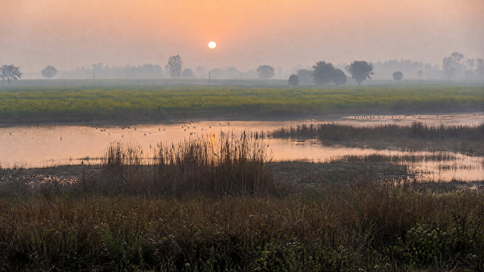
Haryana is a varied North Indian state where the Delhi metropolitan edge, irrigated plains, old battle corridors, Shivalik foothills, Aravalli scrub and bird-rich wetlands meet. Its shared capital, Chandigarh, sits outside the state as a Union Territory, while Gurugram, Faridabad, Panchkula, Kurukshetra, Panipat, Hisar and Rewari reveal different travel rhythms. It suits travellers who value cultural landscapes over a single landmark: Harappan mounds at Rakhigarhi, Sultanate architecture in Hisar and Narnaul, Kurukshetra’s sacred geography, Pinjore’s Mughal-style gardens, and winter waterbird habitat near Delhi. The essential trade-off is seasonal and spatial. Winter supports wetland watching and outdoor days; late monsoon freshens the hills but can complicate roads; summer heat narrows daytime exploration. Build an itinerary around one corridor rather than treating the state as a quick detour, and let sacred sites, museums and protected areas set the pace.
 HP
HPState · Shimla
Himachal Pradesh
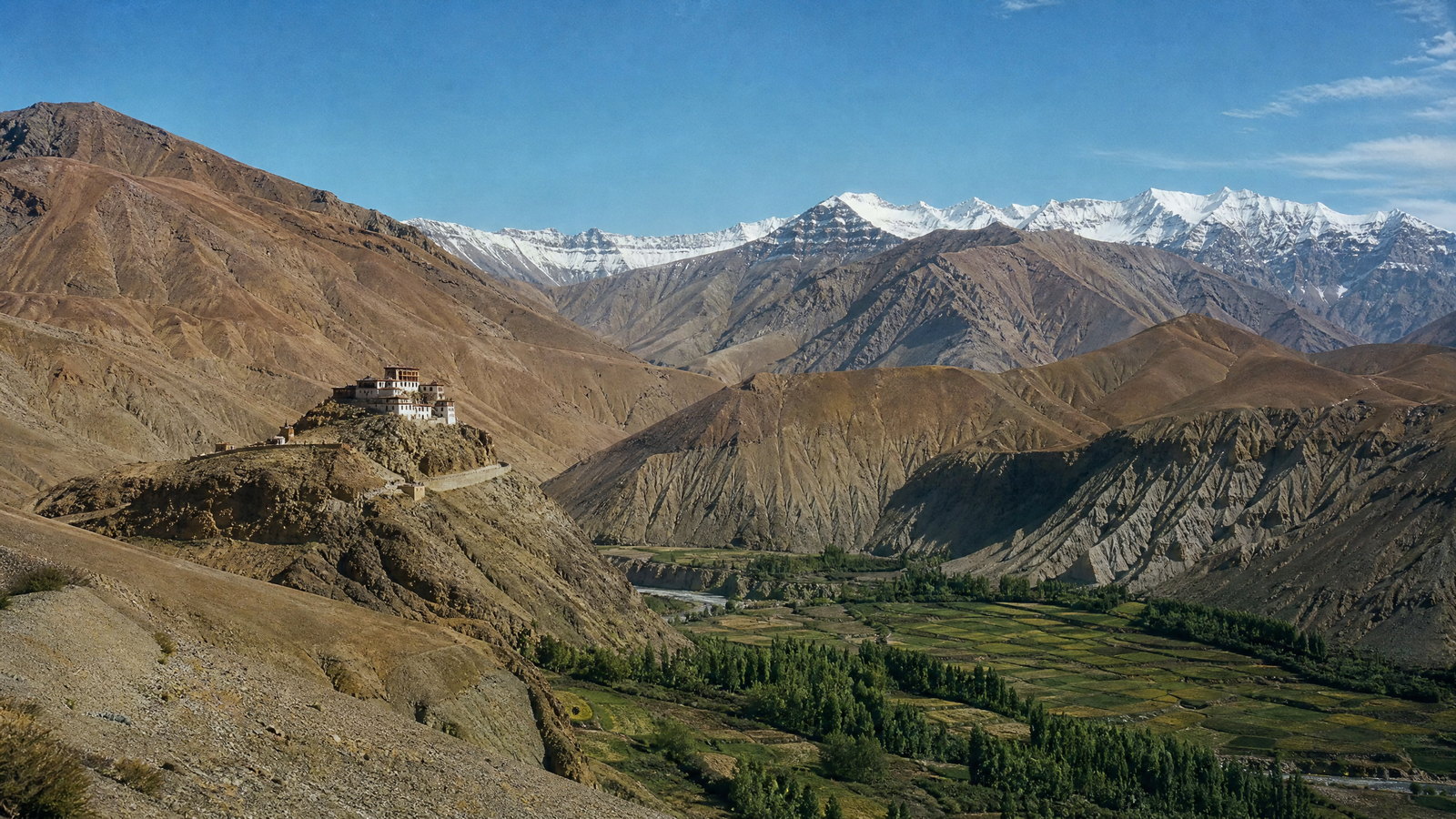
Himachal Pradesh is a mountain state of sharp contrasts: subtropical Shivalik foothills, cedar valleys, orchard country, historic hill towns, trans-Himalayan cold desert and high glacial catchments. Shimla provides the civic and rail heritage entry point; Kangra and Chamba reward slower cultural travel; Kullu, Kinnaur and Lahaul–Spiti require more time and flexibility. The Sutlej, Beas, Ravi and Parbati link landscapes that otherwise feel distinct. Travel decisions should begin with altitude, season and road resilience rather than a checklist. Spring and autumn often balance visibility and access in the middle hills, while winter birding at Pong and summer in the high valleys follow different calendars. Mountain weather, snow, rainfall, landslides and maintenance can change plans quickly. This selection is a considered introduction, not a complete inventory of the state’s places. It is best experienced through one or two carefully chosen valleys, with room to pause, walk, and revise plans responsibly.
 JK
JKUnion territory · Srinagar (summer); Jammu (winter)
Jammu and Kashmir
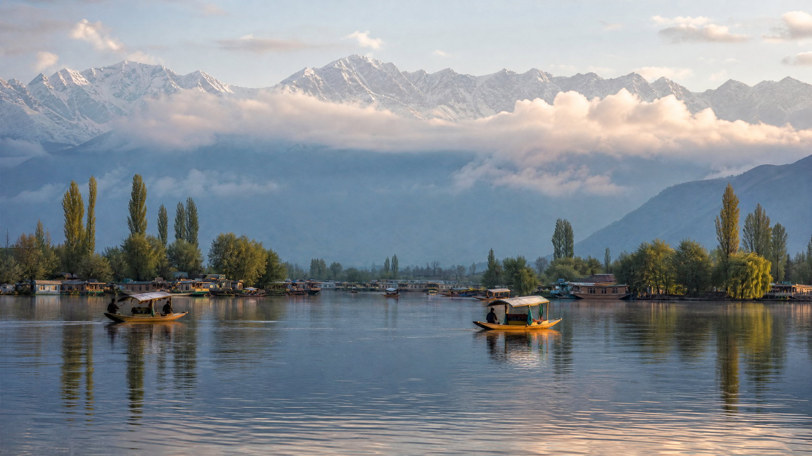
Jammu and Kashmir is a high-contrast Himalayan union territory where lake-and-garden Srinagar, the pastoral Kashmir Valley, Pir Panjal mountains and warmer Jammu foothills make very different journeys. Srinagar is the summer capital and Jammu the winter capital, reflecting movement from subtropical plains through Shivalik ridges to temperate valleys and high mountains. The Jhelum, Chenab and Ravi shape its drainage; lakes, forests, meadows, pilgrimage routes and Dogra-era heritage broaden an itinerary beyond one valley circuit. Kashmiri crafts, literary and musical traditions and living religious landscapes sit alongside Jammu’s Dogri culture. A trip can shift in a few hours from urban water lanes and formal gardens to a forested national park, a high meadow or a busy shrine route. Weather, conservation rules, crowd management and road conditions need flexible pacing. Give each landscape adequate time, respect local rhythms, and plan around seasonal realities rather than promises. This is a considered selection of signature places, not an exhaustive directory.
 LA
LAUnion territory · Leh and Kargil (joint capitals)
Ladakh
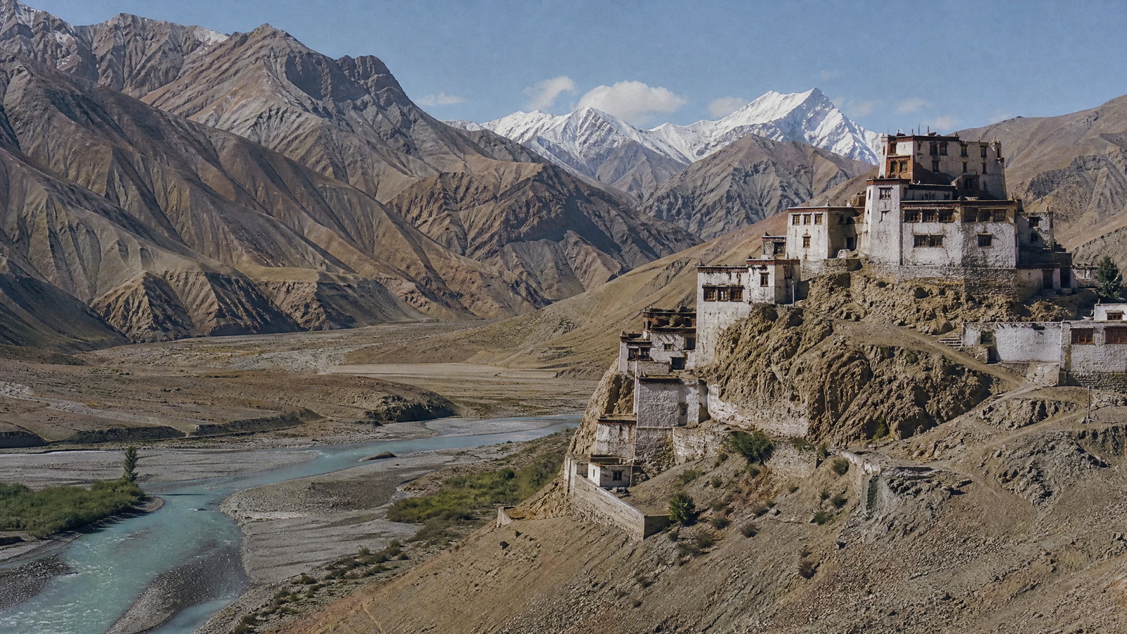
Ladakh is India’s high-altitude trans-Himalayan union territory: a cold desert of Indus-side settlements, plateaux, glaciated ranges and local cultures. Its joint capitals, Leh and Kargil, anchor travel geographies. Leh is the practical base for the Indus Valley, Nubra and Changthang; Kargil opens western valleys, Suru and Zanskar. Living monasteries, trade landscapes, wetlands and mountain towns bring variety. The trade-off is remoteness: altitude affects itineraries, services thin beyond towns, and weather or roads reshape plans. Acclimatise in Leh or Kargil, choose one or two landscape systems rather than every lake and pass, and leave contingency time. This is an introduction, not a Ladakh inventory.
 PB
PBState · Chandigarh
Punjab
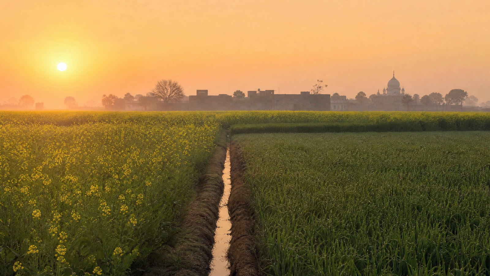
Punjab is a northwestern state where cultivated plains, riverine wetlands, historic towns and the Shivalik foothills meet within short but meaningful travel distances. Chandigarh is its capital, though it is a separate Union Territory shared with Haryana; Amritsar, Ludhiana, Jalandhar, Patiala and Anandpur Sahib are key visitor centres. A route can move from the Amrit Sarovar to royal-era murals, Partition memory, winter bird habitat and farming landscapes shaped by canals and the Green Revolution. The strongest itineraries preserve this range: Amritsar is dense and emotionally charged; the southwest is hotter and drier; the northeast is greener and hillier. October through March is usually the most forgiving travel window, but winter fog, festival crowds and changing local arrangements demand flexibility.
 UP
UPState · Lucknow
Uttar Pradesh
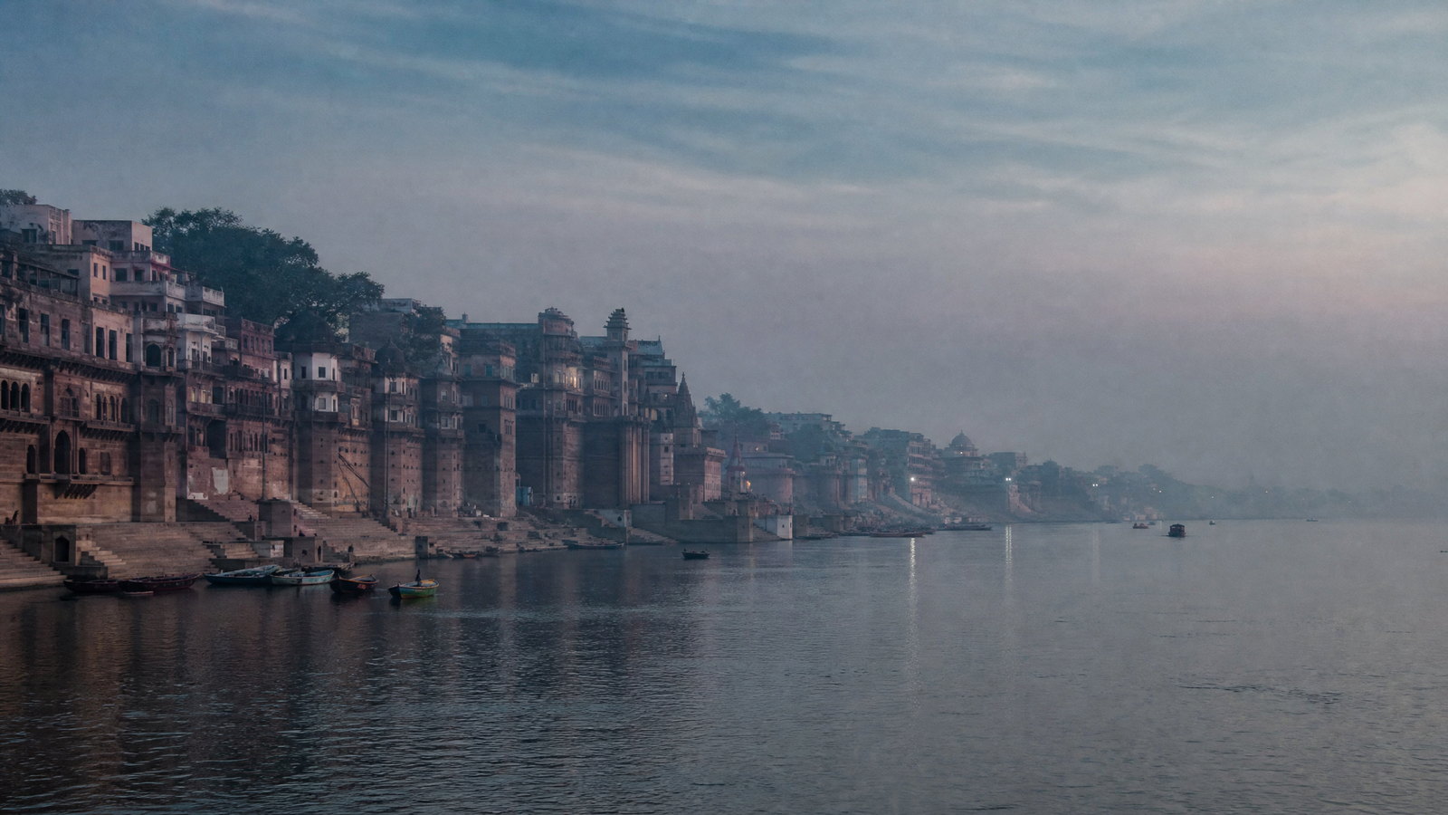
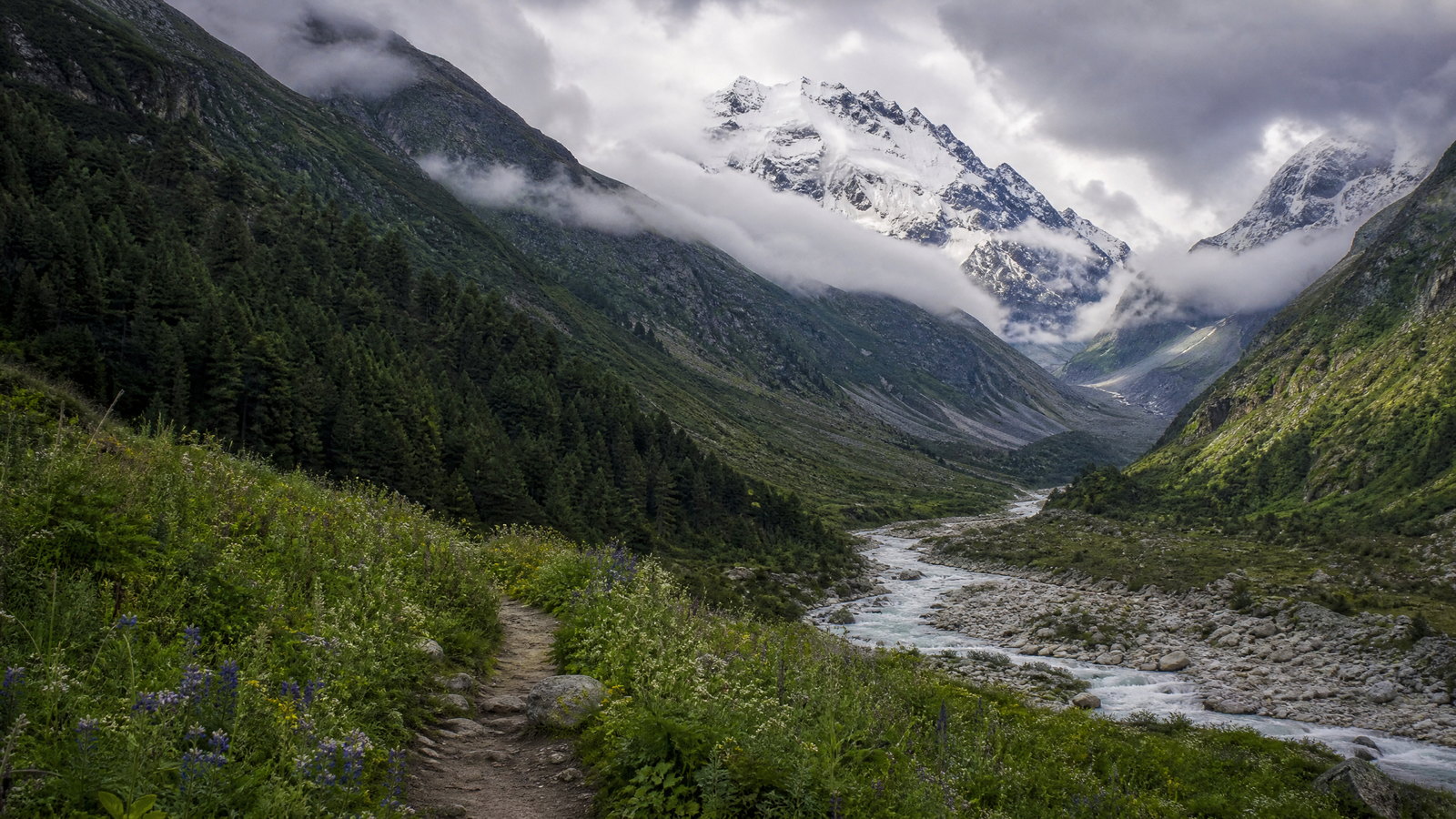
Uttar Pradesh is a vast North Indian state where the Ganga–Yamuna plain holds some of the subcontinent’s most consequential religious, artistic and political landscapes. Its travel geography is not one experience: westward, Agra and Fatehpur Sikri concentrate Mughal imperial architecture; Braj connects Mathura and Vrindavan through Krishna devotion; Lucknow frames Awadhi urban culture; and the east gathers the riverfront intensity of Varanasi, the Buddhist pilgrimage landscape of Sarnath, Ayodhya and Prayagraj. North along the Nepal border, the Terai opens into sal forest, grassland and wetlands, while the south shifts toward the stonier Bundelkhand uplands around Jhansi. This scale rewards selective itineraries rather than a rushed circuit. Winter is the clearest broad travel window, yet fog can disrupt movement, major ritual dates reshape city access, and summer heat changes what is comfortable outdoors. Choose one or two regional clusters, allow room for river, rail and crowd variability, and approach active places of worship and wildlife habitats with patience.
 UK
UKState · Dehradun
Uttarakhand
Uttarakhand is a Himalayan state where a short journey can move from the sal forests and river plains of the Doon Valley to pilgrimage towns, lake-country Kumaon, and glacier-fed Garhwal. Dehradun is the administrative capital and a practical gateway, while Haridwar and Rishikesh anchor the lower Ganga’s living religious and wellness traditions. Higher up, roads and foot routes lead to seasonal shrine towns, alpine meadows, protected forests and one of India’s most dramatic high-mountain landscapes. This atlas selection is deliberately varied rather than exhaustive: it pairs crowded, accessible cultural centres with quieter heritage, wetland and mountain settings. The central trade-off is time and certainty. A lowland or foothill itinerary can be compact and comparatively flexible; high Himalayan travel needs spare days, conservative pacing and readiness for weather or road changes. Choose one geographic arc well rather than treating the state as a single drive-through destination.
Regional collection 02
Northeast India
8 states and territories
 AR
ARState · Itanagar
Arunachal Pradesh
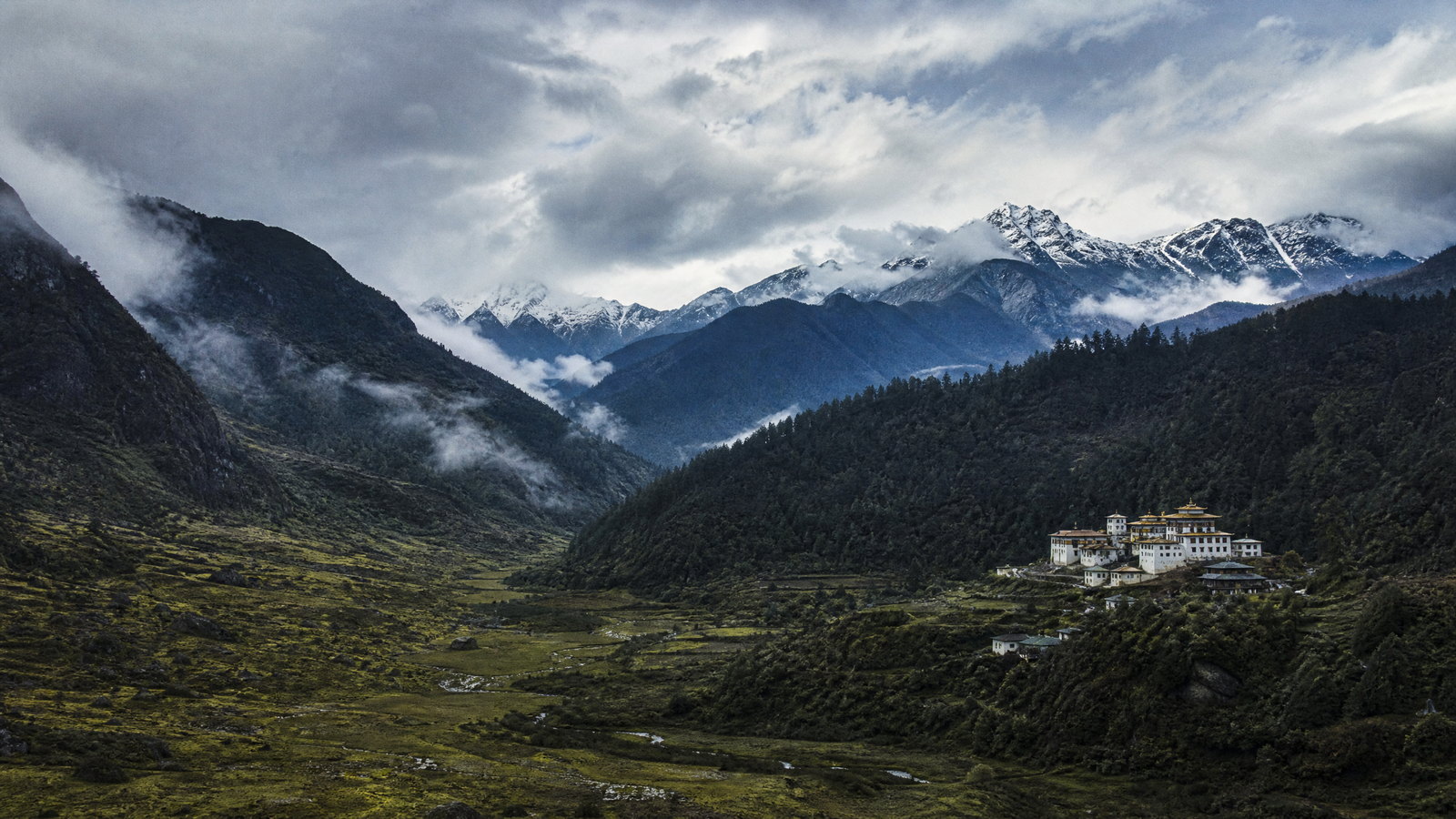
Arunachal Pradesh is a vast eastern Himalayan state where itineraries are shaped less by straight-line distance than by river valleys, mountain weather and respectful access to many living cultures. Itanagar provides the most practical urban start, while the west layers Monpa Buddhist settlements, high passes and alpine lakes around Tawang. Central valleys pair Apatani wet-rice landscapes at Ziro with Galo and Adi river country around Aalo and Pasighat. Farther east, Tai Khamti Buddhist places, Idu Mishmi landscapes and exceptionally biodiverse forests shift the experience again. The best journeys choose one or two corridors rather than attempting the whole state, keep buffer days, and treat villages, monasteries, fields and protected habitats as places with their own rhythms rather than scenic backdrops.
 AS
ASState · Dispur
Assam
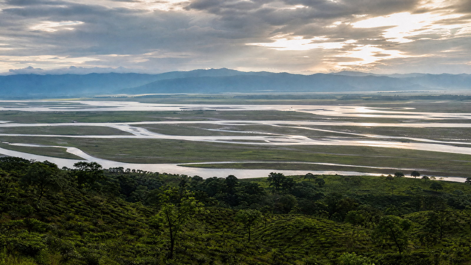
Assam is a river-shaped state where the Brahmaputra floodplain meets Himalayan foothills, tea country, ancient capitals and living religious traditions. Dispur is the administrative capital; Guwahati is the main urban and transport gateway. A first journey can combine Kaziranga grasslands, Majuli’s river-island culture and Ahom monuments around Sivasagar. With more time, routes extend west to Manas or east to rainforests, wetlands and Dima Hasao’s uplands. These places are not interchangeable: river crossings, rain, wildlife management and road conditions can reset a schedule. Build in buffers, use local guidance in protected areas, and treat monasteries, shrines, craft workshops and villages as lived places. This selective signature itinerary is designed to show regional range, not to be exhaustive. The strongest trips choose a few connected landscapes rather than attempting the entire state at speed, leaving time for weather, slow observation and conversations that turn a route into a meaningful encounter.
 MN
MNState · Imphal
Manipur
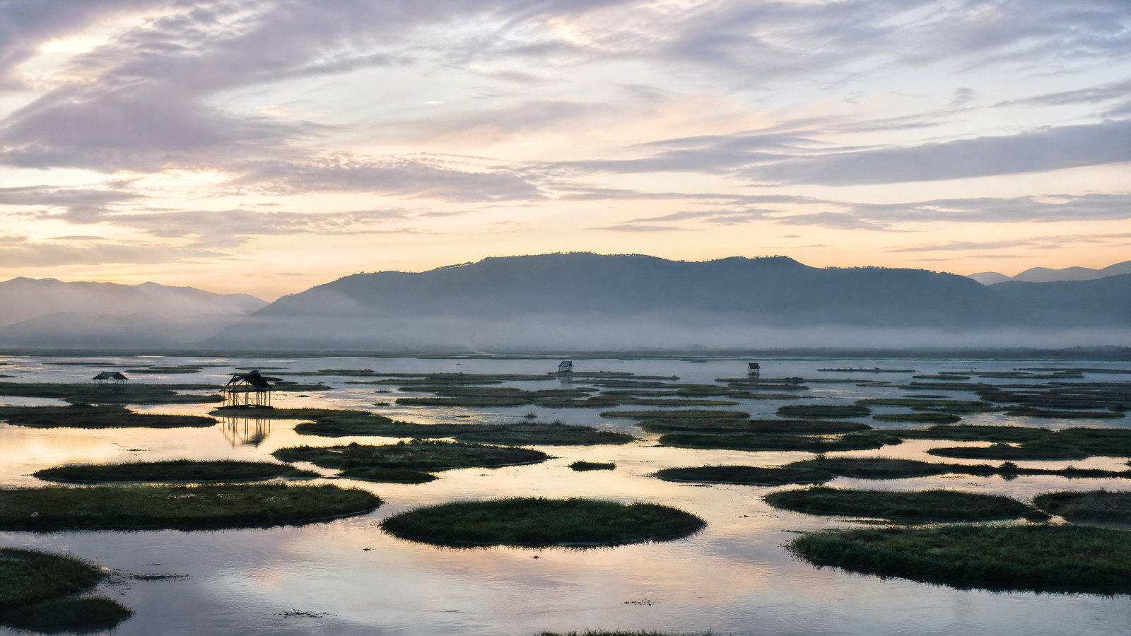
Manipur is a highland-and-valley state in India’s northeast, organised around the Imphal valley and ringed by forested hills. Its strongest journeys pair the capital’s layered civic and royal heritage with the living wetland of Loktak, then add one hill district rather than rushing across the map. Imphal offers Kangla, the women-run Ima Keithel and Vaishnavite ritual space; Bishnupur adds Moirang’s independence-era memory and the phumdi landscape that sustains the Sangai. Eastward, Ukhrul brings Tangkhul cultural landscapes, a seasonal endemic lily, caves and black pottery; western routes lead to caves, lakes, meadows and rivers around Tamenglong. The trade-off is time: roads cross steep, rain-sensitive terrain and local conditions can alter plans. Give priority to verified access, community consent and an unhurried pace. Manipur rewards travellers who treat its diverse communities, sacred places and fragile habitats as living places rather than backdrops.
 ML
MLState · Shillong
Meghalaya
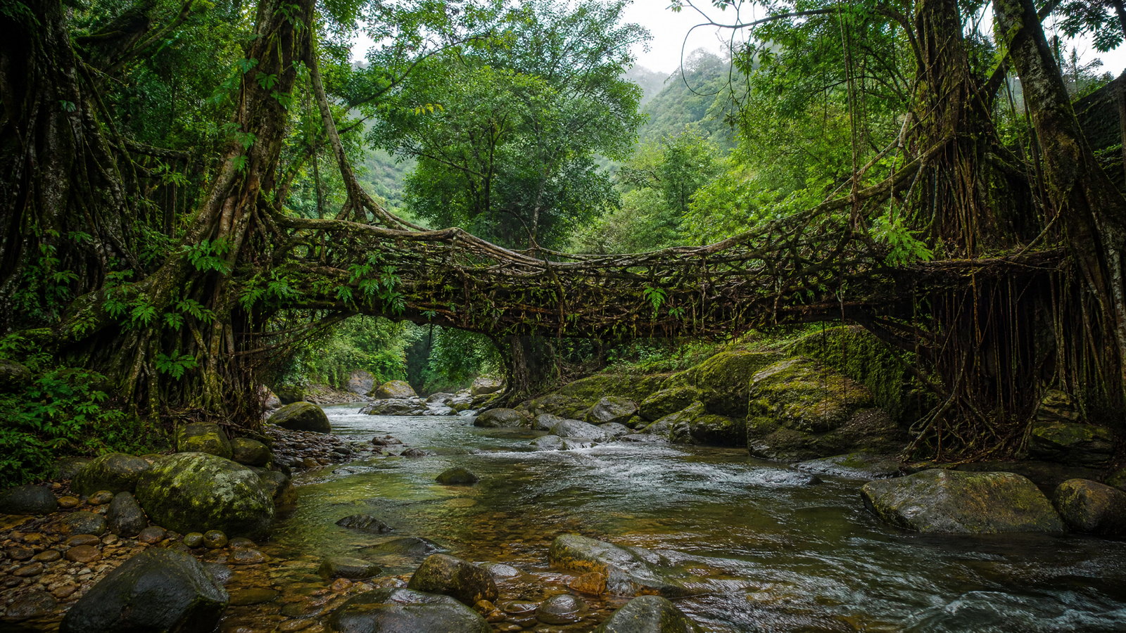
Meghalaya is a high-rainfall hill state in Northeast India where weather and community stewardship shape travel as much as distance. Shillong is the urban base; the Khasi Hills hold Sohra’s escarpments, root-bridge valleys and sacred groves; the Jaintia Hills combine rivers, falls and megaliths; and the Garo Hills reward longer journeys with forests, caves and protected landscapes. A short road can be slowed by cloud, wet surfaces or a long descent, while a village landscape may be culturally significant as well as beautiful. Plan one hill circuit at a time, use local knowledge where terrain calls for it, and accept that rain, river levels and conservation controls can change the day. Shillong is the administrative capital.
 MZ
MZState · Aizawl
Mizoram
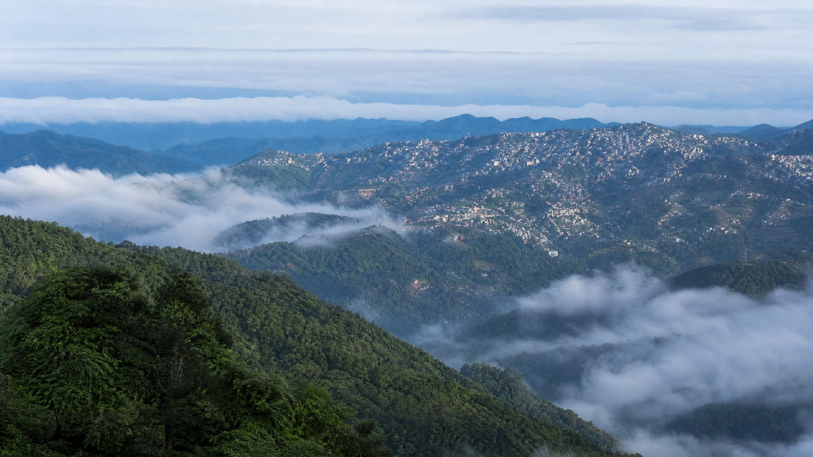
Mizoram is a time-intensive hill state at India’s southeastern edge, where roads follow ridges, bamboo-rich forest meets protected highlands, and valleys hold small settlements. Aizawl is the practical base and clearest urban window on contemporary Mizo life; the east and south reward slower travel with Champhai’s cultivated valley, Vangchhia’s carved stones, Blue Mountain country and Palak Lake. The west offers rainforest-scale Dampa, while Hmuifang, Reiek, Tam Dil and Vantawng are strong extensions from the capital. Long overland days, rain-sensitive roads and conservation rules make this a place to explore by clusters, not checklists. Give village, church and forest settings the quiet consideration expected of a guest. Its rewards are unhurried ridge views, attentive cultural landscapes, and a grounded sense of the forests and communities that shape the state. Plan for two or three compatible clusters, retain weather buffers, and confirm changing access before departure.
 NL
NLState · Kohima
Nagaland
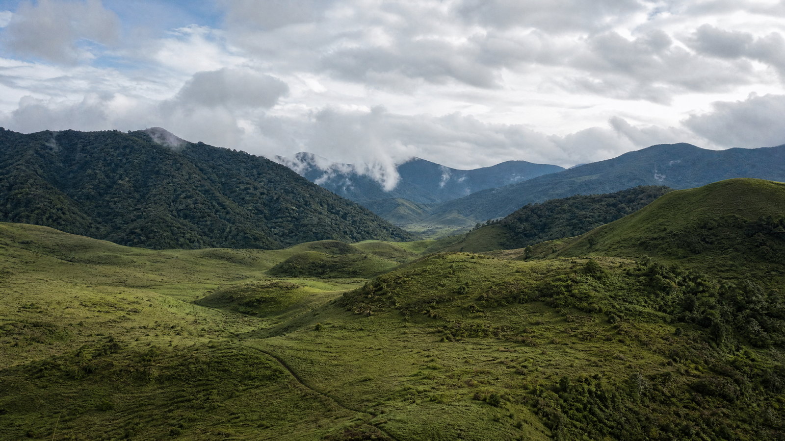
Nagaland is a compact but topographically demanding hill state on India’s eastern frontier, where routes between valleys matter as much as map distance. Kohima, the capital, is a useful cultural and historical base; Dimapur is the principal lowland transport gateway. Beyond them, the state opens into markedly different Naga homelands: Angami terraced country around Kohima, Ao villages above Mokokchung, Konyak settlements in Mon, Lotha landscapes around Wokha, and the far-eastern forests beneath Mount Saramati. It is a cross-section of war memory, vernacular architecture, village-led conservation, craft, reservoir birdlife, rainforest, and high mountain terrain. The strongest trip is usually unhurried and regional rather than a rapid circuit. Kohima and its nearby cultural landscapes suit first visits and short breaks; Doyang adds a seasonal wildlife focus; Mokokchung and Mon reward time for community context; Kiphire is for prepared mountain travellers. Roads, rain, festivals, village protocols, and entry requirements can reshape plans. Build spare time, use locally current advice, and approach each community as a living place rather than a backdrop.
 SK
SKState · Gangtok
Sikkim
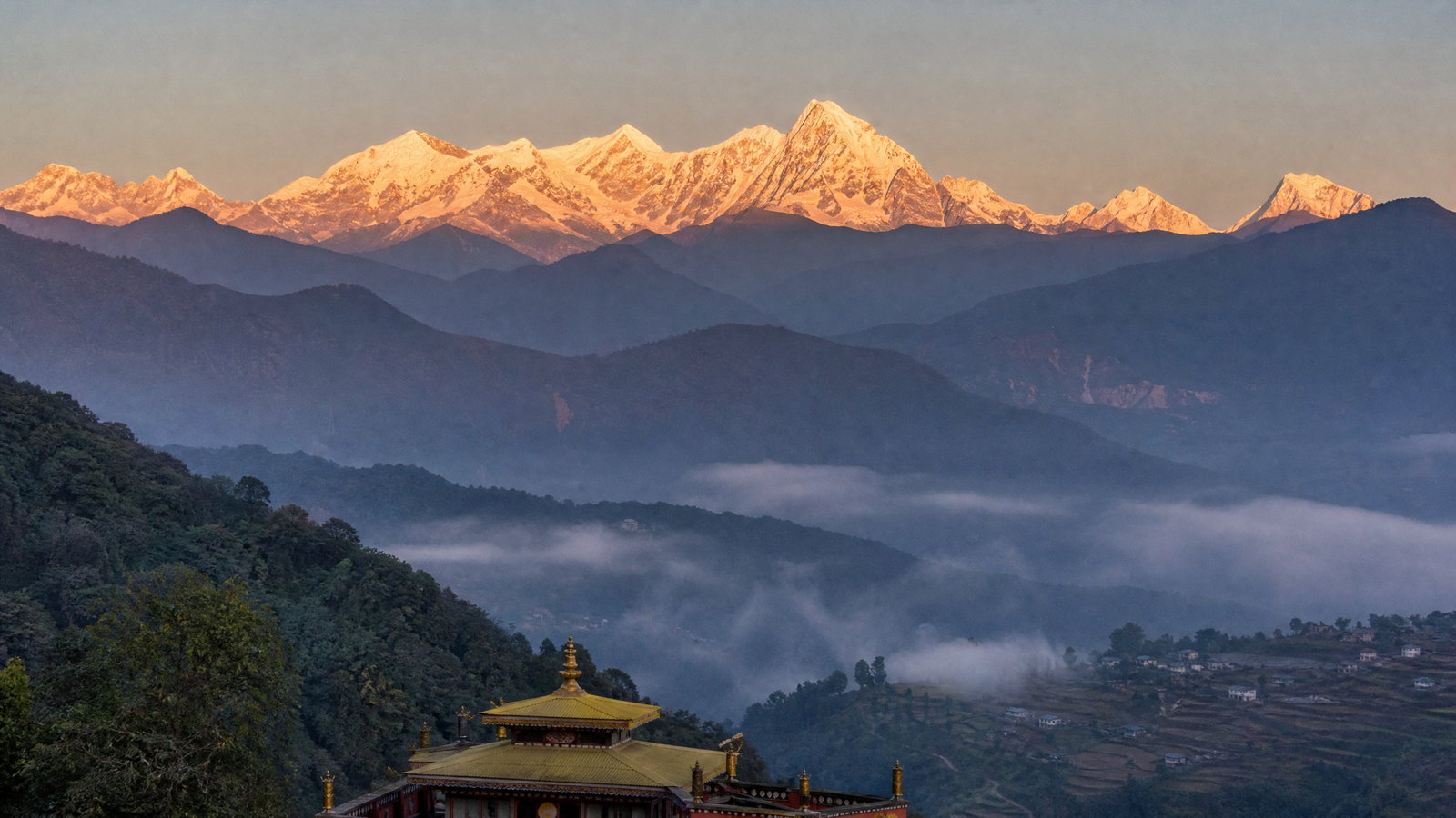
Sikkim is a compact Eastern Himalayan state whose short distances conceal exceptional changes in altitude, climate and culture. Gangtok supplies the most practical urban base, while the east reaches glacial lakes and a tightly regulated border pass, the west holds the kingdom’s early capitals and monasteries, the south offers gentler hill landscapes, and the north turns alpine. Khangchendzonga is not simply a view: its mountains, lakes, forests and stories form a living sacred geography for many communities. This is a destination for travellers who can accept weather-led adjustments, slow mountain journeys and careful preparation. A well-paced visit combines a town, one monastic or historic circuit, and one highland or forest landscape rather than trying to traverse every district quickly. Clear autumn light and spring flowering are attractive broad windows, but road conditions, permits, snow, rainfall and local observances always shape the actual journey.
 TR
TRState · Agartala
Tripura
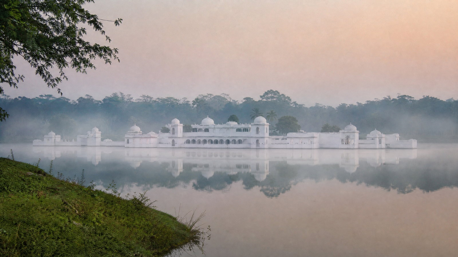
Tripura is a compact, green northeastern state where royal-era Agartala, carved sacred hills, lake palaces, forest sanctuaries and highland villages can be combined without attempting a rushed circuit. Its strongest contrast is between the Bengali-speaking urban and temple belt in the west and south, the forested interior and lakes of the east, and the Mizo-influenced Jampui uplands in the north. Unakoti and Chabimura reward visitors who want archaeology embedded in living landscapes; Neermahal and Ujjayanta Palace give a legible Manikya-era frame; and sanctuaries shift the emphasis to habitat, not guaranteed sightings. Roads link the principal centres, but rain, distance and limited local transport make a flexible itinerary more useful than a dense checklist. Plan around cool, clearer months, retain spare time for weather, and approach pilgrimage, community life and wildlife as places with their own rhythms rather than staged attractions.
Regional collection 03
East India
4 states and territories
 BR
BRState · Patna
Bihar
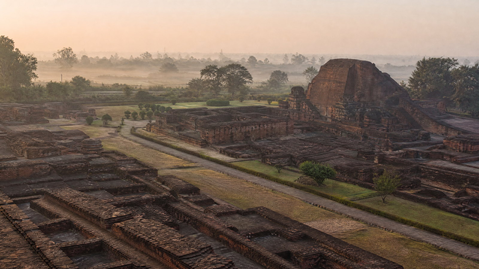
Bihar is an East Indian state where a broad, river-made plain carries some of South Asia’s most consequential sacred and intellectual landscapes. Patna, its capital on the Ganga, is a practical urban base; south and east lie the brick ruins of Nalanda and Vikramshila, while Bodh Gaya, Rajgir, Pawapuri and Vaishali connect Buddhist, Jain, Hindu and Sikh histories that remain living traditions. North Bihar shifts the emphasis toward Mithila’s painted visual language, fertile floodplains and the Himalayan-terai edge of Valmiki Tiger Reserve. This is not a single-circuit destination: a reflective heritage journey, a religious pilgrimage, a craft-focused stay and a wildlife visit involve very different distances, facilities and rhythms. The strongest itineraries pair nearby clusters rather than treating the state as a quick transit between monuments. Cool, drier months usually make long road days and open archaeological sites more comfortable. In the monsoon, river conditions, rain and local disruption can reshape plans, especially across the north; flexible timing and current local confirmation are essential.
 JH
JHState · Ranchi
Jharkhand
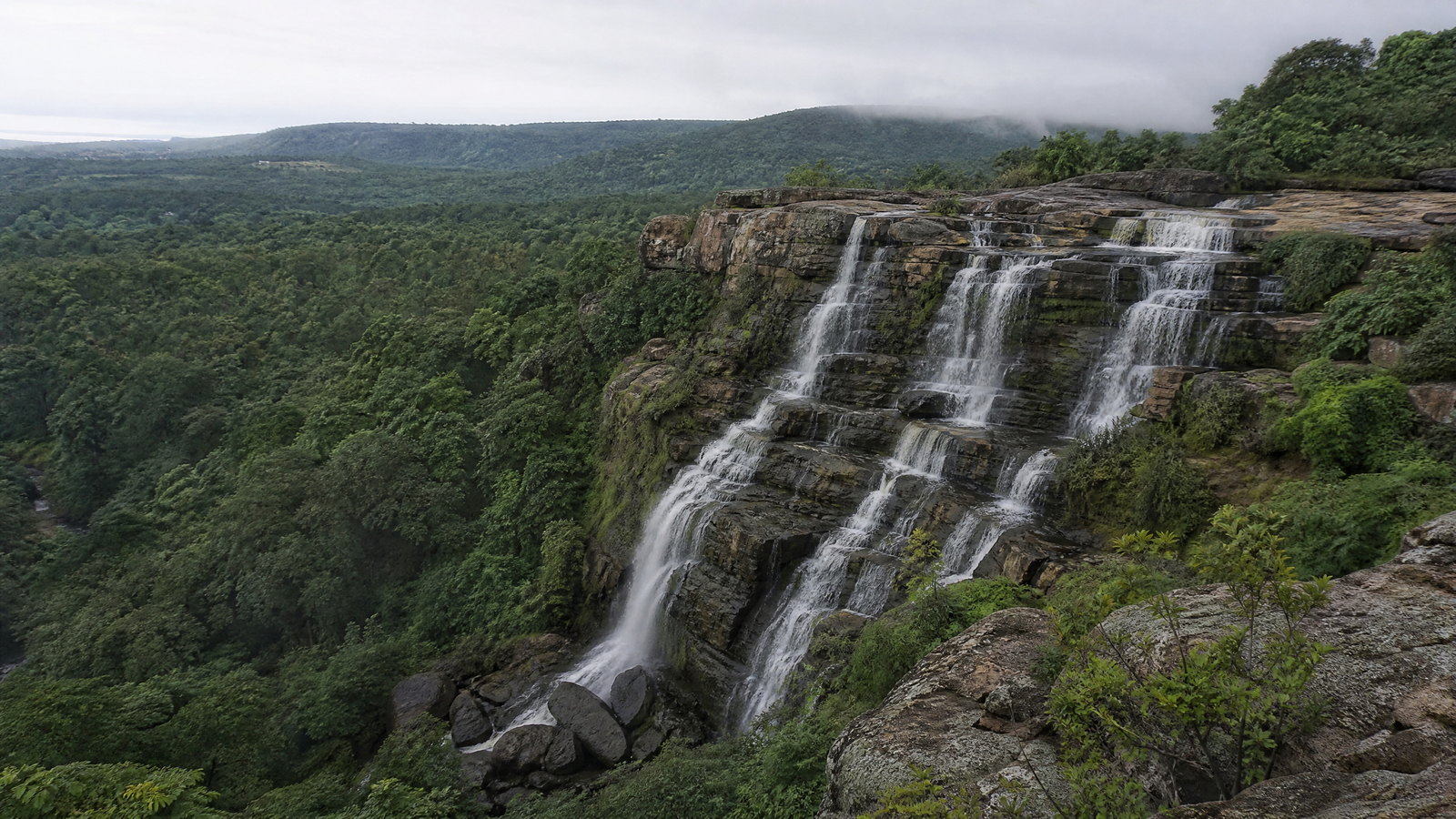
Jharkhand is a plateau state shaped by sal forest, river-cut escarpments, mineral landscapes and a deeply plural cultural life. Ranchi is a useful gateway for waterfalls, services and short plateau excursions, while the western plateau opens into Netarhat and the regulated forests of Palamau. In the south and east, the Dalma Hills, Jamshedpur’s planned-industrial landscape and Saranda’s sal canopy make a more remote proposition. Deoghar, Rajrappa, Maluti and Parasnath add major Hindu, Shakta, terracotta and Jain sacred geographies. The strongest journeys make room for this range rather than compressing it into a waterfall circuit. Cooler months are most comfortable; monsoon brings full rivers but much greater weather and road uncertainty. Forest visits, hill walks and pilgrimage days need a slower, confirmation-led approach. It is a state best understood through these contrasts, not a standardised circuit.
 OD
ODState · Bhubaneswar
Odisha
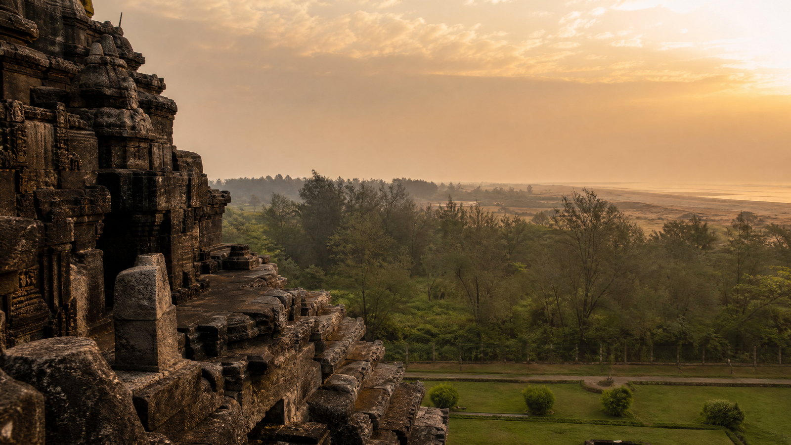
Odisha is best understood through contrasts. Bhubaneswar, Puri and Konark bring together Kalinga stonework, active pilgrimage and a major World Heritage monument on the Bay of Bengal. Inland, the Mahanadi cuts Satkosia Gorge, the Eastern Ghats rise around Koraput and Deomali, and large protected landscapes hold forests, mangroves and wetlands. Chilika offers birding and boat-based nature viewing; Bhitarkanika brings tidal creeks and crocodile habitat; Similipal is a conservation-managed forest reserve. Cultural depth extends through Jagannath practice, Pattachitra, Gotipua, Odissi, Cuttack filigree and many Indigenous communities with distinct languages and customs. A first visit can link the coastal heritage corridor with one nature extension. Longer, slower trips suit northern reserves or the southwest highlands. Winter is usually most flexible, but crowds, sea weather, heat, rain, reserve controls and ceremonial schedules should determine the final route.
 WB
WBState · Kolkata
West Bengal
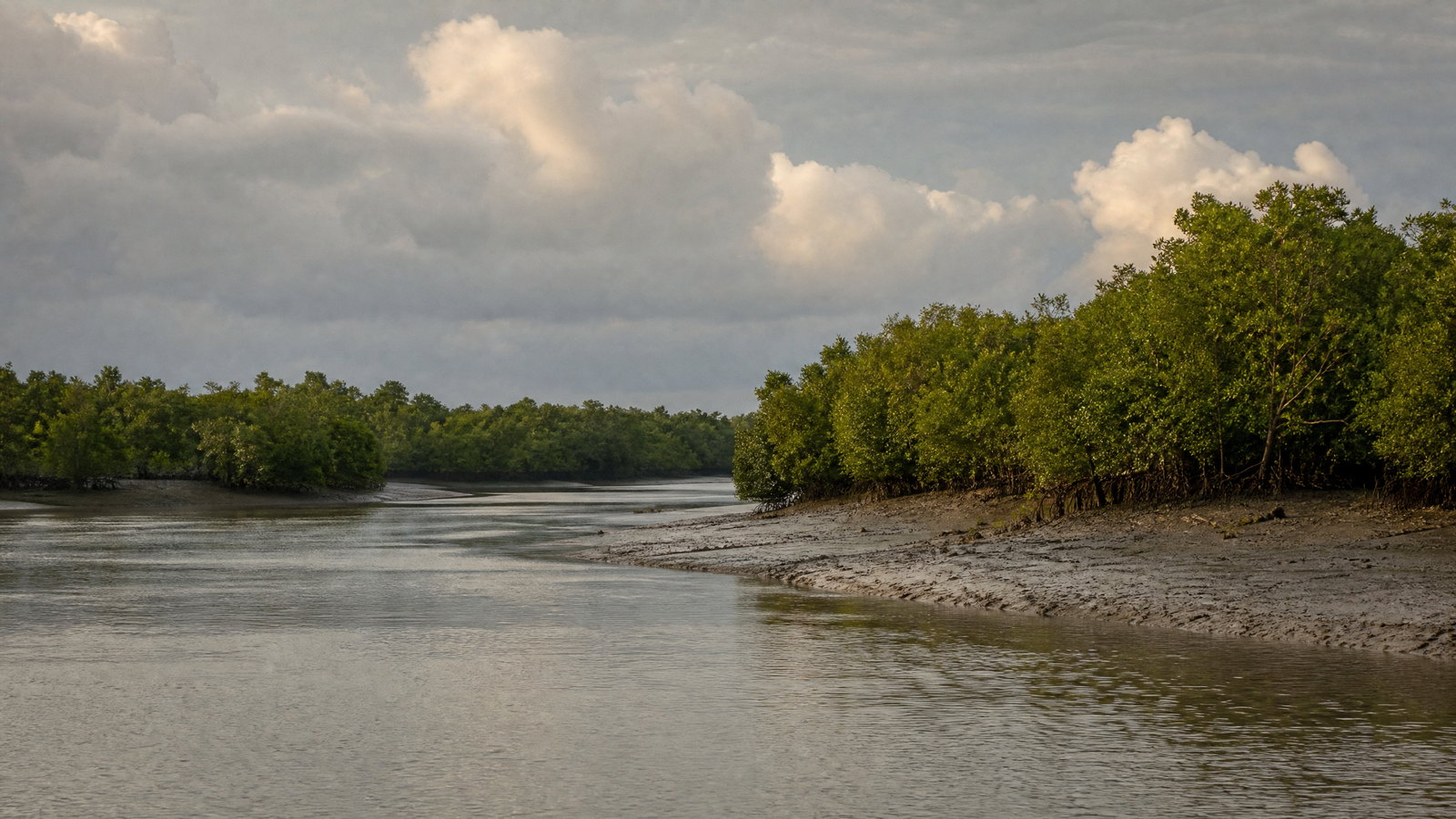
West Bengal rewards travelers who plan by landscape rather than trying to compress the state into one circuit. Kolkata is the practical gateway, a dense Hooghly-side city of institutions, sacred sites, markets and Bengali cultural life. North Bengal combines tea slopes, Himalayan towns, narrow-gauge rail heritage and weather-sensitive trekking. The south opens into tidal delta, island pilgrimage and the Bay of Bengal coast. Terracotta temple towns and Santiniketan add further cultural depth. The payoff is variety; the trade-off is distance and variable conditions. A Kolkata-and-heritage journey is manageable by rail and road, but Darjeeling, the Dooars and the Sundarbans deserve their own buffer. October to March is broadly comfortable for plains, coast and delta travel, although monsoon disruption and cyclone alerts can reshape plans. Build around connected regions, use current official or local guidance, and leave room for weather rather than treating any service or crossing as assured.
Regional collection 04
Central India
2 states and territories
 CG
CGState · Raipur
Chhattisgarh
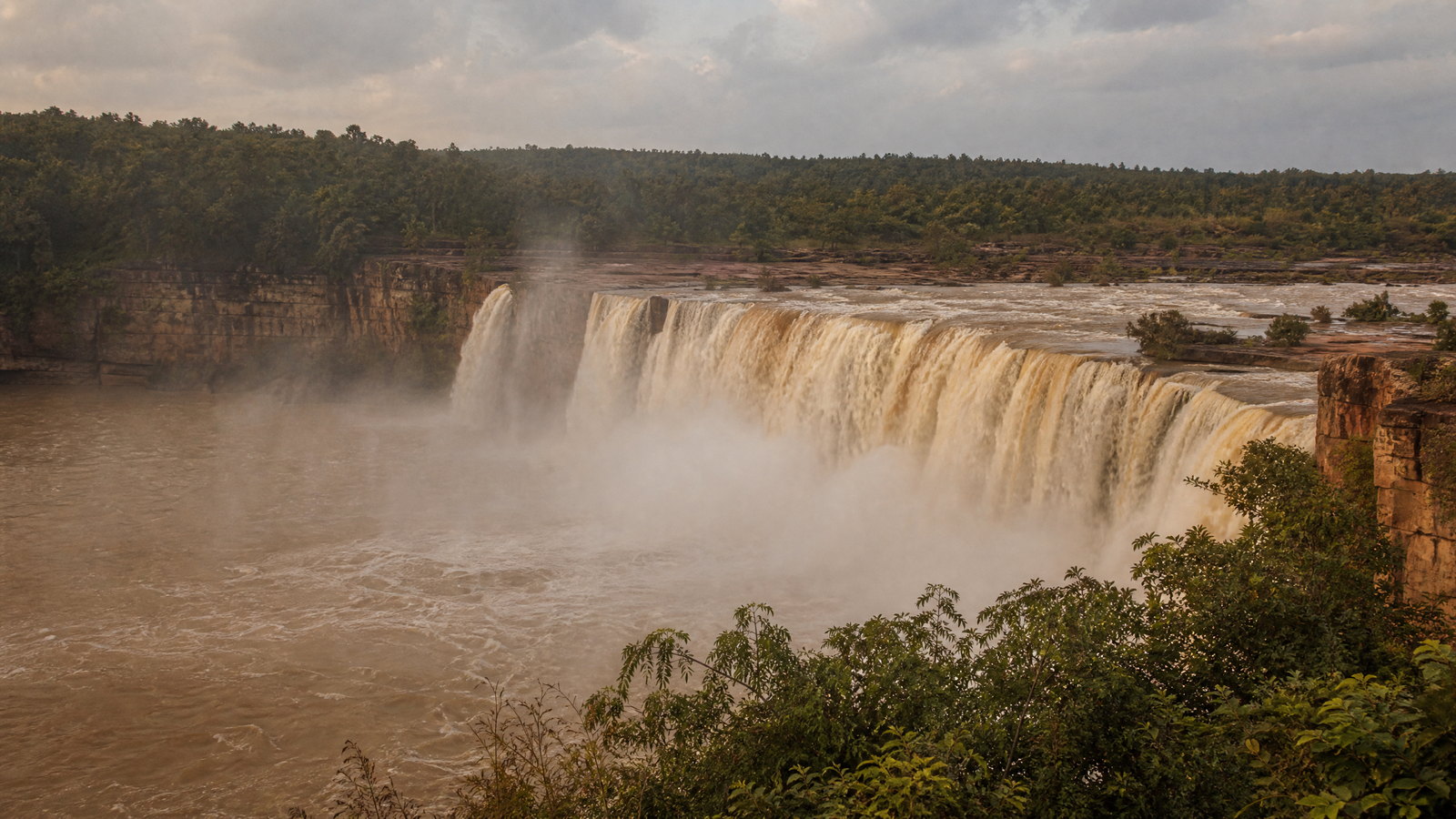
Chhattisgarh rewards travellers who plan for range rather than a single circuit. The central Mahanadi plain links Raipur, early historic Sirpur, temple landscapes and reservoirs; northward, Mainpat offers a cooler plateau rhythm; southward, Bastar unfolds through forest, rivers, craft towns, pilgrimage and living ceremonial traditions. The state is inland and often hot, so its most comfortable broad window is November to February, while the rains transform waterfalls and reservoir scenery but can complicate overland movement. Wildlife areas operate on conservation terms, not a promise of sightings, and some forest, cave and remote-road access is seasonal or locally regulated. Give the region time: a central heritage-and-nature route can be short, but adding Bastar deserves several unhurried days. Chhattisgarh is especially compelling for travellers willing to exchange dense landmark-hopping for riverside archaeology, forest-edge communities, handcraft knowledge and a careful awareness of weather, cultural protocol and changing local conditions.
 MP
MPState · Bhopal
Madhya Pradesh
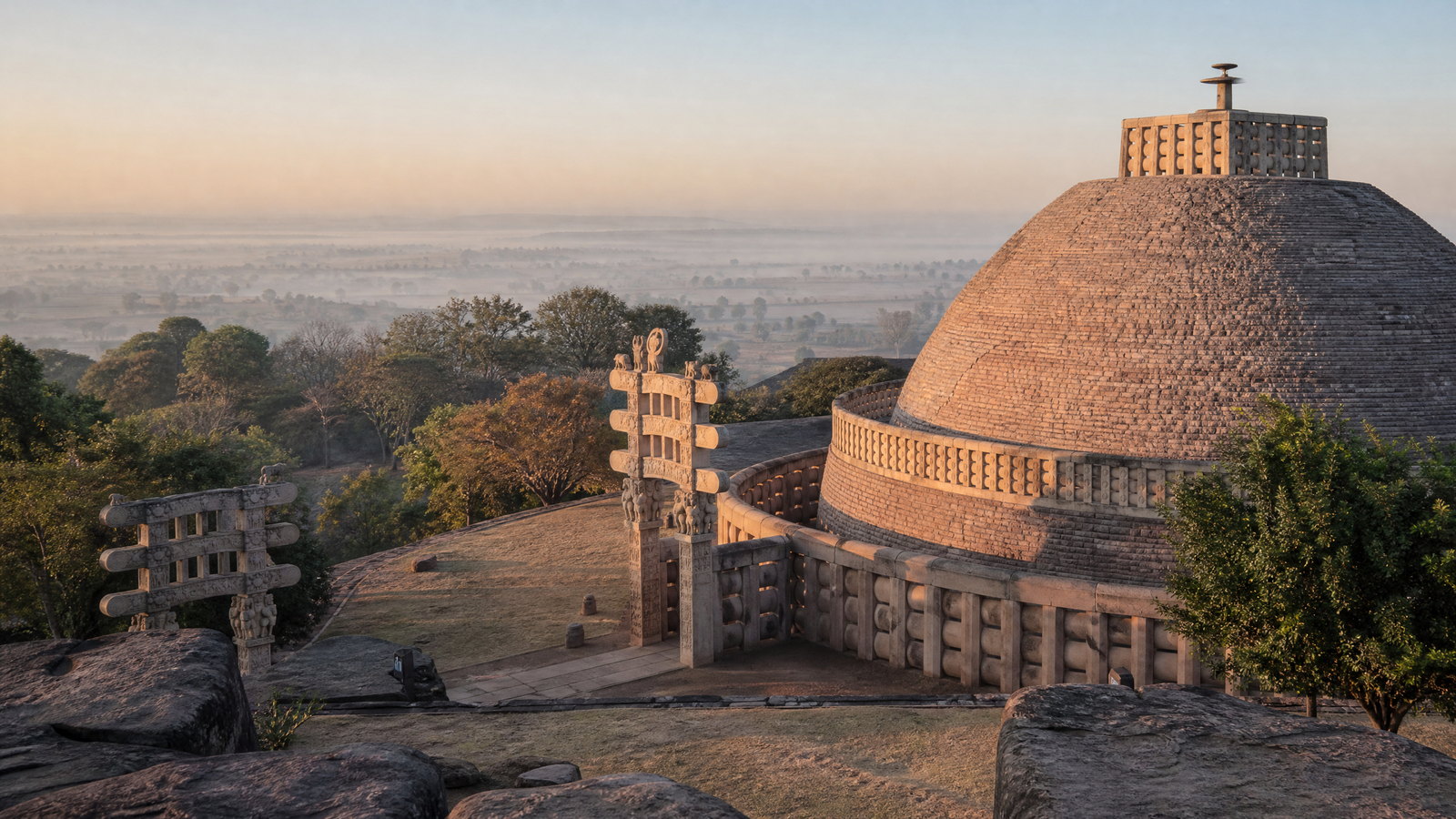
Madhya Pradesh is India’s large landlocked central state, where sandstone temples, medieval plateau capitals, river pilgrimage corridors and protected forests form very different travel worlds. Bhopal, the lake-ringed capital, anchors a central cluster with Sanchi and Bhimbetka. North-east, Khajuraho, Orchha and Chanderi invite close attention to temple sculpture, Bundela architecture and handloom practice. West and south-west, Mandu, Maheshwar, Omkareshwar and Ujjain connect Malwa’s built heritage with the Narmada and Shipra’s sacred landscapes. Kanha and Satpura offer forests rather than promised wildlife sightings. This is a state for linking a few coherent areas, not racing between every headline. Heat, rain, festival crowds and regulated access materially affect the experience, so leave transfer buffers and confirm changing details locally before travel. Choose one heritage route, or add one reserve with enough nights near its gateway. Stone monuments, active temples, craft households and protected forests each require a different pace and a willingness to let local conditions set the day.
Regional collection 05
West India
5 states and territories
 DH
DHUnion territory · Daman
Dadra and Nagar Haveli and Daman and Diu
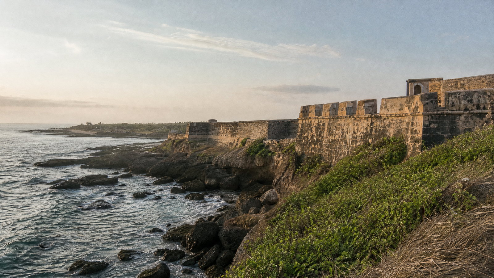
Dadra and Nagar Haveli and Daman and Diu is a dispersed western Indian union territory: forested inland Dadra and Nagar Haveli, estuarine Daman, and the low, sea-facing island of Diu are separate journeys, not one continuous destination. Daman is the administrative capital and Silvassa the inland service centre. A rewarding itinerary combines Adivasi cultural context and reservoirs near Silvassa, Portuguese-era ramparts and churches in Daman, and Diu’s limestone coast, shrine and tidal wetland. The contrast is the attraction. Historic places remain civic or religious settings, while forests, marshes and shorelines call for restraint around wildlife, tides and monsoon weather. November through February is generally most comfortable; access, rain, birds and sea conditions can change. Allow four to six days to link all three clusters, or focus on one or two. The territory rewards patience, seasonal awareness and respectful attention to its separate landscapes.
 GA
GAState · Panaji
Goa
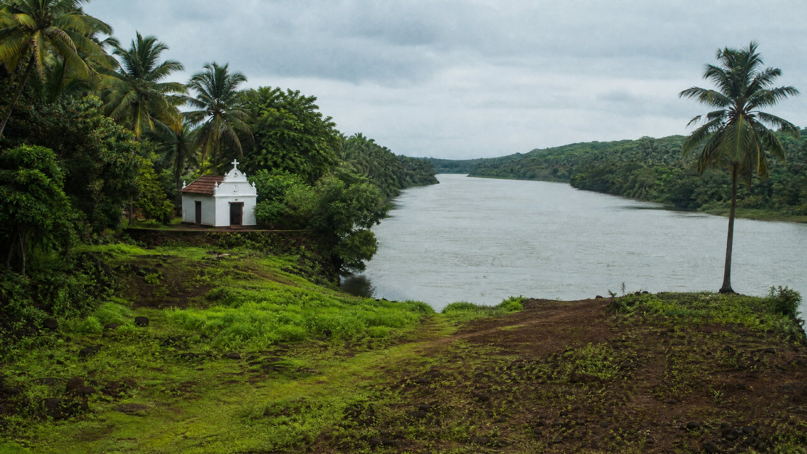
Goa is India’s smallest state by area, yet its short Arabian Sea frontage, tidal rivers and forested Western Ghats create sharply different journeys in a compact region. Panaji and Old Goa reveal a riverine capital and a major sacred and architectural ensemble; Ponda’s temples and Divar’s fields show living village landscapes; the east turns quickly toward evergreen corridors, waterfalls and protected forest. The coast offers both animated headlands and quieter nesting beaches, with seasonal sea conditions shaping what is sensible. A rewarding first visit usually combines two or three zones rather than attempting every beach and reserve. Build time for slow travel, religious etiquette and weather disruption. Goa is not only a coastal holiday setting: it is a Konkani-speaking state whose Hindu, Christian and Muslim traditions, Indo-Portuguese built forms, rice fields, mangroves and wildlife habitats remain closely linked to everyday life. Panaji is the administrative capital.
 GJ
GJState · Gandhinagar
Gujarat
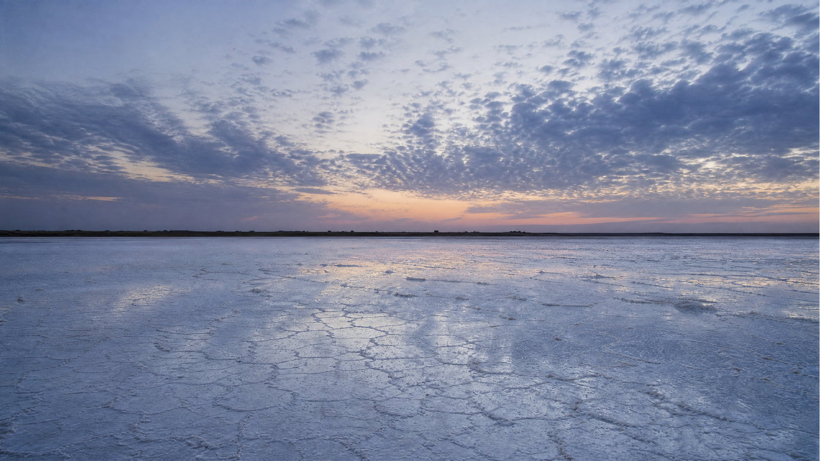
Gujarat rewards travellers who plan by landscape rather than checklist. Compact lanes and timber houses in historic Ahmedabad lie far from Harappan reservoirs on Khadir island, Jain temples above Palitana, rain-fed Dang hills and the tidal Gulf of Kachchh. The west is dry, saline and seasonal; the south is greener and wetter; Saurashtra combines pilgrimage coast with lion habitat. Gujarati is the principal language, while Kutchi, Kathiawadi, Surti and other varieties carry local identity. Crafts are skilled work embedded in communities and places. A first journey should choose one or two arcs—Ahmedabad–north Gujarat–Kutch, or Saurashtra’s coast and wildlife—rather than attempt the state. Winter is usually easiest window, but tides, monsoon closures, religious calendars, wildlife rules and heat require current local confirmation.
 MH
MHState · Mumbai
Maharashtra
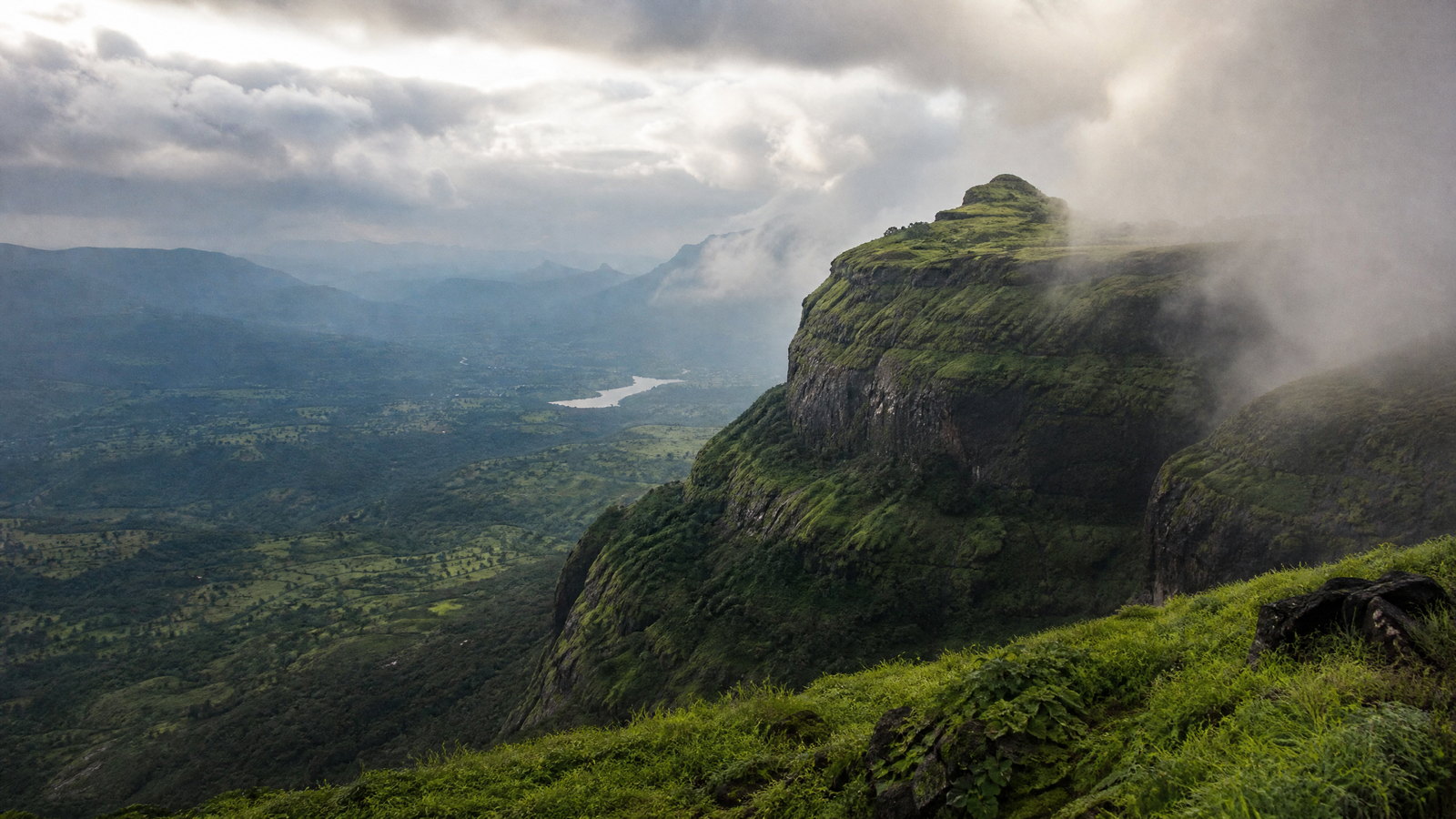
Maharashtra is a western Indian state where the Arabian Sea, rain-catching Sahyadris, basalt Deccan plateau and eastern dry forests create markedly different journeys. Mumbai supplies a port-city lens; Chhatrapati Sambhajinagar anchors major rock-cut heritage; the Konkan offers coast and pilgrimage; Nashik and Pune open devotional and Maratha-era histories; Vidarbha shifts the focus to forest and wetland. The trade-off is distance: coast, caves, cities and reserves are best treated as separate circuits. Mumbai is the administrative capital. Marathi is the principal local language, while Hindi and English are widely useful in many visitor settings. Respectful planning means treating pilgrimage, neighborhoods, protected habitats and monsoon landscapes as places with their own rhythms, not as backdrops.
 RJ
RJState · Jaipur
Rajasthan
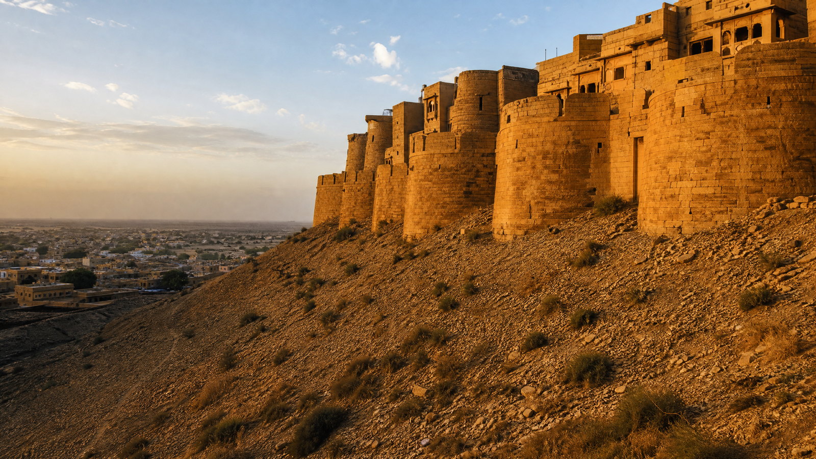
Rajasthan is India’s largest state by area, a vast west-northwestern landscape where the Thar Desert, the ancient Aravalli hills, dry plains, lakes, forests and river valleys create markedly different journeys. Jaipur, the capital, is a logical urban gateway, but the state rewards unhurried regional choices: desert architecture and living fort streets around Jaisalmer; Marwar’s blue-washed Jodhpur; the lake-and-hill setting of Udaipur; Mewar’s monumental forts; and eastern wetlands and tiger forest. Its heritage is not a single royal tableau. Forts contain temples, markets, water systems and, in some cases, continuing homes; craft, music, faith and everyday commerce remain part of the setting. October to March is generally most comfortable, while the hot season can severely limit daytime walking and the monsoon transforms the southeast more than the dry northwest. Distances are substantial, terrain is uneven at many historic sites, and wildlife access is managed rather than spontaneous. Build an itinerary around two or three connected regions, leave room for rest and local timing, and approach sacred, inhabited and protected places with patience.
Regional collection 06
South India
6 states and territories
 AP
APState · Amaravati
Andhra Pradesh
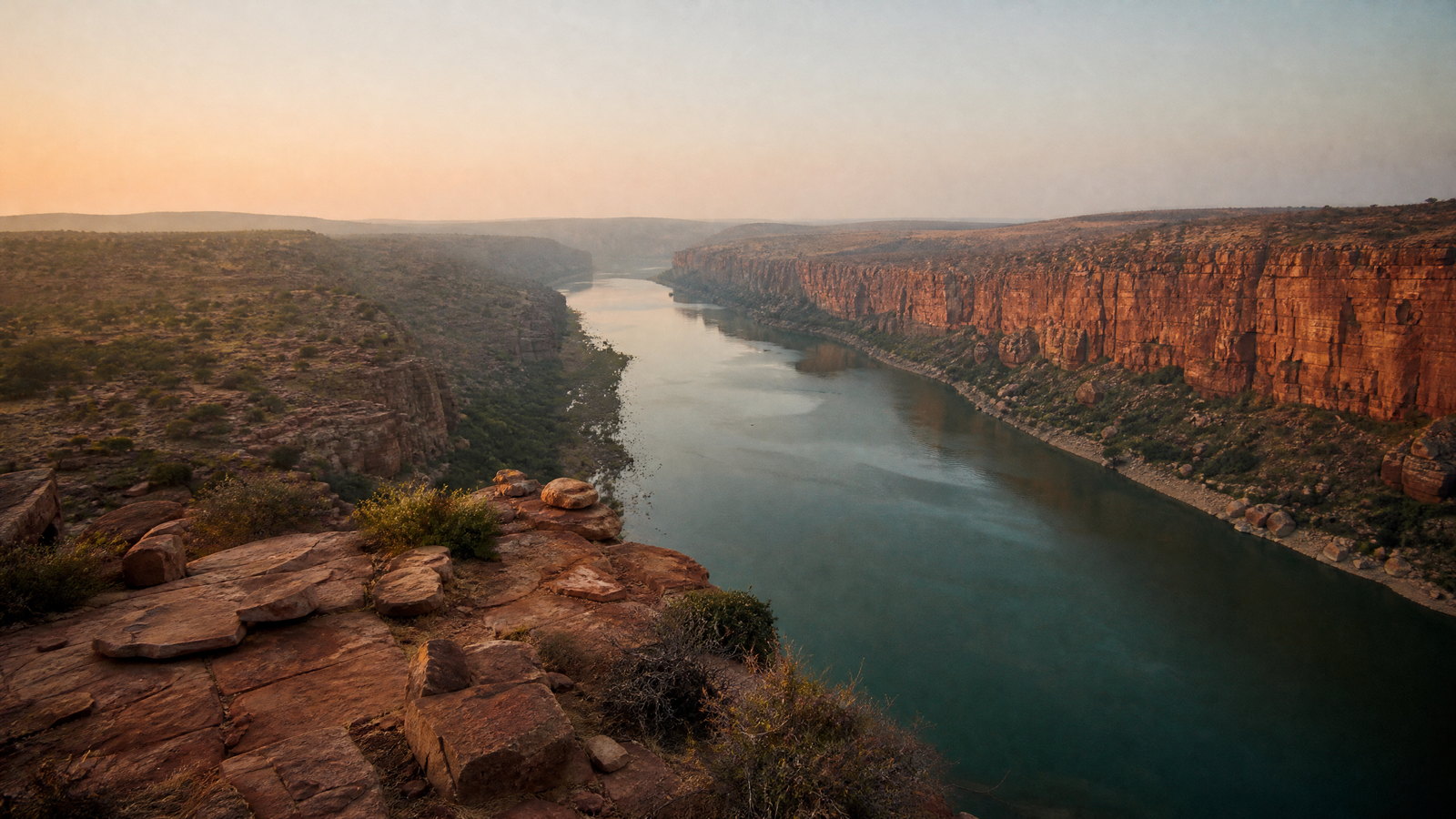
Andhra Pradesh rewards a route built around contrasts rather than a single circuit. The Bay of Bengal edge moves from Visakhapatnam’s city-and-sea setting to mangrove estuaries and the bird-rich Pulicat lagoon; inland, river plains meet Buddhist archaeology and pilgrimage towns. The Eastern Ghats rise into the forested, coffee-growing Araku landscape, while the drier southwest holds granite, fort walls, and the Penna gorge at Gandikota. Sacred travel is central rather than incidental: Tirumala and Srisailam are living places of worship with their own rhythms, while Amaravati and Nagarjunakonda illuminate the lower Krishna valley’s Buddhist past. Telugu is the everyday anchor, but the state’s cultural geography also includes tribal communities of the northern hills and craft lineages in towns such as Pedana and Kuchipudi.
 KA
KAState · Bengaluru
Karnataka
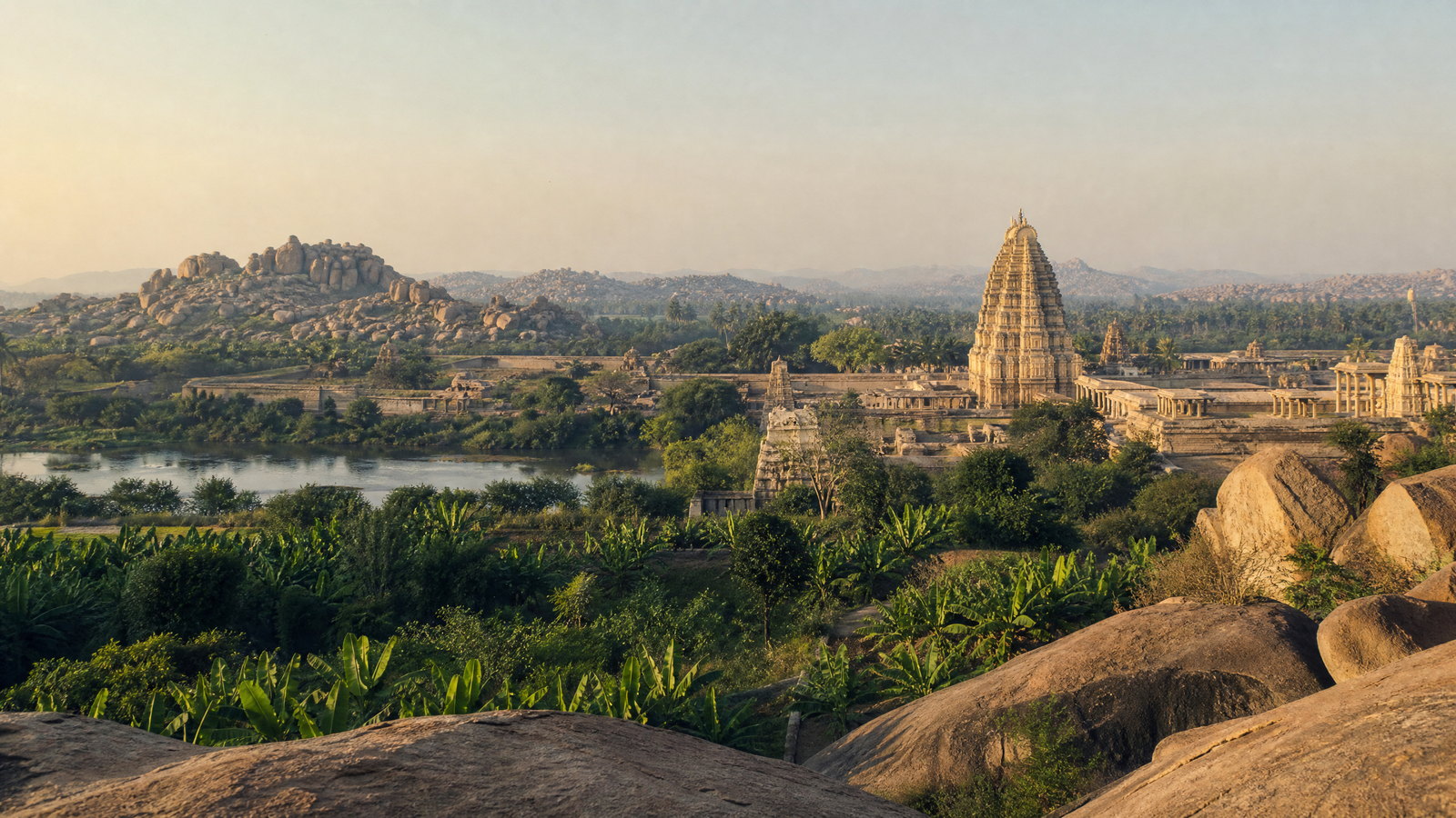
Karnataka rewards a route-based journey rather than a single-base holiday. Its capital, Bengaluru, anchors a broad state that runs from the Arabian Sea and monsoon-soaked Western Ghats to dry northern plateaux and the boulder country of the Tungabhadra. Within that span are the surviving urban landscape of Vijayanagara at Hampi, Chalukyan temple ensembles in the Malaprabha valley, Hoysala carving, Mysuru’s royal and ceremonial traditions, coffee-growing highlands, and major forest habitats. The trade-off is distance: a coast-and-hills itinerary can be wet and slow when the northern heritage belt is hot and open. Build around one or two adjoining regions, leave space for weather, and treat wildlife sightings, water activities, road conditions, monument hours, and festival access as variable. Kannada is the state’s principal language, while local speech and foodways shift markedly from Kodagu to the coast and the Deccan interior. Karnataka is especially strong for travelers who value landscape as part of history, not merely a backdrop to monuments.
 KL
KLState · Thiruvananthapuram
Kerala
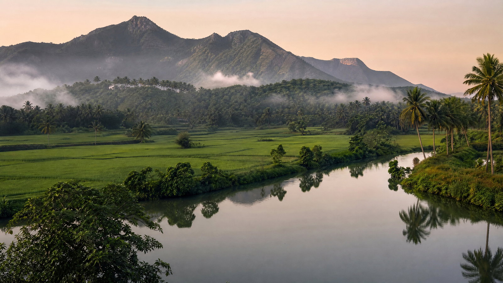
Kerala is a narrow southwest Indian state where the Arabian Sea, backwaters and Western Ghats sit close together. Thiruvananthapuram is the administrative capital and Kochi the principal metropolitan gateway. Within a short map are red-laterite cliff coast, Vembanad canals and polders, old port settlements, Munnar tea highlands, and forest corridors in Wayanad and Periyar. Its 580-kilometre coast, rivers and wet monsoon climate make water both a defining experience and a planning constraint. Malayalam is the state language; English is widely practical in cities and visitor-facing settings. Combine a city or heritage base with a wetland, coast, or mountain landscape rather than forcing a quick north–south circuit. November to February is broadly most comfortable; monsoon travel is beautiful but carries disruption risk in hills and flood-prone lowlands. Regional variation rewards a slower, place-based itinerary.
 PY
PYUnion territory · Puducherry
Puducherry
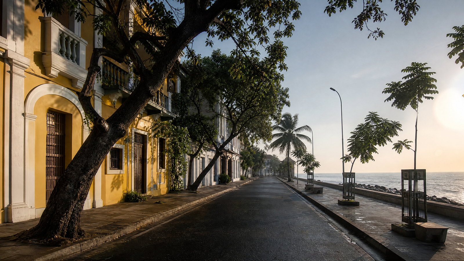
Puducherry is a discontinuous Union Territory whose four former French possessions span South India: Tamil-speaking Coromandel coast around Puducherry and Karaikal, Malayalam-speaking Mahe on the Malabar coast, and Telugu-speaking Yanam on a Godavari distributary in coastal Andhra Pradesh. The capital rewards unhurried walks through a Franco-Tamil streetscape, spiritual institutions, gardens and Bay of Bengal promenade; its hinterland adds an archaeological riverbank, wetland and estuary. Karaikal brings Cauvery-fed fields and Shaiva pilgrimage; Mahe, laterite slopes, intense southwest monsoon and an Arabian Sea estuary; Yanam, a riverine counterpoint. This is not one compact circuit. Use Puducherry city as a two- or three-day base and plan detached regions as separate journeys. Treat beaches, sacred spaces, wetlands and residential streets as lived environments, checking weather, sea conditions and access shortly before departure.
 TN
TNState · Chennai
Tamil Nadu
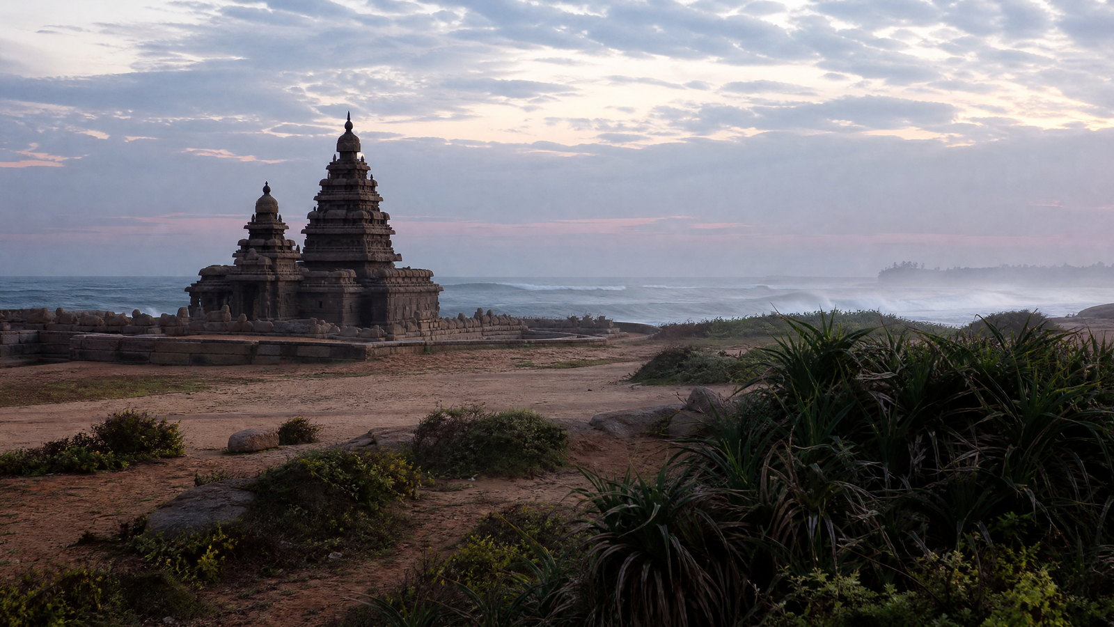
Tamil Nadu rewards a route built around contrasts rather than a checklist. Chennai is a major coastal capital; the eastern shore holds Pallava monuments, mangroves and bird wetlands; the Kaveri plain concentrates Chola temples, rice country and artistic traditions; the far southeast moves through island pilgrimage and fragile marine habitats. Westward, the Nilgiris and Palani Hills replace humid lowlands with cool, winding high country and protected forests. Tamil is the everyday language and classical cultural anchor, while English is useful in many urban, transport and visitor-facing settings. A first visit works best as two or three linked regions, not an attempt to cross the whole state quickly. Temperatures, rain, festival crowds, sea conditions and forest access vary markedly by coast, plain and plateau, so timing is a core route decision.
 TS
TSState · Hyderabad
Telangana
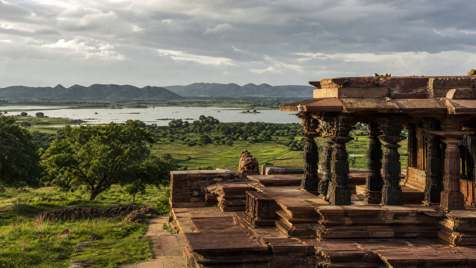
Telangana is a Deccan Plateau state whose strongest journeys connect Hyderabad’s layered Indo-Islamic cityscape with Kakatiya stonework, forested river country and active craft or pilgrimage towns. Hyderabad is the administrative capital and the main air-and-rail gateway, yet it should not stand in for the whole state: Warangal and Palampet reward heritage time, Pochampally offers a living textile landscape, and the north and south open into dry deciduous reserves, reservoirs and hill forests. October to February is the broadest comfortable window for a first trip; monsoon brings greener water landscapes but can disrupt rural movement, while late spring heat changes the pace dramatically. Plan by geographic cluster rather than attempting a circuit: the Hyderabad–Yadadri–Pochampally belt, the Warangal–Ramappa–Pakhal belt, and the longer wildlife edges each have different transport, heat and accessibility trade-offs. This is a curated introduction, not a complete inventory of Telangana.
Regional collection 07
Islands
2 states and territories
 AN
ANUnion territory · Sri Vijaya Puram
Andaman and Nicobar Islands
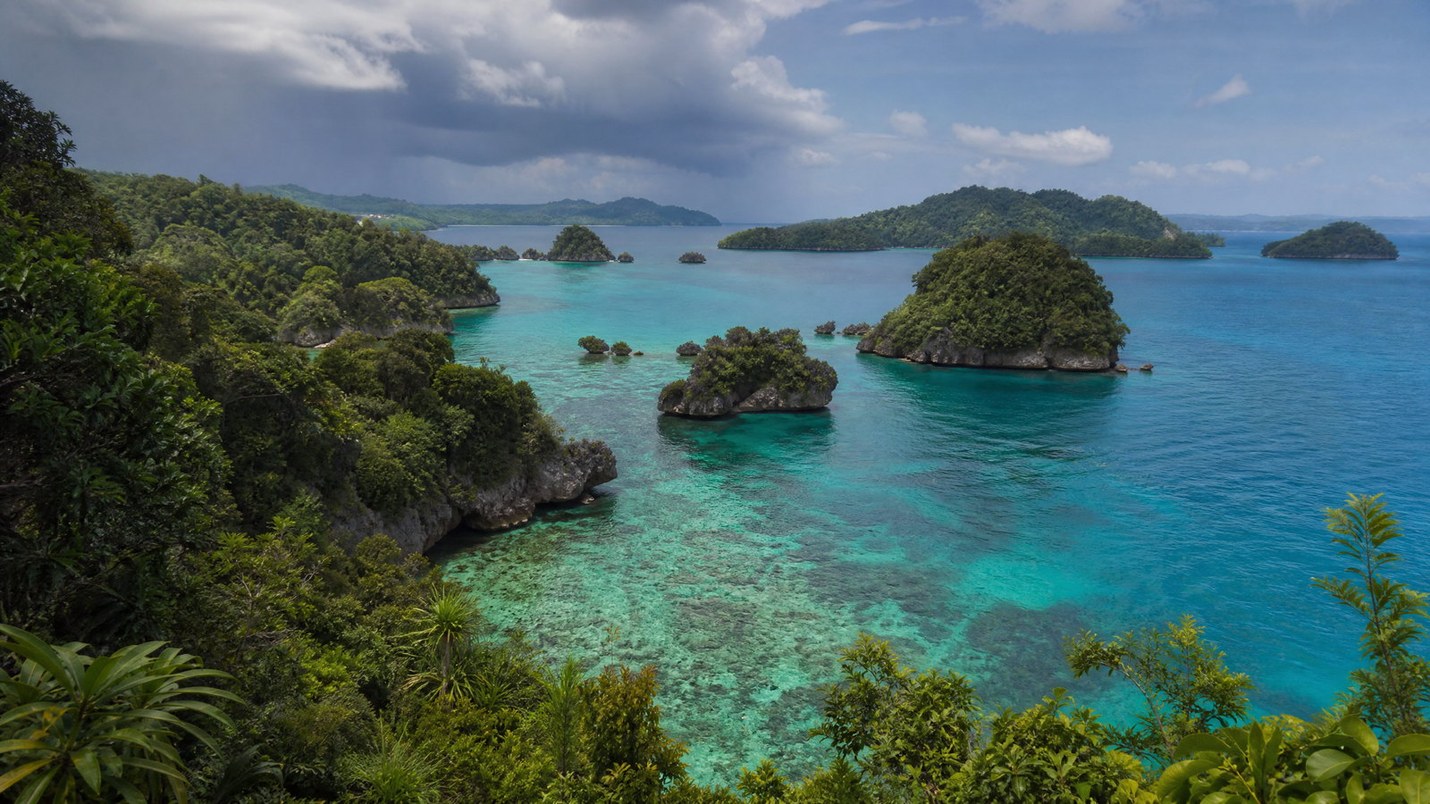
Andaman and Nicobar Islands is India’s far-eastern island union territory, a long chain of forested islands, reefs, mangroves and beaches between the Bay of Bengal and the Andaman Sea. Sri Vijaya Puram is the logistical and historical gateway, while ferries open up very different experiences: coral-fringed Swaraj Dweep, small agricultural Shaheed Dweep, the forested north around Diglipur, and the much more regulated Nicobar group. The attraction is not simply a beach circuit. Colonial incarceration, freedom-movement memory, living multilingual communities and globally significant ecosystems sit alongside one another. Some islands, reserves and tribal areas are not visitor attractions. A thoughtful plan concentrates on places open to the public, keeps buffer days, and treats reef, forest, shoreline and community boundaries as part of the experience.
 LD
LDUnion territory · Kavaratti
Lakshadweep
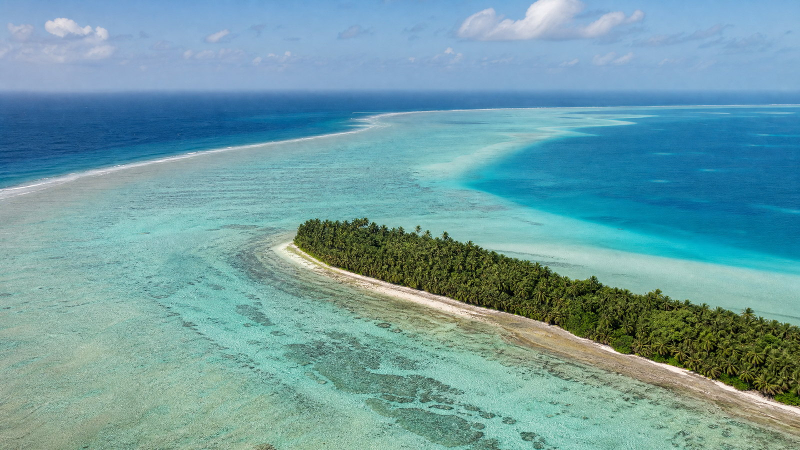
Lakshadweep is India's smallest Union Territory by land area but a vast marine geography: twelve atolls, reefs, submerged banks, and ten inhabited islands scattered in the Arabian Sea off the Kerala coast. Kavaratti is the administrative capital, while Agatti functions as the principal air gateway. The region's appeal is not interchangeable tropical scenery. Each island balances shallow lagoon, reef edge, coconut settlement, fishing culture, and faith in a different way; Minicoy adds its own Mahl-speaking, Dhivehi-linked cultural world. Travel is deliberately conditional here. Entry permission, transport capacity, sea state, protected-area rules, and local hospitality determine what is possible. A rewarding visit combines a few islands slowly, treats coral as living habitat rather than scenery, and leaves space for weather changes. The enduring experience is an understanding of how people live on low coral land surrounded by an immense and dynamic sea.