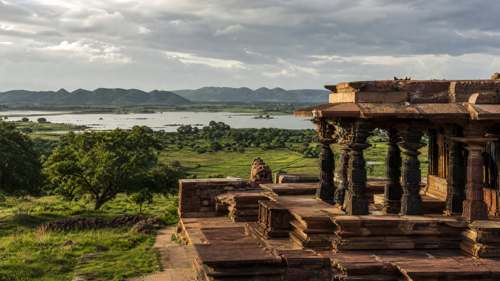
South India · State · TS
Telangana
Telangana is a Deccan Plateau state whose strongest journeys connect Hyderabad’s layered Indo-Islamic cityscape with Kakatiya stonework, forested river country and active craft or pilgrimage towns. Hyderabad is the administrative capital and the main air-and-rail gateway, yet it should not stand in for the whole state: Warangal and Palampet reward heritage time, Pochampally offers a living textile landscape, and the north and south open into dry deciduous reserves, reservoirs and hill forests. October to February is the broadest comfortable window for a first trip; monsoon brings greener water landscapes but can disrupt rural movement, while late spring heat changes the pace dramatically. Plan by geographic cluster rather than attempting a circuit: the Hyderabad–Yadadri–Pochampally belt, the Warangal–Ramappa–Pakhal belt, and the longer wildlife edges each have different transport, heat and accessibility trade-offs. This is a curated introduction, not a complete inventory of Telangana.
Regional notebook
Begin with the shape of the region.
Telangana rewards visitors who see contrasting Deccan landscapes rather than Hyderabad alone. The capital supplies historic transit; routes east and north-east pass granite, dry cropland and former dynastic centres; southern and eastern extensions reach the Krishna and Godavari catchments, reservoirs and forest. Kakatiya heritage centres on Warangal and Palampet, while Qutb Shahi and Nizam-era layers define Hyderabad. Handloom work, temple towns and festivals keep culture present-tense. Distance is the practical trade-off: heritage routes can use Hyderabad and Warangal as bases, while wildlife and river country require daylight and flexible transport. Choose a few clusters and treat sacred and protected places as working spaces.
Landscape
Geography changes the journey.
Telangana occupies an inland part of the Deccan Plateau, bordered by Maharashtra and Chhattisgarh to the north, Karnataka to the west, and Andhra Pradesh to the south and east. Granite outcrops, low hills, cultivated plains, tanks and reservoirs create varied relief rather than alpine terrain. The Godavari and Krishna systems and tributaries shape settlement and ecology. Nallamala and northern tiger forests differ strongly from Hyderabad’s built plateau and the lake-fringed Warangal region. Long road days cross dry open country, while reserve roads and rural approaches can be slow or weather-sensitive. Telangana is landlocked; water experiences centre on rivers, reservoirs, lakes and wetlands. Plan around terrain and distance, not map proximity alone.
Living culture
Arrive as a guest, not an audience.
Telangana’s culture is plural and regionally specific. Telugu is central to public life, with Urdu especially resonant in Hyderabad; Lambadi and Gondi belong to wider community landscapes. Kakatiya patronage survives in stone architecture, sculpture and Perini Sivatandavam, while Hyderabad reflects Persianate, Deccani, Telugu and Nizam-era influences. Bathukamma, Bonalu, Oggu Katha and Lambadi dance are living practices, not generic entertainment. Pochampally double ikat, Gadwal weaving, Nirmal painting, Cheriyal scrolls, Pembarthi brasswork and Karimnagar filigree arise from distinct skills and economies. Ask before photographing artisans or worshippers, learn what is made on site, and avoid demanding demonstrations. Food ranges from robust plateau cooking to Hyderabad’s urban culinary traditions.
Curated regional atlas
Places that reveal different parts of Telangana
This is a selective, geographically varied starting point rather than an exhaustive list. Use it to choose a coherent route, not to compress every place into one trip.
historic urban precinct · Old City, Hyderabad
Charminar and Hyderabad Old City
Charminar is the four-arched, four-minaret landmark at the centre of Hyderabad’s old city, an immediate introduction to Deccani urban history. Its Indo-Islamic design combines Persian influences with Hindu-inspired floral stucco, while the lanes around it join religious buildings, trading activity and long-established craft traditions. This is not an isolated monument: prayer, commerce, traffic and dense footfall shape the experience. Nearby streets matter as much as the silhouette. Visit with time to observe the relationship between architecture and an active neighbourhood, not just to collect a photograph.
Why this place matters
Choose Charminar for Hyderabad’s concentrated meeting of civic monument, sacred space and lived street culture. The building has a clear architectural presence, but the surrounding old-city texture—changing light, markets and narrow lanes—gives it meaning. It is a useful contrast to Golconda’s expansive fortress landscape. The reward is greatest for visitors interested in urban history, architecture and everyday cultural exchange. This is attentive walking rather than fast sightseeing; those seeking quieter, lower-sensory conditions should try an early weekday and expect an active public realm.
fortress and royal necropolis landscape · Golconda, Hyderabad
Golconda Fort and Qutb Shahi Landscape
Golconda Fort rises from a granite hill west of central Hyderabad, with ramparts, gateways, halls, water systems and viewpoints that make a former capital legible as a fortified landscape. Its history includes Kakatiya associations, Bahmani rule and a long Qutb Shahi period, when it was the principal capital. Rock, walls and successive enclosures shape movement uphill. Acoustic traditions at the entrance are often discussed, but the durable experience is the scale of hill fort and the mixture of Hindu-Islamic architectural vocabulary. Pair it with Qutb Shahi tombs when time allows.
Why this place matters
Golconda explains why Hyderabad’s history exceeds a single old-city landmark. Granite ridge, gates and climbing routes clarify how terrain served control, visibility and water management. Its changing rulers bridge Telangana’s Kakatiya and Qutb Shahi stories. It suits architecture, landscape and photography-minded travellers who can manage uneven paths. The trade-off is physical: distances are substantial, steps can be steep and shade is inconsistent. Visit in cooler hours, then slow down at the necropolis or a museum rather than forcing several major sites into a hot midday circuit.
historic city and temple precincts · Warangal and Hanamkonda
Warangal Kakatiya Heritage City
Warangal was the Kakatiya capital and remains Telangana’s clearest urban concentration of the dynasty’s stone architecture. The fort’s gateways, walls and sculptural fragments are best read with the Thousand Pillar Temple in neighbouring Hanamkonda, whose shrines are dedicated to Shiva, Vishnu and Surya. The name relates to Orugallu, or single stone, a cue to the granite-led landscape and building tradition. Warangal is a working city, not a preserved museum quarter, so remains sit amid contemporary roads, worship and commerce. It is an essential base before extending to Palampet or lake country.
Why this place matters
Warangal gives architectural history an urban scale. At the fort, gateways and defensive remains reveal a former capital’s planning; at the Thousand Pillar Temple, dense carving, multi-deity worship and stone engineering shift attention to ritual architecture. Seeing both prevents Ramappa becoming an isolated masterpiece and makes the Kakatiya cultural landscape more intelligible. It suits travellers who learn through sculpture and city texture. Allow time between sites rather than rushing in peak heat. Traffic, noise and variable pedestrian infrastructure are the trade-off, but also keep the history connected to modern Telangana.
World Heritage temple complex · Palampet, Mulugu district
Kakatiya Rudreshwara (Ramappa) Temple
Rudreshwara, popularly called Ramappa Temple, is a living Shiva temple in a walled Kakatiya complex at Palampet. Begun in 1213, it combines sandstone with carved granite and dolerite, and its stepped pyramidal tower uses lightweight porous bricks. Its sculptures convey movement, dance customs and regional cultural forms with exceptional refinement. Low forested hills, cultivation, water infrastructure and Ramappa Cheruvu form an intentional cultural landscape. Inscribed on the World Heritage List in 2021, it remains a protected archaeological monument while ritual practice continues. Its rural setting contrasts strongly with Warangal’s urban remains.
Why this place matters
Ramappa is Telangana’s essential single heritage encounter because artistry, structural ingenuity and landscape work together. Bracket figures, beams and pillars reward close looking, but the larger lesson is Kakatiya place-making: temple, reservoir, fields and wooded foothills remain connected. The site becomes richer after Warangal’s fort and temple precincts. It suits architecture, sculpture, dance-history and cultural-landscape travellers. The trade-off is distance from the capital and a rural approach that can take longer than expected. Plan daylight, preserve time for the complex, and do not mistake protected status for universal accessibility.
living craft town · Bhoodan Pochampally, Yadadri Bhuvanagiri district
Bhoodan Pochampally Ikat Weaving Town
Bhoodan Pochampally is Telangana’s best-known ikat weaving town, where planned tie-dyeing of warp and weft creates patterns before weaving begins. The double-ikat tradition produces sarees and cloth for garments, furnishings and wall hangings; motifs may include flowers, parrots and elephants within geometric grids. Cotton, silk and blended yarns all appear in the local craft economy, and natural colour traditions remain part of its story. This is not a theme park: workshops and sales settings are connected to working livelihoods, household routines and variable production. Focus a respectful visit on process and makers’ consent.
Why this place matters
Pochampally shows how regional visual identity is built through skilled sequence, not simply displayed in a finished textile. Resist-dye planning, alignment, loom work and pattern all matter; a conversation with a willing artisan can make the fabric’s geometry meaningful. It is a useful cultural counterpoint to stone monuments and a manageable extension from Hyderabad eastward. The trade-off is that working-space access is not automatic, and a sales encounter may reveal little about craft. Ask before entering or photographing, give makers time to work, and approach any purchase thoughtfully.
Buddhist archaeological site · Phanigiri, Suryapet district
Phanigiri Buddhist Archaeological Complex
Phanigiri is a Buddhist archaeological complex on a hillock in Suryapet district, a different chronological layer from Telangana’s Kakatiya and Qutb Shahi landmarks. Reports identify a Mahastupa, viharas, apsidal chaitya halls, stone-pillared congregation spaces and inscriptions, broadly dating from the first century BCE to the fourth century CE. Recent excavations, including a large coin find, sharpen attention on its regional importance. Exposed ground, fragmentary remains and hilltop views encourage visitors to imagine monastic movement, ritual and Deccan connections. It rewards a contemplative, site-protective approach rather than expectations of reconstructed buildings.
Why this place matters
Phanigiri expands Telangana’s story beyond dynastic capitals and living temples. Stupas, monastery traces and inscriptions invite questions about patronage, trade, pilgrimage and early Buddhist practice in the Deccan. It rewards people who enjoy reading landscape and archaeological fragments. Pair it with an eastbound heritage route, but do not treat it as a rushed roadside stop: exposure, terrain and interpretive challenge call for daylight and time. The trade-off is sparse shade and modest infrastructure compared with Hyderabad or Warangal. Bring water, stay on marked paths, and accept that conservation work can affect viewing.
pilgrimage town and river landscape · Bhadrachalam, Bhadradri Kothagudem district
Bhadrachalam and the Godavari Riverfront
Bhadrachalam sits on the Godavari and centres on the Sri Sita Ramachandra Swamy Temple, a major Rama pilgrimage destination. Its meaning comes from active devotion, riverside setting and narratives associating the town with Rama’s exile and Bhadrachala Ramadasu. The temple is not merely an architectural object: darshan rhythms, ritual calendars, queues and festivals determine movement. The Godavari adds a physical scale very different from Hyderabad’s plateau and Warangal’s inland stone. Bhadrachalam is most compelling for visitors who can approach a sacred town patiently, observe etiquette and let the river landscape frame its devotional purpose.
Why this place matters
Choose Bhadrachalam for a living pilgrimage landscape where river, temple music, ritual and regional memory meet. It offers an alternative to Ramappa or Phanigiri: worship is central and visitors should observe responsibly. The location also introduces the Godavari’s importance to eastern Telangana. It suits those interested in devotional traditions, Carnatic-linked history and river towns, not people seeking unrestricted monument photography or a tightly controlled schedule. Crowds rise around Sri Rama Navami and river conditions change seasonally. Build flexibility into the day and make temple instructions the priority.
forest hills and eco-tourism landscape · Vikarabad district
Ananthagiri Hills
Ananthagiri Hills are a low, forested hill landscape near Vikarabad, valued for greenery, viewpoints, temple context and trails that feel more enclosed than much of the plateau. The appeal is relief rather than altitude: mist can soften ridges in wet weather, while forest paths and cycling or walking routes offer a nature-focused break from Hyderabad. Conditions vary by season and trail. Approach it as a day or overnight landscape for slow observation of forest, birds and weather, not as a guarantee of a particular trek or camping plan. After rain, its greenery comes with clear safety trade-offs.
Why this place matters
Ananthagiri is a useful reset within a heritage-heavy itinerary. Its value is a sensory shift from stone precincts and traffic to forest texture, small elevation changes and quieter outlooks. Gentle walkers, cyclists and birders will gain more than people seeking a dramatic mountain expedition. It shows how Telangana’s Deccan geography can be intimate rather than monumental. The trade-off is variability: trails, visibility, insects, rain and ground conditions change with season. Use authorised paths, visit early, choose a pace for the weather, and retain daylight for a safe return to Vikarabad or Hyderabad.
tiger reserve and Nallamala forest landscape · Nagarkurnool and Nalgonda districts
Amrabad Tiger Reserve
Amrabad Tiger Reserve occupies a large section of the Nallamala forest tract across Nagarkurnool and Nalgonda districts. Hilly ground, deep valleys and gorges form part of the Krishna catchment, unlike the open central plateau. It supports significant biodiversity and is Telangana’s principal tiger landscape by area, while management works with water, fire, habitat and litter issues. Chenchu communities have long connections to this forest, including settlements described as pentas, gudems and small hamlets. For visitors, it is conservation space first: movement is controlled and the strongest experience may be terrain, birds, quiet and interpretation rather than an animal sighting.
Why this place matters
Amrabad offers Telangana’s fullest encounter with Nallamala ecology: rugged terrain, deciduous forest, Krishna catchment and a scale absent from urban routes. It suits travellers who value conservation context over a wildlife checklist. Chenchu cultural geography makes respectful conduct essential; local people are not attractions, and visits should not intrude on settlements or resource spaces. The trade-off is logistics and uncertainty. Access is controlled, seasonal conditions matter and wildlife cannot be promised. Give it adequate time, listen to designated staff and guides, and focus expectations on habitat rather than close encounters, especially in hot or fire-sensitive periods.
tiger reserve and dry deciduous forest · Jannaram area, northern Telangana
Kawal Tiger Reserve
Kawal Tiger Reserve lies in north-eastern Telangana along the Godavari side of the former Adilabad region, connected to the wider central Indian tiger landscape. Southern tropical dry deciduous habitat includes teak, bamboo, rivers, grassland and open areas, supporting Deccan mammals, birds, reptiles and amphibians. Its Godavari and Kadam catchment role adds a water-management dimension. Understand it as a conservation corridor, not a zoo: tiger density is variable, habitat protection and fire management are ongoing issues, and disturbance can be significant. It offers a powerful view of northern Telangana’s ecology for patient naturalists willing to accept uncertainty.
Why this place matters
Kawal is an ecological rather than merely emblematic wildlife experience. Teak-and-bamboo forest, seasonal grasslands and river connections reveal a dry-forest system very different from evergreen expectations. It is meaningful for birding and for travellers interested in corridor conservation linking Telangana, Maharashtra and Chhattisgarh. Remoteness and unpredictability are the trade-offs: a tiger sighting cannot be assumed, and hot weather can be intense. A visit that prioritises habitat, tracks, birds, water and field interpretation is more satisfying. Plan a dedicated stay, never pressure staff for sightings, and do not treat reserve roads as high-speed transit.
reservoir, wetland and wildlife sanctuary · Warangal region
Pakhal Lake and Wildlife Sanctuary
Pakhal combines a historic water body with forest-edge habitat east of Warangal, a valuable counterpoint to Kakatiya stone heritage. The lake is a man-made reservoir surrounded by forest and hills, while the sanctuary supports deer, wild boar, marsh crocodiles and varied birdlife. Its appeal is the meeting of water, deciduous vegetation and open views rather than one built landmark. Seasonal water level, rain and management decisions shape the day. Pakhal works best as a slow nature extension from Warangal or Ramappa, especially for birdwatchers and travellers who value a lake-and-forest setting without expecting guaranteed boating, access or sightings.
Why this place matters
Visit Pakhal to see how Telangana’s reservoirs belong to its cultural and ecological geography, not just scenic stops. The lake gives rest to a Kakatiya route while the sanctuary introduces forest-edge habitat, aquatic life and birding. It suits travellers wanting water, wildlife and unhurried observation without the longer approach to a tiger reserve. Infrastructure and weather sensitivity are the trade-offs. Monsoon makes it lush but can alter roads and water edges; dry-season heat changes comfort. Use authorised access and be content with landscape and birds even if larger mammals remain unseen.
Season and pace
Choose a date window for the experience, then keep a fallback.
October through February is the most forgiving range for historic precincts, temple courtyards and open landscapes, though northern interiors can feel cool at night and holiday dates change crowd levels. March to May is dry and can be severe: schedule outdoor visits early or late, carrying water, shade and sun protection. Kawal records very high summer heat, illustrating local extremes. Southwest monsoon conditions generally run from June to September, refreshing forests and reservoirs but bringing slippery stone, rain delays and changing water-edge access. September to November can be green and atmospheric without guaranteeing clear weather. Check current district forecasts and official warnings before rural, water or forest outings.
Movement and planning
Distance on a map is not the same as usable travel time.
Moving through the region
Hyderabad is the arrival hub, with the principal airport, major railheads and the most developed local transit. Rail helps on key urban corridors, and state buses reach many towns, but final stretches to reserves, lakes, craft villages and dispersed heritage are often slower or less frequent than expected. A hired vehicle with a local driver can help multi-stop rural days, but unfamiliar road driving after dark remains unwise. Metro, city rail and road transport can reduce car use in Hyderabad, though the historic core has narrow, congested lanes and variable pedestrian conditions. Warangal is a practical secondary base; Palampet, Pakhal, Bhadrachalam and tiger reserves need purposeful onward planning. Confirm transport, connections, roads and final-entry arrangements locally, especially in monsoon or festival periods.
Building a workable route
Choose depth over coverage. Four or five days can give Hyderabad, Golconda, Warangal and Ramappa breathing room; Pochampally or Phanigiri makes a deliberate eastbound extension. Add at least two days for Bhadrachalam or a wildlife landscape and do not combine a reserve outing with a long intercity transfer. Heritage sites reward cooler daylight and have uneven stone, steps and limited shade. Wildlife is never assured, and reserve routes, activity, vehicle allocation and opening dates change. Sacred sites have dress, security, queue and photography practices that can tighten on observance days. Travellers with limited mobility should confirm step-free routes, toilets, drop points and shade before arrival. Carry water, modest sun cover, a charged phone and cash for rural contingencies, with identification and any required tickets accessible.
Travel responsibly
The regional context includes its limits.
Protected landscapes are habitats first. Remain on authorised routes, keep quiet, never feed or call wildlife, do not fly a drone without clear permission, and accept closures for weather, fire, breeding or management. Take litter out; dry deciduous vegetation is fire-sensitive. At temples, mosques and shrines, dress conservatively, follow photography and footwear rules, and make room for worshippers. At craft communities, ask before entering workshops or photographing people, credit artisans only if they want it, and pay transparently for work rather than devaluing skilled labour. Water levels, roads and safety constraints change quickly. Check with the responsible local authority shortly before departure, and treat instructions from site staff, forest personnel and community hosts as decisive.
This is an evergreen regional guide. Weather, permits, closures, transport and local rules can change; confirm material conditions through the relevant local or official channel before travel.