South India · State · KL
Kerala
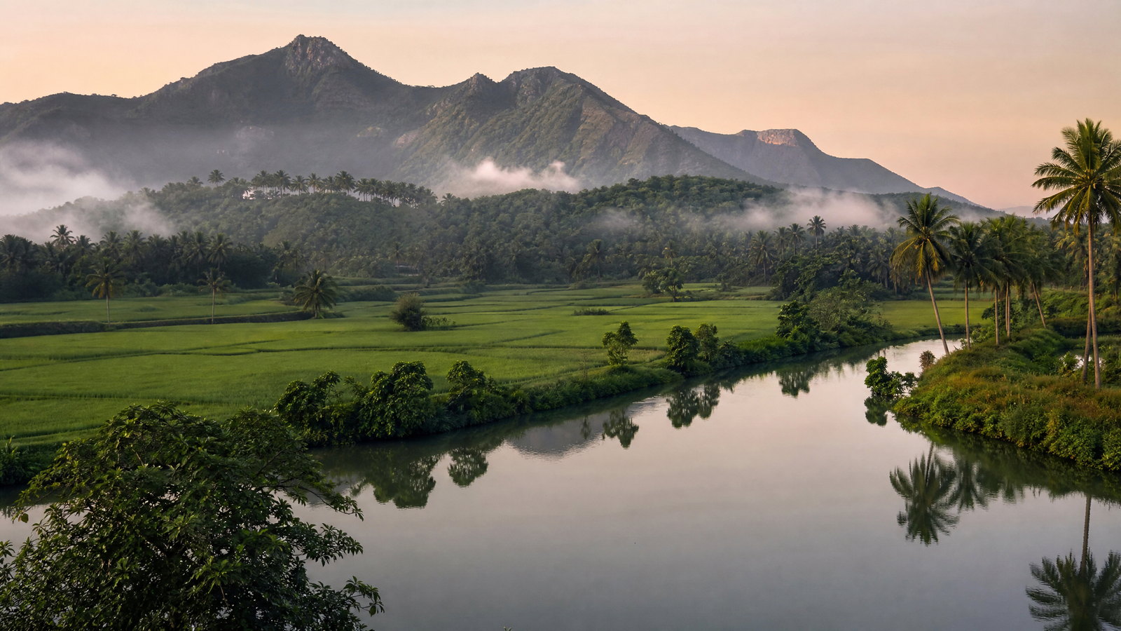
Kerala is a narrow southwest Indian state where the Arabian Sea, backwaters and Western Ghats sit close together. Thiruvananthapuram is the administrative capital and Kochi the principal metropolitan gateway. Within a short map are red-laterite cliff coast, Vembanad canals and polders, old port settlements, Munnar tea highlands, and forest corridors in Wayanad and Periyar. Its 580-kilometre coast, rivers and wet monsoon climate make water both a defining experience and a planning constraint. Malayalam is the state language; English is widely practical in cities and visitor-facing settings. Combine a city or heritage base with a wetland, coast, or mountain landscape rather than forcing a quick north–south circuit. November to February is broadly most comfortable; monsoon travel is beautiful but carries disruption risk in hills and flood-prone lowlands. Regional variation rewards a slower, place-based itinerary.
Regional notebook
Begin with the shape of the region.
Kerala is a sequence of water-and-mountain worlds, not one uniform tropical destination. Thiruvananthapuram has royal and temple heritage; Kochi and Kodungallur carry Indian Ocean histories; Vembanad and Kuttanad are lived-in wetland country; eastern high ranges combine plantation, grassland and forest. Northern Malabar adds forts and ritual traditions.
Compact geography makes variety possible, but not frictionless. Roads can be slow and rain reshapes plans. The selected places are an introduction, not an exhaustive list. Choose a coherent cluster and travel slowly enough to understand its connections.
Landscape
Geography changes the journey.
Kerala lies between the Arabian Sea and the Western Ghats. Its profile records 38,863 square kilometres, a 580-kilometre coast, 41 west-flowing rivers and Anamudi at about 2,694 metres. Coastal lagoons and laterite midlands rise quickly into highlands, explaining both dramatic variety and slow transfers.
The Ghats’ shola forests, grasslands and corridors hold exceptional endemism and deserve regulated access. Vembanad-Kol is an estuarine wetland shaped by rivers, farming, fisheries, flood buffering and transport. Kerala’s geography is a relationship among sea, rivers, wetlands and mountains.
Living culture
Arrive as a guest, not an audience.
Malayalam carries a rich literary, devotional and performing-arts world; English is commonly useful in urban and visitor-facing contexts. Kathakali, Mohiniyattam, Kutiyattam, Thullal, percussion, martial arts, temple arts, mosque and church heritage depend on venue, season and community. Follow dress, photography, seating and timing guidance at performances and sacred precincts.
Kochi, Kodungallur and Malabar reveal Indian Ocean trade, while Munnar and Thekkady also hold plantation and land-use histories. Buy directly from craftspeople or community groups when possible and seek consent before photographs.
Curated regional atlas
Places that reveal different parts of Kerala
This is a selective, geographically varied starting point rather than an exhaustive list. Use it to choose a coherent route, not to compress every place into one trip.
heritage precinct and capital-city quarter · Thiruvananthapuram, Thiruvananthapuram district
Thiruvananthapuram East Fort
East Fort is the historic core of Thiruvananthapuram, Kerala’s administrative capital, where a surviving gate, palace-era buildings, markets and sacred architecture reveal the former Travancore centre. The precinct is anchored by the Sree Padmanabhaswamy Temple and its seven-tiered facade, with Kuthiramalika and other royal structures close by. It is a dense, working city district rather than a sealed monument zone: traffic, commerce, worship and heritage overlap throughout the day. The place offers an effective introduction to Kerala’s southern political history, timber-rich architectural vocabulary, music traditions and urban religious life. Explore at a walking pace, but expect crowded pavements, heat and uneven surfaces.
Why this place matters
Go here to begin Kerala with civic and royal context rather than a resort landscape. The value is in reading relationships: gate to bazaar, temple to palace, and ceremonial space to ordinary street life. Visitors interested in architecture can compare Kerala roofs and woodwork with Dravidian monumental form; those interested in culture can time a visit around permitted public music or heritage programming without treating worship as entertainment. East Fort also works well for travellers who need a city-based first or final night. It is less suited to anyone seeking quiet, car-free heritage wandering or easy step-free access, since congestion and religious protocols shape the experience.
coastal geological and pilgrimage landscape · Varkala, Thiruvananthapuram district
Varkala Cliff Coast
Varkala combines a palm-lined Arabian Sea shore with the red laterite escarpment known as the Varkala Formation, a rare cliffed interruption on Kerala’s otherwise low coastal edge. The cliff top and beach sit beside the long-established Janardhana Swamy temple and Papanasam ritual landscape, so geology, recreation and pilgrimage occupy the same small area. Mineral springs, coastal paths and changing ocean views give it a different texture from flat sandy resort belts. The appeal is strongest in the contrast between exposed layered earth, sea light and everyday religious practice. Erosion, surf and monsoon rain make this a landscape to observe with care rather than to treat as an unrestricted adventure playground.
Why this place matters
Go for a southern Kerala coast that has a clear physical identity and a meaningful sacred context. Varkala rewards unhurried walking, dawn or late-day sea views, and a visit that pairs the cliff with the town’s temple traditions rather than focusing only on the beach. It can be an appealing alternative to a busy urban stop after Thiruvananthapuram, yet it remains close enough for a simple connection. The trade-off is exposure: midday heat, humid conditions, steep approaches and rough seas can narrow the experience. Travellers looking for a serene coast should avoid assuming that every section is quiet or suitable for swimming.
historic port quarter and waterfront cityscape · Kochi, Ernakulam district
Fort Kochi and Mattancherry
Fort Kochi and adjacent Mattancherry form a layered waterfront quarter on Kochi’s islands and peninsula, where Kerala, West Asian, European, Jewish and Christian histories meet in streets, warehouses, churches, mosques, markets and waterside edges. The district is not a single frozen colonial scene: fishing, ferry movement, arts activity and resident neighbourhoods continue around restored buildings and major landmarks. St. Francis Church, Mattancherry Palace, synagogue-area streets and the waterfront together make maritime exchange visible at walking scale. The nearby Dutch Cemetery’s restricted access is a reminder that heritage survives under varied stewardship. Allow time for the layered port story instead of collecting isolated facades.
Why this place matters
Go for Kerala’s clearest urban encounter with Indian Ocean history and adaptive reuse. Fort Kochi works especially well for people who like walking, museums, architecture, photography and contemporary cultural life, and it links easily to central Kerala rail, road and air corridors. Its streets reveal how trade, faith communities and colonial power shaped a port without making that history simple or romantic. The trade-off is density: traffic, heat, uneven paving and event crowds can make short distances slow. It is more rewarding as a two-night base than as a rushed stop between transfers, particularly if you want time for Mattancherry as well as the waterfront.
historic port town and multi-faith heritage landscape · Kodungallur, Thrissur district
Kodungallur–Muziris Cultural Landscape
Kodungallur is a coastal-backwater town south of Thrissur associated with ancient Muziris, a major node in Indian Ocean trade. The Periyar’s meeting with the sea, remnants of fortification, shrines and older settlement patterns make the wider area more revealing than any one landmark. Local traditions connect the town with early Christian, Islamic, Jewish and Hindu histories, while the Cheraman Juma Masjid, St. Thomas church tradition, Bhagavati Temple and Kottappuram Fort ruins convey distinct layers of memory. These claims deserve attentive, place-specific interpretation rather than a single origin-story narrative. Kodungallur is best seen as a living, multi-faith coastal landscape shaped by water, commerce and pilgrimage.
Why this place matters
Go to understand why Kerala’s culture cannot be separated from sea routes and river mouths. Kodungallur offers a slower, more locally rooted counterpoint to Fort Kochi: less polished as a single heritage district, but powerful for travellers interested in religious coexistence, archaeology, port history and ritual landscapes. It can be paired with Kochi or Thrissur, though it benefits from a guide or careful pre-reading because its sites are dispersed and their histories are complex. The trade-off is that access, ceremonies and interpretation vary substantially by site. It is not a place to rush through merely to tick off religious landmarks.
performing-arts institution and cultural landscape · Cheruthuruthy, Thrissur district
Kerala Kalamandalam
Kerala Kalamandalam stands on the Bharatapuzha, or Nila, at Cheruthuruthy and is one of the state’s defining institutions for classical performing arts. Founded in 1930 by poet Vallathol Narayana Menon, it helped revive and teach Kathakali and Mohiniyattam while also sustaining Kutiyattam, Thullal, Nangiarkoothu, music and percussion traditions. The campus’s residential teaching model and its Koothambalam make clear that these forms are disciplined bodies of knowledge, not only evening spectacle. Its location beside the river adds a landscape dimension to the cultural visit. A visit is most meaningful when structured around what the institution is actually offering rather than an expectation of constant performance.
Why this place matters
Go to encounter Kerala’s arts as practice, pedagogy and architectural setting. Kalamandalam is valuable for travellers who want to move beyond surface-level dance imagery and understand the intensive training behind gesture, makeup, rhythm and repertory. The campus can complement temple-town or heritage travel in central Kerala, and the Nila setting offers a quieter contrast to coastal Kochi. The trade-off is that an academic institution does not operate like a daily show venue; public access, classes and performances may be limited or scheduled. Give it time, arrive with curiosity, and treat students and teachers as people at work rather than as subjects for unsolicited photography.
mountain town and plantation cultural landscape · Munnar, Idukki district
Munnar High Range
Munnar is a high-range town in Idukki where the Muthirapuzha, Nallathanni and Kundala streams meet amid tea estates, forest ranges, reservoirs and steep valleys. At roughly 1,600 metres, it delivers a notable shift from Kerala’s humid coast: cool mornings, cloud, sharp road bends and layered green slopes. The tea landscape is visually dominant, but its story also includes plantation labour, Indigenous Muthuvan presence and ecological edges where estates meet shola forest. Munnar is a useful base for learning this highland geography, not simply a sequence of viewpoints. Nearby Eravikulam, reservoirs and smaller settlements require separate time and often different access arrangements.
Why this place matters
Go for Kerala’s most legible meeting of mountain climate, tea culture and Western Ghats scenery. Munnar suits travellers who enjoy long views, slow drives, easy-to-moderate nature stops and conversations about how cultivation shapes a mountain region. It pairs naturally with Eravikulam, but the town itself deserves attention for its streams and plantation history. The trade-off is popularity: traffic, crowding at viewpoints and concentrated development can diminish the sense of remoteness. It is also not an effortless coastal escape; winding transfers can be tiring and rain or fog may erase views. Plan two full nights rather than a rushed day trip.
national park and high-altitude grassland · Kannan Devan Hills near Munnar, Idukki and Ernakulam districts
Eravikulam National Park
Eravikulam National Park protects a distinctive Western Ghats mosaic of high grassland and shola forest in the Kannan Devan Hills. It includes Anamudi, South India’s highest peak, and is central to the conservation of Nilgiri tahr. The park’s accessible Rajamalai area is only a limited visitor interface with a much larger habitat; core and buffer areas are protected from routine visitor movement. The landscape is also associated with the episodic mass flowering of Neelakurinji, but that rare event should never be treated as an annual attraction. Above all, Eravikulam is a conservation landscape where altitude, weather and animal breeding cycles determine what visitors may see and do.
Why this place matters
Go to see why the Western Ghats are internationally important: montane habitat, endemic life, sharp ecological gradients and a conservation model that limits access. For most visitors, carefully managed viewing in Rajamalai offers a better encounter than an attempt to range freely. The park is rewarding for naturalists, landscape photographers and anyone willing to accept that a tahr sighting or long view is a possibility, not an entitlement. It pairs well with Munnar but deserves its own half or full day. The trade-off is limited spontaneity: seasonal closure, visitor quotas, transport arrangements and weather can all reshape a plan.
tiger reserve and forest–lake landscape · Thekkady, Idukki district
Periyar Tiger Reserve
Periyar Tiger Reserve is a large Western Ghats protected landscape centred on the lake created after the Mullaperiyar Dam was built across the Periyar River. Evergreen, semi-evergreen, moist deciduous forest and grassland support elephants, gaur, sambar, tiger habitat, endemic primates and a diverse bird community. Thekkady is the visitor gateway, but the reserve itself is not a theme park: lake experiences, walks and other nature programmes operate only within defined conservation and safety systems. The reservoir’s drowned trunks and forested shores make an evocative visual setting, yet the deeper reason to visit is the overlap of watershed protection, wildlife conservation and community-linked ecological management.
Why this place matters
Go for an accessible introduction to a major Kerala forest reserve, especially if you want to understand wildlife travel as habitat observation rather than a promise of large-animal sightings. Periyar offers a productive contrast with Munnar’s open high range: denser forest, a central lake and a different set of species. It can also connect naturally with nearby spice-growing highlands, though plantations and the reserve should not be conflated. The trade-off is uncertainty and regulation. Wildlife may remain unseen, boat or trail options can change, and summer heat or monsoon rain affects comfort. Two nights in the gateway area allow more flexibility than an overnight stop.
wetland village, lake and bird habitat · Kumarakom, Kottayam district
Kumarakom and Vembanad Wetland
Kumarakom is a cluster of islands, canals, mangroves and village edges on Vembanad Lake within the Kuttanad region. It is an intimate way into the Vembanad-Kol wetland system, a vast brackish tropical wetland fed by rivers and important for flood buffering, groundwater recharge, transport, fisheries and wintering waterbirds. The local bird sanctuary and narrow waterways draw attention, but the landscape is equally about farming, coconut, paddy bunds and daily movement by water. Kumarakom’s strength is scale: it slows the visitor down enough to notice how wetland ecology and human livelihoods depend on each other. Birdlife and water conditions are seasonal, not staged.
Why this place matters
Go for a quieter, more ecologically legible backwater experience than a quick cruise through open channels. Kumarakom suits birders, photographers, families and travellers interested in village-scale water landscapes, especially when explored with time for walking or a small, low-impact boat outing. It makes a strong counterpart to Alappuzha: Kumarakom foregrounds lake, mangrove and wetland habitat, whereas Alappuzha foregrounds canals, coir and town life. The trade-off is humidity, insects and variable bird activity. Water-based access also depends on weather and operational conditions, so it is not the place for a tightly timed transfer-day excursion.
canal town, coastal backwater and agrarian landscape · Alappuzha and Kuttanad, Alappuzha district
Alappuzha and Kuttanad Waterways
Alappuzha is a coastal canal town at the edge of the Kuttanad water world, where lagoons, narrow channels, paddy landscapes, coir work and the Arabian Sea meet. Its famous waterways are part of everyday transport and drainage systems, not merely a scenic circuit. Traditional kettuvallam forms recall the movement of rice and goods, while boat-race culture expresses collective skill and seasonal celebration. The town’s beach, pier area and canals can be combined with a slower look at the surrounding lowlands. Alappuzha is most revealing when visitors notice the labour and engineering behind water management as well as the coconut-lined views.
Why this place matters
Go for the most direct introduction to Kerala’s canal-and-coast identity, especially if you want to understand how water transport, paddy, coir and settlement intersect. Alappuzha works for travellers who enjoy town texture as much as open-water scenery, and it connects conveniently by rail and road. It can be paired with Kumarakom, but the two should not be treated as duplicates: one is a lake-wetland village cluster and the other a more urban, canal-linked gateway to Kuttanad. The trade-off is crowding around popular water experiences and strong heat outside the cooler season. Choose slower, smaller-scale water time over a packed itinerary.
wildlife sanctuary and biosphere-reserve corridor · Muthanga and Tholpetty ranges, Wayanad district
Wayanad Wildlife Sanctuary
Wayanad Wildlife Sanctuary occupies a crucial part of the Nilgiri landscape, with Muthanga in the south and Tholpetty in the north linking Kerala forests to protected areas in Karnataka and Tamil Nadu. Its deciduous and semi-evergreen forest, bamboo, valleys, rivers and wetlands support elephants, tiger habitat, gaur, deer, birds and smaller mammals. Elevations roughly between 650 and 1,150 metres produce a cooler feel than the coast but do not remove monsoon risk. The sanctuary also sits within a lived cultural region of Paniya, Kattunaickan, Kuruma and Kurichiya communities. It should be approached as a cross-border conservation corridor, not as a guaranteed wildlife-viewing drive.
Why this place matters
Go to appreciate connectivity: Wayanad makes visible how elephants, tigers and forest processes exceed a single state boundary. It is a strong choice for wildlife-minded travellers who can accept early starts, patient observation and the likelihood that a forest visit may yield birds, tracks and habitat rather than dramatic sightings. It pairs well with Wayanad’s agricultural uplands but should not be compressed into a quick transfer between cities. The trade-off is variable visibility and access, particularly in the monsoon, along with the ethical need to keep distance from animals and communities. Choose authorised guides and listen to range staff over informal wildlife promises.
coastal fort and Arabian Sea landscape · Pallikere, Kasaragod district
Bekal Fort and Coast
Bekal Fort rises on a laterite promontory above the Arabian Sea near Pallikere in Kasaragod, giving northern Kerala a bold combination of military architecture and open coast. The 17th-century fort is among the state’s largest and best-preserved, with a keyhole plan, thick walls, bastions, water tank and expansive views across beach and sea. Its setting reflects the strategic importance of the Malabar coast and spice routes, while later control by Mysore and the British adds further historical layers. The fort is a protected monument, so the experience should focus on ramparts, materials, views and interpretation rather than unsupervised exploration of every structure.
Why this place matters
Go for a northern Kerala landmark where architecture makes sense only because of its headland setting. Bekal is especially rewarding at lower light, when laterite walls, sea horizon and coastal vegetation show its defensive logic without the glare of midday. It offers a strong counterpoint to Kochi’s mercantile waterfront: this is a large coastal fort rather than a dense port quarter. The trade-off is exposure—sun, wind, rain and uneven stone can make rampart walking demanding—and the site can become busy. Give it enough time to read the fort slowly, then continue along the wider Kasaragod coast rather than treating it as a brief roadside photo stop.
Season and pace
Choose a date window for the experience, then keep a fallback.
There is no single perfect Kerala season. The southwest monsoon normally reaches Kerala around 1 June; June–September can bring persistent rain, swollen waterways, low mountain visibility and closures. District-level warnings matter more than a calendar.
November–February is usually easier for sightseeing, though busier. March–May is hot and humid on the coast; highlands are cooler but can be sunny or hazy. Dry spells may aid wildlife observation and cooler months birding, but sightings are never assured. Reconfirm forest and boat access locally.
Movement and planning
Distance on a map is not the same as usable travel time.
Moving through the region
Roads, rail, airports and inland water transport form Kerala’s network, but roads dominate and can be slow through continuous settlement, traffic and hill bends. Rail works along the coast; mountains require road transfers. Kochi, Thiruvananthapuram and Kozhikode suit different route shapes, so the nearest airport is not always the quickest highland arrival.
Ferries are useful in selected backwater areas, not a statewide solution. Historic lanes, ramparts, jetties and forest vehicles can involve steps or rough ground. Verify exact routes and surfaces if accessibility is important.
Building a workable route
Choose two or three clusters instead of attempting coast, wetland, high range and far north in a few nights. An eight- to twelve-day first route can pair Thiruvananthapuram and Varkala, Kochi and Kodungallur, then either Vembanad–Alappuzha or Munnar–Periyar. Add Wayanad and Bekal only with extra nights.
Carry rain protection, grippy footwear and waterproof storage; highlands can be cool after rain. Confirm opening status, entry expectations, weather, routes, accessibility and advance arrangements through the relevant local or official channel. Do not plan around rare blooms, wildlife or one ferry.
Travel responsibly
The regional context includes its limits.
Kerala’s wetlands and mountain habitats are working ecosystems. Refill water, avoid single-use plastics, carry litter out, and keep boat noise and wake low. Do not feed wildlife, pursue sightings, cross barriers, enter restricted forest, or approach large mammals. Conservation staff determine routes and timing.
During heavy rain or official warnings, avoid rivers, waterfalls, cliff edges, beaches, flooded roads and disaster-affected communities. At sacred places, dress modestly and never obstruct worship. Seek consent before photographing people. Favour transparently local guides, crafts, food and community experiences.
This is an evergreen regional guide. Weather, permits, closures, transport and local rules can change; confirm material conditions through the relevant local or official channel before travel.