Northeast India · State · AS
Assam
Assam is a river-shaped state where the Brahmaputra floodplain meets Himalayan foothills, tea country, ancient capitals and living religious traditions. Dispur is the administrative capital; Guwahati is the main urban and transport gateway. A first journey can combine Kaziranga grasslands, Majuli’s river-island culture and Ahom monuments around Sivasagar. With more time, routes extend west to Manas or east to rainforests, wetlands and Dima Hasao’s uplands. These places are not interchangeable: river crossings, rain, wildlife management and road conditions can reset a schedule. Build in buffers, use local guidance in protected areas, and treat monasteries, shrines, craft workshops and villages as lived places. This selective signature itinerary is designed to show regional range, not to be exhaustive. The strongest trips choose a few connected landscapes rather than attempting the entire state at speed, leaving time for weather, slow observation and conversations that turn a route into a meaningful encounter.
Regional notebook
Begin with the shape of the region.
Assam rewards a route, not a checklist. Guwahati concentrates transport and pilgrimage; Kaziranga and Pobitora offer grassland wildlife; Majuli is a flood-shaped island; Sivasagar and Charaideo reveal Ahom history; Manas, Nameri, Dibru-Saikhowa and Dehing Patkai run from foothills to eastern forest. Haflong offers an upland contrast. Build around two or three anchors. Wildlife trips suit the drier reserve season; heritage and craft travel is more flexible but rain-sensitive. Plan by daylight and river realities.
Landscape
Geography changes the journey.
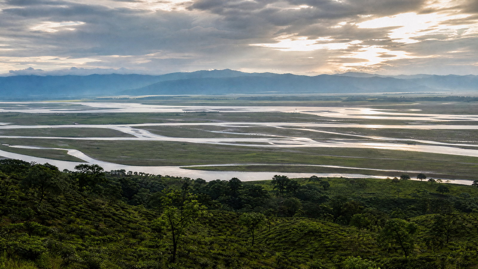
The Brahmaputra shapes Assam through channels, grasslands, sandbars, wetlands and cultivation. The valley is framed by the Eastern Himalayas and Patkai ranges; hills appear in Karbi Anglong, Guwahati and Dima Hasao. Southward, the Barak Valley has a separate river system and cultural geography. Floods, erosion, landslides and seismic risk are durable realities. In parks, seasonal water and animal movement govern access.
Living culture
Arrive as a guest, not an audience.
Assamese cultural life is plural and regional. Assamese is widely used, while Bengali, Bodo and Indigenous languages shape daily life. Bihu is important but does not encompass all communities. Majuli’s satras sustain Neo-Vaishnavite music, theatre and mask making; Sualkuchi’s handlooms link silk and household work; Hajo gathers Hindu, Muslim and Buddhist associations. Ask before photographing people, ritual, weaving or performance; shrines, workshops and homes have their own protocols.
Curated regional atlas
Places that reveal different parts of Assam
This is a selective, geographically varied starting point rather than an exhaustive list. Use it to choose a coherent route, not to compress every place into one trip.
city and pilgrimage landscape · Guwahati, Kamrup Metropolitan
Guwahati and Kamakhya Temple
Guwahati, Assam’s largest city and principal transport gateway, spreads across the Brahmaputra’s southern bank and surrounding hills. Nilachal Hill, home to Kamakhya Temple, is its most resonant historic landscape. The temple is major Shakta pilgrimage centre with a distinct Tantric association, while neighbouring shrines deepen the hill’s sacred geography. The city also offers museums, markets, river views and practical reset days before longer journeys. It is not a quiet stop: traffic, hill gradients, rain and festival crowds are central planning factors. Approach it as an active religious city, with time for both devotion and urban context.
Why this place matters
Choose Guwahati when you need the state’s most connected base but want more than a transit night. Kamakhya provides an encounter with an influential living pilgrimage tradition, and the Brahmaputra setting gives the city scale. It pairs easily with Deepor Beel, Hajo or Sualkuchi. The trade-off: intensity: queues and close quarters can be substantial, especially during major observances, and the hill approach is not universally easy. A measured visit, outside peak times where possible, makes room for the shrine’s significance rather than treating it as a viewpoint. It is an effective introduction before quieter grasslands, islands or heritage towns.
multi-faith pilgrimage town · Kamrup district
Hajo
Hajo is compact historic town in hills northeast of Guwahati, close to the Brahmaputra. It is distinguished by overlapping Hindu, Muslim and Buddhist associations rather than one monumental precinct. Hayagriva Madhava temple is focal point, while Powa Mecca and other sacred places create a layered devotional landscape. Its modest scale encourages slow exploration and attention to daily worship, processions, hill and river. Hajo is cultural counterweight to Guwahati’s urban pace and combines naturally with Sualkuchi’s craft landscape. It is best understood as a living pilgrimage town, not a group of detached monuments.
Why this place matters
Go to Hajo for an intimate view of Assam’s shared sacred geography. The point is not to tick off shrines but to see how different religious histories inhabit one small town and its surrounding landscape. It suits a half- or full-day cultural stop and pairs well with Sualkuchi. The trade-off: variability: worship, local events and weather can reshape access. Respectful clothing and a quiet manner matter more than elaborate preparation. Confirm the day’s conditions before setting out and remain flexible about the order of visits. Give each site enough time to avoid reducing active religious spaces to photo stops.
handloom craft town · Kamrup district
Sualkuchi
Sualkuchi is Brahmaputra-side weaving town northwest of Guwahati, where household handlooms remain part of the streetscape. It is associated with Assam’s silk traditions, including golden muga, paat and eri, and textiles such as mekhela chadors and gamusas. Craft is embedded in homes, workshops, trade and ritual life rather than isolated in a display hall. Small temples, satras, fields and low hills frame the weaving neighbourhoods. A visit can focus on processes, informed questions and the labour behind fabric, not merely finished goods. The town connects regional material culture with the wider river-valley landscape.
Why this place matters
Choose Sualkuchi for the human scale of a working craft landscape. Seeing preparation and weaving, when welcomed, offers more context than meeting finished silk in a market. It suits travelers interested in design, textiles and slow observation, and fits readily with Guwahati or Hajo. The trade-off: that workshops are workplaces and domestic spaces; visits should follow makers’ time, consent and photography preferences. Winter festivals can add atmosphere, but quieter days may support better conversation. Allow enough time to distinguish muga, paat and eri traditions, while remembering that demonstrations and availability are changing details to confirm locally.
Ramsar wetland and bird habitat · Western Guwahati, Kamrup Metropolitan
Deepor Beel Wildlife Sanctuary
Deepor Beel is freshwater wetland at Guwahati’s western edge, where open water, aquatic vegetation and the adjoining Rani–Garbhanga forest landscape meet. It is Assam’s Ramsar wetland and a valuable urban-edge bird habitat, holding resident and migratory waterbirds alongside fish, reptiles and amphibians. Its significance is ecological, not ornamental: the wetland belongs to a living hydrological system beside a fast-growing city. A visit offers a different reading of Guwahati, replacing hill traffic and temple crowds with water, seasonal bird movement and conservation pressure. Quiet observation and patient birding suit this sensitive landscape.
Why this place matters
Go to Deepor Beel to understand why wetlands matter in a riverine state and how biodiversity persists at an urban boundary. It is a low-transfer excursion for birders, families and travelers seeking nature near Guwahati. The reward can be subtle: changing light, waterbird activity and the wetland–forest edge. It is not a substitute for a national park, and sightings vary with water level, season and disturbance. Keep expectations flexible and do not pursue birds or elephants. Stay on permitted access, keep noise low and leave no litter. Confirm viewing areas and conditions before setting out.
alluvial grassland wildlife sanctuary · Morigaon district
Pobitora Wildlife Sanctuary
Pobitora Wildlife Sanctuary is compact Brahmaputra floodplain grassland east of Guwahati, known for one-horned rhinoceros and a mix of wetlands, tall grass and open habitat. Its proximity to the city makes it a practical short wildlife addition when a longer Kaziranga stay is impossible. The sanctuary’s small scale is both strength and limit: it can offer concentrated grassland viewing but lacks the breadth of a multi-day national-park visit. The surrounding Mayong area adds cultural context, though wildlife should remain the focus inside. Seasonal water, animal movement and management decisions shape what can be responsibly seen.
Why this place matters
Choose Pobitora when time is short, when Guwahati is your base, or when you want to compare a compact rhino grassland with Kaziranga’s broader floodplain. It works best as a half-day or overnight stop, leaving room for weather and changing entry sessions. Ease of reach should not encourage crowding, loud behavior or off-route requests. Sightings vary, and the most meaningful visit includes habitat, birds and wetland processes alongside rhino observation. It is an introduction to conservation, not a guarantee of close views. Confirm operating conditions, authorised vehicles and entry timing through the responsible local authority.
World Heritage national park · Golaghat, Nagaon, Sonitpur and Biswanath areas
Kaziranga National Park
Kaziranga is Assam’s defining floodplain wildlife landscape: wet alluvial grasslands, shallow water bodies, woodland patches and the shifting influence of the Brahmaputra beneath the Karbi Anglong hills. A World Heritage property, it is the major global stronghold of the Indian one-horned rhinoceros and supports elephant, wild water buffalo, tiger, swamp deer, river dolphin and rich birdlife. The park is not static. Annual flooding, grassland change and animal movement are integral to its ecology and affect access. Managed ranges reveal differing habitats and distances. Kaziranga merits time for landscape, conservation context and changing light, not only a flagship species.
Why this place matters
Go to Kaziranga for a consequential conservation landscape and the scale of a living river floodplain. A memorable moment may be a rhino in grass, a wetland full of birds or an empty view toward hills, not a dramatic encounter. Two nights allow flexibility across weather and managed routes; another helps birders. The trade-off: seasonality and regulation: floods, wildlife movement and park management shape access. Keep distance, avoid pressure on animals and accept that no sighting is guaranteed. Use authorised entry arrangements and treat local safety instructions as part of the experience, not an inconvenience.
Himalayan foothill national park · Sonitpur district
Nameri National Park
Nameri occupies the eastern Himalayan foothill zone near the Arunachal Pradesh boundary, where forest, river and grassland create a different atmosphere from Kaziranga’s open floodplain. The Jia Bhoroli marks an important landscape edge, and the park is associated with elephant, gaur, tiger habitat, hornbills and threatened birds including white-winged wood duck. It is place for forest texture and bird calls as much as large-mammal expectations. Tezpur is the usual urban anchor, while weather can be more changeable than in the central valley. Nameri’s value lies in an unhurried, low-impact encounter with a foothill ecosystem.
Why this place matters
Choose Nameri if you prefer forest and river ambience to Kaziranga’s more concentrated wildlife rhythm. It complements Tezpur or a nature-focused eastern Himalayan route. Birders may value it most, but patient travelers gain from the habitat mosaic and landscape scale. The trade-off: uncertainty: dense vegetation means large mammals can remain unseen, while water activities depend on conditions and management permission. Do not treat the river as casual recreation in rain or high water. Allow a full day, follow authorised naturalists and confirm which trails, river activities or entry areas are operating before travel.
World Heritage national park · Baksa, Chirang and Udalguri areas
Manas National Park
Manas is World Heritage landscape in western Assam where Bhutan-facing foothills descend through forest into alluvial grassland, riverine tracts and marshes. The Manas river system and monsoon processes continually shape these habitats. The sanctuary is important for tiger, elephant, greater one-horned rhinoceros, wild water buffalo, golden langur, pygmy hog, Bengal florican and exceptional birdlife. Its identity is broader and more mountainous than Kaziranga’s: wooded hills and Bhutan’s horizon frame the grasslands. Manas shows how conservation links communities, transboundary landscapes and long-term management. Come for habitat diversity and restoration context, not a quick species tally.
Why this place matters
Go to Manas for the rare combination of Himalayan foothill scenery, varied habitats and high conservation significance. It suits travelers wanting a fuller wilderness landscape than a single grassland reserve provides. Two nights allow space for light, birds and separate managed excursions. The trade-off: distance from Guwahati and variable viewing in extensive habitat. Some species are elusive; a day without a headline sighting can still be informative. Respect management instructions, avoid boundary speculation and never request access outside visitor zones. Confirm entry points, opening conditions and permitted activities before travelling.
inhabited river island and cultural landscape · Majuli district
Majuli
Majuli is an inhabited Brahmaputra river island whose identity comes from water and culture. Its Neo-Vaishnavite satras sustain devotional music, dance, theatre and scholarship, while Samaguri is associated with performance mask making. Mising and Deori communities, handloom work, pottery, wetlands and stilt-house landscapes broaden the island beyond monasteries. Majuli was formed through river-course change and remains exposed to erosion and transport uncertainty, making geography inseparable from daily life. Satras are religious institutions and villages are homes, not an open-air museum. Arriving by river explains its scale and fragility, but requires patience and respect for conditions.
Why this place matters
Choose Majuli for a slower cultural landscape where a river crossing, satra visit, craft observation and wetland light can belong to one day. It rewards travelers who value living traditions over monument density and can spare time for transit uncertainty. Two nights are better than a rushed day trip when ferries or weather are unsettled. The trade-off: variable infrastructure: river operations, roads and seasonal conditions can change, while religious spaces may limit access or photography. Dress modestly, ask permission before images and avoid reducing communities to performance. Keep the schedule light enough to accommodate a changed crossing time.
historic town and royal architecture ensemble · Sivasagar district
Sivasagar Ahom Monuments
Sivasagar preserves Assam’s most legible urban landscape of the Ahom kingdom. Great tanks, temples and brick monuments connect water management, faith, court life and ceremony. Rang Ghar is an eighteenth-century royal pavilion associated with public games and festivals, while Talatal Ghar was a multi-storeyed palace, administrative centre and military complex. The surviving upper structures and grounds matter more than tales of hidden passages: they show late Ahom engineering ambition and political life. Sivasagar is compact enough for deliberate exploration, yet its monuments gain depth when read alongside Charaideo’s burial landscape and the wider upper-Assam plain.
Why this place matters
Go to Sivasagar to understand an indigenous state’s architecture, water systems and ceremonial life beyond generic palace sightseeing. Rang Ghar’s form and Talatal Ghar’s scale make a strong pair, while tanks and temples slow the experience into a civic landscape. One full day works, though heritage-focused travelers may prefer two. The trade-off: conservation sensitivity: underground or fragile sections can be closed, and access changes. Do not rely on old tunnel stories or assume every building is open. Use signed routes, observe barriers and confirm hours, restoration work and photography rules with the relevant local authority.
World Heritage royal necropolis · Charaideo district
Charaideo Moidams
The Moidams of Charaideo are the Tai-Ahom royal mound-burial landscape in eastern Assam’s Patkai foothills. For six centuries, the dynasty shaped hills, forests, planted trees and water bodies into a sacred geography. The mounds combine earthen forms with vaults of brick, stone or earth and embody Tai-Ahom cosmology rather than a palace aesthetic. Continuing ancestor-related rituals confirm that this is living sacred landscape as well as an archaeological one. Its World Heritage recognition reflects the burial system and the composed relationship of mound, water, vegetation and topography. It calls for contemplative, low-impact attention rather than monument collecting.
Why this place matters
Choose Charaideo for the spiritual and funerary side of the Ahom world, ideally after Sivasagar’s court architecture. The contrast is powerful: Sivasagar explains governance and ceremony, while the moidams explain memory, ancestry and sacred landscape. A half day suits a focused visit, with extra time if combining both. The trade-off: protection and ritual use: movement or photography may be limited. This is not a site for climbing mounds, searching for vaults or casual picnics. Follow established routes, keep noise low and confirm visitor procedures, restricted areas and weather-related ground conditions through the responsible authority.
riverine national park and biosphere reserve · Tinsukia district
Dibru-Saikhowa National Park
Dibru-Saikhowa is far-eastern riverine national park and biosphere reserve shaped by the Brahmaputra system and ecological change after the 1950 earthquake. Grassland, swamp forest, wetlands and river channels create a landscape valued for migratory and threatened birds, plus dolphin, primates, elephant and other wildlife. Feral horses are associated with the park, although sightings always vary. This is more remote-feeling nature destination than Kaziranga, with Tinsukia as a practical base. Its appeal is the texture of a changing river landscape and bird-focused, water-aware exploration under conservation rules, rather than polished infrastructure or fixed wildlife outcomes.
Why this place matters
Go to Dibru-Saikhowa for an eastern Assam reserve where water, birds and riverine habitat set the pace. It complements Dibrugarh, Dehing Patkai or upper-Assam tea country and rewards ecological interest over certainty. Two nights in the wider area reduce logistical pressure. The trade-off: distance and operational dependence: access can involve weather, river conditions, guides and forest procedures, while terrain may not suit every mobility need. Do not expect Kaziranga-style viewing. Carry binoculars and patience, keep a flexible schedule, and confirm entry points, boat feasibility and safe observation protocols before departure.
tropical evergreen rainforest national park · Dibrugarh and Tinsukia districts
Dehing Patkai National Park
Dehing Patkai protects Assam Valley tropical wet evergreen forest in the far east, near the Arunachal Pradesh boundary and the towns of Digboi, Duliajan and Margherita. Its rainforest character—dense canopy, humidity and layered vegetation—is a marked change from open floodplain parks. The wider landscape includes the Dehing-Patkai Elephant Reserve and histories of extraction alongside conservation. Hoolock gibbon, slow loris, macaques, hornbills and elusive mammals belong to this forest, but observation depends on patience and permission, not visibility. It is best understood as a sensitive rainforest system, where sound, vegetation and ecological connections can matter more than dramatic encounters.
Why this place matters
Choose Dehing Patkai to encounter Assam’s humid evergreen side and balance grassland wildlife with forest ecology. It works with Dibrugarh or Dibru-Saikhowa, but requires tolerance for long transfers and limited sightlines. Birders and natural-history travelers often gain most; those expecting easy large-animal viewing may be disappointed. The forest’s value is precisely why access should remain low impact. Avoid loud groups, never leave permitted paths and do not seek unsupervised entry. Confirm authorised visitor areas, walks or interpretation opportunities, plus weather, road conditions and conservation instructions before travelling.
hill town and cultural landscape · Dima Hasao district
Haflong
Haflong is Assam’s principal hill town and Dima Hasao headquarters, set about 966 metres above sea level amid folded hills and a cooler climate than the Brahmaputra Valley. Hill roads, lake views, markets and the cultural presence of Dimasa, Jeme-Naga, Hmar, Kuki, Biate and Vaiphei communities shape its setting. Haflong is not a high-altitude trekking base in the Himalayan sense; it is lived upland town where weather, road conditions and local rhythms matter. It can anchor careful exploration of nearby landscapes while offering a temperate counterpoint to Guwahati and upper-Assam cities.
Why this place matters
Go to Haflong for hill climate, a different cultural setting and a break from river-valley circuits. It rewards travelers who can slow down, use it as a base and accept that the journey may be the main logistical event. Cooler conditions are an advantage, but steep terrain, rain and road disruption can reduce accessibility. Two nights provide a weather buffer. The trade-off: connectivity: routes are longer and less predictable than the main valley corridor, so do not insert Haflong into a compressed plan. Confirm rail or road status, transport, landslide advisories and accessible accommodation directly before travel.
Season and pace
Choose a date window for the experience, then keep a fallback.
November through February is usually coolest for wildlife and drives; March and April grow hotter but remain useful before the rains. Monsoon weather can bring river rise, erosion, cancellations and landslides, especially near ferries, foothills and hill roads. Reserve patterns, island crossings and festivals affect access. Treat month ranges as guidance, not a promise. Confirm weather, reserve status, ferries, roads and observances through the relevant local or official channel.
Movement and planning
Distance on a map is not the same as usable travel time.
Moving through the region
Guwahati is the main air, rail and road gateway; Jorhat or Dibrugarh can suit upper-Assam routes. Rail helps with city connections, but parks, ghats, villages and archaeological sites usually need a road vehicle. Bridges, traffic, rain, road works and wildlife corridors affect pace. Majuli requires river transport or a longer road approach. Travelers with limited mobility should confirm boat boarding, uneven paths and vehicle transfers in advance.
Building a workable route
For a first route, pair Guwahati with Kaziranga, Majuli and Sivasagar–Charaideo; add either Manas in the west or Dibrugarh, Dibru-Saikhowa and Dehing Patkai in the east. Reserve two nights near major wildlife landscapes and a full day for Majuli. Keep an extra day for ferries, rain or long transfers. Pack modest shrine clothing, sun and insect protection, rain layers and a light layer for Haflong. Confirm procedures, boats, roads and accessibility locally.
Travel responsibly
The regional context includes its limits.
Assam’s appeal depends on dynamic rivers, intact habitat and communities who live with both. In wildlife areas, keep distance, stay with authorised staff and never request off-route approaches. Around wetlands, carry out litter and avoid playback or crowding birds. On Majuli, recognise erosion and ferry dependence as residents’ daily risk, not entertainment. At sacred places, dress conservatively and follow footwear and photography instructions. In craft areas, ask before handling textiles or looms; use refillable water and reduce packaging.
This is an evergreen regional guide. Weather, permits, closures, transport and local rules can change; confirm material conditions through the relevant local or official channel before travel.