North India · State · UK
Uttarakhand
Uttarakhand is a Himalayan state where a short journey can move from the sal forests and river plains of the Doon Valley to pilgrimage towns, lake-country Kumaon, and glacier-fed Garhwal. Dehradun is the administrative capital and a practical gateway, while Haridwar and Rishikesh anchor the lower Ganga’s living religious and wellness traditions. Higher up, roads and foot routes lead to seasonal shrine towns, alpine meadows, protected forests and one of India’s most dramatic high-mountain landscapes. This atlas selection is deliberately varied rather than exhaustive: it pairs crowded, accessible cultural centres with quieter heritage, wetland and mountain settings. The central trade-off is time and certainty. A lowland or foothill itinerary can be compact and comparatively flexible; high Himalayan travel needs spare days, conservative pacing and readiness for weather or road changes. Choose one geographic arc well rather than treating the state as a single drive-through destination.
Regional notebook
Begin with the shape of the region.
Uttarakhand rewards an itinerary built around elevation rather than a checklist. Low foothills hold urban gateways, Ganga pilgrimage and sal-forest wildlife; Kumaon offers lake towns, stone temples and ridge views; Garhwal concentrates great river valleys, Char Dham shrines and serious high-altitude terrain. Dehradun, Haridwar and Rishikesh suit first or last nights and travelers needing stronger transport and medical access. Nainital and Mussoorie are accessible hill choices but can be busy in holidays. Jageshwar, Asan and Corbett offer different tempos: heritage in cedar forest, migratory-bird wetland and regulated wildlife habitat. Badrinath, Kedarnath, Auli and the Valley of Flowers require more time, warm layers and flexibility. Pair one populated cultural centre with one protected or highland landscape, leaving buffers for slow mountain travel.
Landscape
Geography changes the journey.
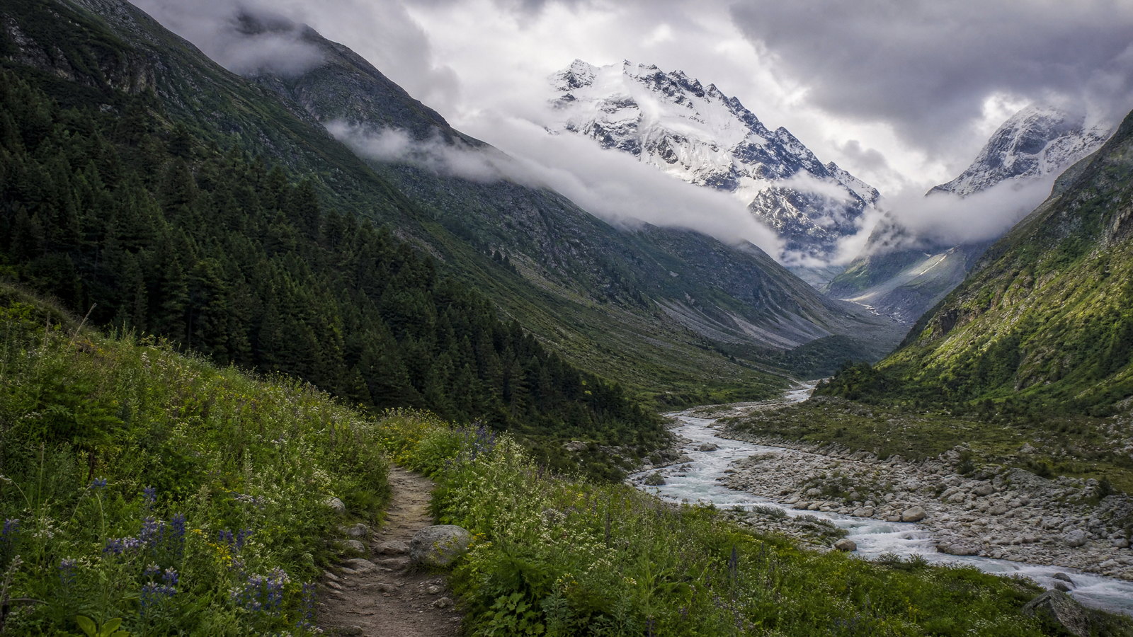
The state is divided between Garhwal in the west and Kumaon in the east. It rises from the Shivalik foothills and Doon Valley through forested middle slopes to alpine meadows, glaciers and high Himalayan ridges. The Ganga and Yamuna systems begin here; the Alaknanda, Bhagirathi and Mandakini valleys structure much Garhwal travel. Nanda Devi dominates the eastern high mountains, while Naini Lake and Kumaon hills offer a less extreme counterpoint. This relief creates extraordinary variety but makes distance deceptive: a road map cannot convey hairpins, weather holds, landslide repair or altitude fatigue.
Living culture
Arrive as a guest, not an audience.
Devbhoomi, or land of the gods, is a widely used description, but Uttarakhand is more than a shrine circuit. Haridwar’s ghats and Rishikesh’s ashrams are living public spaces, while Badrinath and Kedarnath are seasonal high-altitude pilgrimage towns. Garhwali and Kumaoni identities, foodways, music, festivals and village life give the state much of its texture. Jageshwar’s temple cluster and regional crafts connect architecture to a forested Kumaoni landscape. Buddhist and Sikh sites, Dehradun’s educational institutions and a conservation tradition broaden the picture. Dress modestly at shrines and villages; observe before photographing ceremonies or individuals, and ask consent when unsure.
Curated regional atlas
Places that reveal different parts of Uttarakhand
This is a selective, geographically varied starting point rather than an exhaustive list. Use it to choose a coherent route, not to compress every place into one trip.
capital city and valley gateway · Dehradun district, Doon Valley
Dehradun
Dehradun, Uttarakhand’s capital, sits in the Doon Valley between the Himalayan foothills and the Shivaliks. It is the state’s most practical urban base: a working city of institutions, markets and transport rather than a mountain resort. The Forest Research Institute’s monumental campus, the Guru Ram Rai Darbar and Mindrolling Monastery reveal different strands of the city’s intellectual, religious and built heritage. On the outskirts, Asan Barrage, Sahastradhara and forest-fringed valleys provide a transition toward nature. Dehradun also makes geographic sense before Mussoorie, Rishikesh, Haridwar or a Garhwal road journey, especially for travelers who value services and a gentler first night over immediate altitude.
Why this place matters
Choose Dehradun to understand Uttarakhand as a contemporary state as well as a mountain destination. Its valley setting, institutions and layered religious sites add substance to an arrival or departure day, while its transport links reduce friction before moving into hill country. It is especially useful for mixed-age groups, first-time mountain travelers and anyone who wants dependable urban facilities before a longer road transfer. The trade-off is atmosphere: this is a busy city, not a quiet alpine retreat. Combine it with nearby Asan for birds, Mussoorie for a ridge escape, or Rishikesh and Haridwar for river-based cultural life rather than treating it as a standalone wilderness stop.
hill town and colonial-era ridge landscape · Dehradun district, Garhwal
Mussoorie
Mussoorie occupies a roughly 2,000-metre ridge above the Doon Valley, with high Garhwal views to the north and a long history as a nineteenth-century hill station. Its built fabric mixes busy bazaar corridors, old churches, former estates and the quieter cantonment character of nearby Landour. Walks around Camel’s Back Road, the views from Lal Tibba and the George Everest estate area make the geography legible beyond the commercial centre. The town is also a useful low-commitment introduction to Himalayan weather and gradients. It remains a popular weekend and school-holiday destination, so its strongest qualities emerge when visitors step beyond the most congested stretches and accept a slower, foot-first rhythm.
Why this place matters
Mussoorie suits travelers who want ridge scenery, heritage architecture and short walks without committing to a remote mountain itinerary. It is a good counterweight to Dehradun’s valley pace, and Landour adds a more residential, wooded perspective. Its celebrated winterline can be an atmospheric seasonal bonus, but it should not drive a fixed plan. The main trade-off is crowding and traffic in peak periods; a quiet morning walk is more rewarding than a rushed sequence of viewpoints. Those seeking deep silence, wild habitat or high Himalayan trekking should use Mussoorie as a comfortable staging place, then continue to a more appropriate landscape.
Ganga river town and living spiritual landscape · Dehradun district, lower Garhwal
Rishikesh
Rishikesh is a Ganga-side town at the entrance to Garhwal, known for ashrams, yoga and meditation traditions, river ghats and suspension-bridge walks. The setting is as important as the institutions: the river narrows between wooded foothills before the plains, making the town both a pilgrimage place and a threshold to the mountains. Triveni Ghat’s evening ritual, Bharat Mandir, Swargashram and the former Chaurasi Kutia ashram illustrate how ritual, learning and twentieth-century cultural history overlap here. White-water activity on nearby stretches is another draw, but it belongs to a river whose flow and safety conditions deserve more respect than a quick adventure label suggests.
Why this place matters
Go to Rishikesh for a living encounter with the Ganga and for a gentle introduction to Garhwal’s spiritual geography. It works well when the goal is a few unhurried days of walks, temple etiquette, reflective time and river views, rather than consuming a schedule of classes or thrill activities. The town’s proximity to the airport and foothill roads makes it an efficient start for Badrinath- or Kedarnath-bound travel. It can be crowded and commercially intense in places; travelers who seek quiet should plan early mornings, stay longer than a day trip, and treat yoga, ritual and river settings as practices and public spaces, not props.
pilgrimage city and Ganga riverfront · Haridwar district, Himalayan foothills
Haridwar
Haridwar stands where the Ganga reaches the Indo-Gangetic plains, making it one of North India’s major Hindu pilgrimage cities and a powerful contrast to Uttarakhand’s higher valleys. Har Ki Pauri is its best-known ghat, while Kankhal, the hill temples and older ashram districts reveal a wider sacred geography. Daily river worship, bathing practices, pilgrimage queues and market movement make the city a lived religious landscape rather than a museum. It also hosts the Kumbh Mela cycle and the annual Kanwar season, when the scale of movement and civic management changes substantially. Haridwar’s railway and road connections make it a logical gateway before heading upriver.
Why this place matters
Haridwar is the place to grasp how a river, ritual and urban life converge before the Ganga enters the plains. It rewards patient observation at the ghats, a respectful pace and an evening or morning timed around the river rather than a hurried photo stop. The city is highly accessible compared with mountain destinations and can anchor an itinerary for travelers with limited time or mobility. Its trade-off is density: festivals, weekends and pilgrimage seasons bring crowds, diversions and heightened demand on public space. Visit with flexible expectations, preserve quiet around worship, and avoid treating sacred water as a backdrop for risky behavior.
Ramsar wetland and bird habitat · Dehradun district, near the Asan–Yamuna confluence
Asan Conservation Reserve
Asan Conservation Reserve is a foothill wetland near Dehradun, formed around the Asan Barrage and valued for resident and migratory waterbirds. It is Uttarakhand’s Ramsar-listed wetland, an important reminder that the state’s nature story is not confined to snow peaks and national parks. Open water, reed-edge habitat and the surrounding valley make it a quieter, lower-elevation alternative to a long mountain transfer. Winter migration is the principal draw, but a visit is best framed as slow observation rather than a search for a particular species. The reserve’s conservation purpose comes first; birds may be distant, seasonal water levels vary and the most rewarding experience is often patient watching from appropriate public areas.
Why this place matters
Choose Asan for a gentle wildlife stop that is realistic for families, birders and travelers based in Dehradun. It adds wetland ecology to an itinerary otherwise dominated by hills, shrines and forests, and needs far less physical commitment than the high Himalaya. Autumn through late winter can offer strong bird activity, while quieter months may appeal to travelers interested in landscape rather than peak migration. The trade-off is subtlety: this is not a spectacle-driven reserve, and a short visit may yield only brief sightings. Bring binoculars if possible, keep sound low and plan it alongside Dehradun rather than as a substitute for a full wildlife circuit.
tiger reserve and sal-forest landscape · Nainital and Pauri Garhwal districts, around Ramnagar
Corbett Tiger Reserve
Corbett Tiger Reserve spans riverine grassland, sal forest, hills and the Ramganga landscape at the Himalayan foothills. The park is India’s first national park, established in 1936, and remains a major conservation landscape for tigers, elephants, deer, birds and river fauna. Ramnagar is the main gateway, but the reserve is not a single interchangeable outing: visitor zones, timing, vehicle allocation and seasonal openings are tightly managed. Its ecological value lies as much in habitat and animal movement as in any one sighting. A responsible visit accepts regulated routes, early starts and long quiet stretches, with observation guided by the forest’s own rhythms rather than expectations of close encounters.
Why this place matters
Corbett is a strong choice for travelers who want a structured wildlife experience within a larger foothill itinerary. The mix of forest, river and open habitat can make it rewarding for birdwatchers and landscape observers as well as people interested in large mammals. Its accessible Ramnagar approach pairs naturally with Nainital or Kumaon. The trade-off is uncertainty and regulation: access differs by zone and season, wildlife never performs on demand, and monsoon closures affect several areas. Give the reserve at least two sessions if conditions allow, use only the prescribed process, and value a well-run, low-impact visit over a hurried attempt to maximize sightings.
lake town and Kumaon hill station · Nainital district, Kumaon
Nainital
Nainital gathers a Kumaon hill town around the crescent-shaped Naini Lake at roughly 2,000 metres, enclosed by the ridges locally known as the seven hills. Its character rests on the lake, the lakeside Naina Devi Temple, wooded viewpoints, schools and the legacy of its former role as a colonial-era summer capital. The compact centre encourages walking, while the surrounding slopes offer a broader sense of the forested basin. Nainital is not a remote wilderness destination; it is a dense, popular lake town with an active public realm. That makes it accessible and visually immediate, but also vulnerable to traffic, crowding and pressure on its small urban landscape.
Why this place matters
Nainital is a good Kumaon introduction for travelers wanting a cool-climate town, mountain-lake views and easy access to short scenic walks. It can work particularly well for multigenerational trips because the lakefront offers a concentrated experience without a demanding trek. The town’s heritage, temple setting and ridge geography give it more depth than a single boating stop. The trade-off is predictable peak-period congestion; visitors seeking peace should stay on the shoulders of the season, walk early, and add a nearby quieter landscape rather than expecting seclusion in the centre. It is best enjoyed as a lake-and-ridge place, not as a base for rushed daily drives.
historic temple complex and cedar-forest cultural landscape · Almora district, Kumaon
Jageshwar
Jageshwar is a Kumaon temple settlement set beside the Jata Ganga stream in a deodar-lined valley near Almora. Its cluster of more than a hundred stone shrines, principally associated with Shiva, makes a remarkable architectural ensemble rather than a single monument. The Archaeological Survey of India protects multiple temples in the complex, and inscriptions, sculptures and tightly grouped Nagara-style forms reward slow looking. Yet Jageshwar remains a place of worship, especially around seasonal fairs and Shivratri, so its atmosphere is shaped by living ritual as much as by art history. The forested setting softens the scale of the site and distinguishes it from both urban pilgrimage centres and high-altitude shrines.
Why this place matters
Go to Jageshwar for a quieter encounter with Uttarakhand’s sacred architecture and Kumaoni cultural landscape. It is ideal for travelers who prefer carved stone, forest walks and time to observe a living temple complex over a crowded headline destination. The short distance from Almora makes it an achievable heritage detour, while its elevation and valley setting give a welcome coolness outside the coldest months. The trade-off is that it deserves attention and restraint: temple timing, rituals and photography norms shape the visit, and a quick drive-by misses the ensemble’s value. Combine it with Almora or Binsar-region landscapes, leaving time for unhurried movement.
seasonal high-Himalayan pilgrimage town · Chamoli district, Garhwal
Badrinath
Badrinath is a high Garhwal town on the Alaknanda, around 3,100 metres, between the Nar and Narayana ranges. Its Vishnu temple is one of Uttarakhand’s Char Dham shrines and the centre of a short, intense warm-season pilgrimage landscape. The compact town also opens toward Mana, thermal springs, river valleys and the larger Nanda Devi–Valley of Flowers region. Architecture, ritual, mountain weather and road logistics all converge here: the temple’s seasonal closure is integral to the place, not an inconvenience. The altitude and exposed valley make Badrinath fundamentally different from the foothill pilgrimage cities, even when it is reached by road.
Why this place matters
Badrinath is for travelers who want to understand a major Himalayan shrine in its geographical setting, with time to absorb both ritual life and the Alaknanda valley. It can combine naturally with Auli, Joshimath or the Valley of Flowers approach, but should not be rushed into a same-day mountain transfer. The scenic reward is substantial, while the trade-off is a narrow operating season, possible crowd management and rapidly changing weather. Travelers not on pilgrimage can still visit respectfully, dressing for cold and observing temple rules. A measured pace and a spare day make the experience safer and more meaningful than an ambitious circuit schedule.
high-altitude pilgrimage town and Himalayan valley · Rudraprayag district, Garhwal
Kedarnath
Kedarnath is a seasonal settlement at about 3,580 metres near the Mandakini’s headwaters and beneath the Kedarnath massif. At its centre stands the stone Kedarnath Temple, a Shiva shrine and Char Dham destination set against an unusually direct mountain backdrop. The approach from the roadhead involves a substantial uphill journey through the wider Kedarnath landscape, while the town’s high elevation, snowfall and exposure dictate its seasonal rhythm. The 2013 disaster remains part of its modern context, underscoring why infrastructure, weather interpretation and visitor discipline matter here. Kedarnath is therefore simultaneously a place of devotion, a mountain environment and a managed route where conditions must take precedence over fixed itineraries.
Why this place matters
Kedarnath offers one of the state’s most powerful fusions of pilgrimage, stone architecture and high-Himalayan geography. It is meaningful for devotees and for travelers interested in how people inhabit and care for a fragile sacred mountain landscape. The approach itself gives the destination its weight; it is not an attraction to compress between road transfers. The trade-off is physical and logistical: elevation, steep walking, cold, rain and sudden operational changes can make it unsuitable for some travelers. Prepare honestly, build acclimatisation and weather buffers, and choose the appropriate authorised access option only after current health, route and safety guidance is confirmed.
UNESCO-listed alpine national park · Chamoli district, Garhwal
Valley of Flowers National Park
Valley of Flowers National Park is a high alpine valley in Chamoli, reached on foot from the Govindghat–Ghangaria approach. The park forms part of the UNESCO-listed Nanda Devi and Valley of Flowers National Parks and is celebrated for summer meadows, West Himalayan flora and the transition between the Zanskar and Great Himalayan ranges. Its gentler flowered slopes contrast with the severe wilderness of adjoining Nanda Devi National Park, but it remains a sensitive protected landscape at around 3,600 metres. Waterfalls, birch and rhododendron forest precede the valley; rare wildlife exists but should never be expected or pursued. The route’s seasonality is central to its ecological character.
Why this place matters
Visit the Valley of Flowers for a rare combination of alpine botany, broad mountain scenery and a protected-area experience where walking is the point. It is especially compelling in the monsoon-linked flowering period, when the valley’s ecological story is most visible. The trade-off is deliberate: rain, trail condition, altitude and a multi-stage approach make it less predictable than a hill station. It is not an appropriate place for off-trail exploration, overnight camping in the park or collecting plants. Travelers who can accept wet conditions and leave spare time are more likely to appreciate the landscape on its own terms than those pursuing a guaranteed carpet of bloom.
high-altitude meadow and winter-sports area · Chamoli district, Garhwal
Auli
Auli is a high meadow and winter-sports area above Joshimath, around 2,800 metres, framed by oak and conifer forest and long views toward Nanda Devi and other peaks. Developed initially as a paramilitary base, it is now known for snow-season skiing and for warm-season access to bugyals, or alpine grasslands. Its value is not limited to sport: the slope-and-forest setting provides a legible introduction to the high Garhwal landscape before more demanding routes. Auli also lies in the orbit of Badrinath, the Valley of Flowers and the Nanda Devi region. Snow cover, lift operations and road conditions vary, so the destination must not be approached as a guaranteed winter product.
Why this place matters
Auli works for travelers seeking Himalayan scale without the full commitment of a remote trek, particularly when paired with Joshimath and a day reserved for weather. Winter visitors may be drawn by skiing, while autumn and spring favor mountain views and walks where conditions permit. The core appeal is the meadow-and-peak panorama, not merely equipment rental or a single ride. The trade-off is elevation and exposure: cold, thin air, snow and weather holds can affect comfort and operations, and the journey is longer than a map suggests. Take time to acclimatise, dress in layers and confirm current access arrangements before committing to a tight schedule.
Season and pace
Choose a date window for the experience, then keep a fallback.
October and November often balance post-rain views with manageable temperatures, though high routes can turn cold early. March through June suits foothills and hill towns, but Dehradun and Haridwar can be markedly warmer than the mountains. The June–September monsoon greens forests and brings the Valley of Flowers into bloom, while raising the likelihood of heavy rain, landslides, river swell and travel pauses. Winter can bring crisp views and snow to hill stations, while many high shrines and routes close. Conditions differ sharply by elevation and aspect; a seasonal label is never a guarantee. Check current weather, road status and local instructions before departure and during a mountain journey.
Movement and planning
Distance on a map is not the same as usable travel time.
Moving through the region
Dehradun and the Haridwar–Rishikesh corridor are the principal gateways, with airport and rail access concentrated in the foothills. Kathgodam is useful for a Kumaon arc. Beyond these nodes, roads are the normal link and valley journeys take longer than straight-line distance suggests. Shared transport may suit towns, but remote trailheads and shrine approaches require coordination. Avoid tight same-day connections before a trek, protected-area visit or high-altitude stay. Roads may close after rain, rockfall, snow or safety work. Travelers with limited mobility should prioritise Dehradun, Haridwar, Rishikesh, selected Nainital areas and road-accessible viewpoints, then confirm gradients, parking, toilets and step-free access with the relevant local authority.
Building a workable route
Build by corridor: the Doon Valley and western foothills; Kumaon lakes and temple country; or a Garhwal pilgrimage and high-mountain arc. Allow a recovery night before or after demanding elevation, and keep one uncommitted day for any route above the foothills. Carry layers, rain protection, sturdy footwear, sun protection, refillable water capacity, personal medicines and a power backup; shops and connectivity thin out in high valleys. Operational dates, registration, access controls and identity requirements for high shrines and protected areas can change. Confirm them through the relevant official or local channel, together with the day’s road and weather status. Do not plan unfamiliar walks after dark; use suitably authorised local operators where activities are regulated.
Travel responsibly
The regional context includes its limits.
In Uttarakhand, responsible travel is chiefly a safety and carrying-capacity practice. Stay on designated paths; do not pick flowers, feed animals, use drones or leave waste. Keep voices low at ghats, temple precincts and bird habitat, and never enter water or cross barriers for a photograph. Wildlife sightings are unpredictable: give animals distance, follow guide and reserve rules, and accept a quiet forest as a successful visit. At altitude, ascend gradually, hydrate, avoid overexertion and descend or seek help if symptoms worsen. During rain or warning periods, follow closures without workarounds. Local communities bear route disruption and visitor pressure, so minimise single-use plastic and respect queueing, dress and photography norms. Confirm changing instructions through responsible local or official channels rather than old posts or hearsay.
This is an evergreen regional guide. Weather, permits, closures, transport and local rules can change; confirm material conditions through the relevant local or official channel before travel.