West India · Union territory · DH
Dadra and Nagar Haveli and Daman and Diu
Dadra and Nagar Haveli and Daman and Diu is a dispersed western Indian union territory: forested inland Dadra and Nagar Haveli, estuarine Daman, and the low, sea-facing island of Diu are separate journeys, not one continuous destination. Daman is the administrative capital and Silvassa the inland service centre. A rewarding itinerary combines Adivasi cultural context and reservoirs near Silvassa, Portuguese-era ramparts and churches in Daman, and Diu’s limestone coast, shrine and tidal wetland. The contrast is the attraction. Historic places remain civic or religious settings, while forests, marshes and shorelines call for restraint around wildlife, tides and monsoon weather. November through February is generally most comfortable; access, rain, birds and sea conditions can change. Allow four to six days to link all three clusters, or focus on one or two. The territory rewards patience, seasonal awareness and respectful attention to its separate landscapes.
Regional notebook
Begin with the shape of the region.
This union territory is best read as three visitor landscapes. Inland Dadra and Nagar Haveli combines river country, wooded slopes, gardens and Adivasi cultural context. Daman brings estuary, ramparts, churches and beach into a compact town. Diu shifts toward limestone, sea forts, tidal rocks, beaches and wetland. They are not interchangeable beach breaks.
Daman is the capital; Silvassa is the inland base. Gujarat and Maharashtra separate the components, so travel time matters. Museums, protected habitats and worship spaces reward a slow, respectful approach.
Expect settled streets, reservoirs, forest facilities, tidal coast and uneven historic fabric. Heat, humidity, rain and water conditions set the important boundaries; keep the order flexible.
Landscape
Geography changes the journey.
The territory comprises Dadra, Nagar Haveli, Daman and Diu rather than one continuous area. Dadra is enclosed by Gujarat; Nagar Haveli lies on the Gujarat–Maharashtra frontier; Daman is an Arabian Sea enclave; and Diu is an island-and-coastal setting off Gujarat. Inland, the Daman Ganga and tributaries cross low land toward the Sahyadri fringe. Forest patches, river corridors and Dudhni contrast sharply with the coast.
Daman straddles the estuary, explaining its defensive waterfront precincts. Diu is drier and more exposed, joining beaches and limestone with shrines and tidal marsh. Fudam shows that the island is more than a beach destination.
Think in inter-cluster journeys: rain affects roadside comfort and shore access, and coastal conditions can shift quickly.
Living culture
Arrive as a guest, not an audience.
Inland Dadra and Nagar Haveli is home to Dhodia, Kokna and Varli communities, alongside Koli, Kathodi, Naika and Dubla groups. Silvassa’s museum connects ornaments, instruments, fishing, hunting, farming and household objects to livelihoods. Warli-related art deserves informed, consensual engagement; never treat homes, rituals or people as displays.
Daman and Diu retain Portuguese colonial traces in forts, streets and churches, interwoven with Gujarati, Marathi, Konkani and coastal influences. Buildings may still be religious, civic or residential spaces, so conduct should suit active use.
Ask before photographing crafts rather than assuming a uniform identity.
Curated regional atlas
Places that reveal different parts of Dadra and Nagar Haveli and Daman and Diu
This is a selective, geographically varied starting point rather than an exhaustive list. Use it to choose a coherent route, not to compress every place into one trip.
city and cultural hub · Silvassa, Dadra and Nagar Haveli
Silvassa
Silvassa is the inland service and cultural centre of Dadra and Nagar Haveli, near the Daman Ganga landscape and within reach of gardens, forest facilities and rural roads. Unlike Daman or Diu, it is not a preserved colonial precinct; it is a practical, lived-in base for understanding the interior. Markets, civic streets and cultural institutions provide context before sensitive forest and reservoir settings. The city helps explain how Adivasi traditions, Gujarati and Maharashtrian borderland influences, and newer urban growth meet in the territory.
Why this place matters
Choose Silvassa for context rather than one landmark. It is an efficient base for the Tribal Cultural Museum, Vanganga Lake Garden, Satmalia and Dudhni, and prevents the inland region becoming a quick coastal detour. A museum visit, a garden walk in soft light and time to understand geography make a satisfying day. It is also the sensible place to arrange transport, supplies and current visitor information before travelling to a forest, water body or village-edge attraction. Its distinct value becomes clearer through patient observation, sound judgment, and respect for local rhythms.
museum · Silvassa, Dadra and Nagar Haveli
Tribal Cultural Museum, Silvassa
The Tribal Cultural Museum presents objects connected with communities of Dadra and Nagar Haveli: ornaments, musical instruments, fishing tools, hunting implements, agricultural articles and household material. Its documented focus includes Varli, Dhodia, Kokna and Kathodia heritage. Approach it as orientation rather than a claim to speak for every contemporary person. Time with labels and everyday objects before visiting rural landscapes or seeing art elsewhere helps place skill, work and social context ahead of simplified tribal imagery. Its distinct value becomes clearer through patient observation, sound judgment, and respect for local rhythms.
Why this place matters
This is the territory’s most useful first cultural stop because it links objects to livelihoods and makes the inland landscape more legible. It offers an alternative to treating culture as entertainment and is valuable before travelling toward Khanvel and Dudhni. Visitors interested in visual traditions can consider materials, motifs and consent here. The indoor setting is also useful in midday heat or rain, when forts, beaches and garden paths are less comfortable. Its distinct value becomes clearer through patient observation, sound judgment, and respect for local rhythms.
lake garden · Dadra, Dadra and Nagar Haveli
Vanganga Lake Garden
Vanganga Lake Garden is a landscaped freshwater setting in Dadra, with planted grounds, paths, bridges and lake views. It is a designed public landscape rather than a wilderness reserve, valued for an unhurried walk, changing light and its place in the inland cultural circuit. It suits a low-intensity pause after road or museum time. Trees and water can feel cooler than open streets, though humidity, insects and rain remain part of the experience. Its distinct value becomes clearer through patient observation, sound judgment, and respect for local rhythms.
Why this place matters
Go for a calm inland landscape and an introduction to the Dadra side of the territory. The garden shows how water, greenery and recreation shape local travel beyond the coast. It suits families, reflective-water photography and visitors wanting a short outdoor activity without a demanding trail. Early morning or late afternoon is more comfortable. Pair it with Silvassa’s museum rather than forcing it into a long transfer day to Daman or Diu. Its distinct value becomes clearer through patient observation, sound judgment, and respect for local rhythms.
reservoir landscape · Dudhni, Dadra and Nagar Haveli
Dudhni Lake
Dudhni Lake is an inland water-and-hills landscape suited to a slow nature day. It is a reservoir, not an untouched alpine lake: broad water, seasonal greenery, low hills and the transition from Silvassa toward the Sahyadri fringe define its character. The shore is attractive in clear weather but exposed to sun, wind and changing rain. Read it as a working water landscape and rural setting, not a reason to enter water without current safety information. Its distinct value becomes clearer through patient observation, sound judgment, and respect for local rhythms.
Why this place matters
Dudhni adds geographical range to an itinerary dominated by coast and fort walls. It explains why the inland portion feels greener and more spacious than Daman or Diu, and pairs well with an unhurried interior drive. A low-impact visit—looking across the water, taking a permitted walk and using authorized facilities only when suitable—is most rewarding. After the museum, the cultural, forest-edge and water-management contexts begin to connect. Its distinct value becomes clearer through patient observation, sound judgment, and respect for local rhythms.
wildlife park and sanctuary edge · Near Khanvel, Dadra and Nagar Haveli
Satmalia Deer Park
Satmalia Deer Park is part of the Khanvel-side forest circuit and associated with the territory’s wildlife sanctuary landscape. The forest department identifies it as a sanctuary destination with antelope species, while visitor material frames it as a deer-focused stop. Its value is not a promise of close encounters but a managed view of dry-deciduous habitat and conservation boundaries. Nearby Vasona reinforces that this is an administered landscape where staff directions and seasonal decisions come first. Its distinct value becomes clearer through patient observation, sound judgment, and respect for local rhythms.
Why this place matters
Choose Satmalia for a compact view of the inland ecological story after exploring Silvassa’s cultural side. It makes forest cover tangible and broadens an itinerary beyond gardens and reservoirs. Patient visitors may value habitat, bird sounds and the possibility of ungulates more than a rushed search for sightings. Treat it as a quiet short stop on the Khanvel or Dudhni circuit, not as a substitute for a large wilderness expedition. Its distinct value becomes clearer through patient observation, sound judgment, and respect for local rhythms.
historic fort precinct · Moti Daman, Daman
Moti Daman Fort
Moti Daman Fort is the large walled precinct south of the Daman Ganga estuary and a defining expression of Daman’s Portuguese-era defensive and civic history. Built in the sixteenth century, it is not one isolated ruin: ramparts, gateways, churches, administrative uses and residences share the enclosure. Seaward walls and bastions show its maritime logic, while the Church of Bom Jesus adds architectural depth. Walk it as a living precinct where civic activity shares space with heritage. Its distinct value becomes clearer through patient observation, sound judgment, and respect for local rhythms.
Why this place matters
This is the clearest place to grasp Daman’s scale and historic structure. The fort makes an estuarine town readable through defence, worship, administration and shifting river-and-sea views. It rewards slow walking, especially in cooler morning or late afternoon. Pair it with Nani Daman to compare two fort forms, then leave time for the churches. Choose it for urban history and coastal light rather than a hurried monument checklist. Its distinct value becomes clearer through patient observation, sound judgment, and respect for local rhythms.
historic fort and church precinct · Nani Daman, Daman
St. Jerome Fort (Nani Daman Fort)
St. Jerome Fort, often called Nani Daman Fort, stands north of the Daman Ganga and offers a compact counterpoint to Moti Daman. Riverside walls, a formal gateway and the Church of Our Lady of the Sea concentrate colonial-era architecture within a short walk. The river setting makes the relationship among waterfront trade, crossing and defence easy to see. It remains close to active town life, so approach it as a public neighbourhood with religious significance, not an empty historical stage.
Why this place matters
Visit St. Jerome Fort to compare scale and viewpoint across Daman’s estuary. Its compact enclosure lets visitors focus on gateway details, river light and the church’s woodwork where access permits. It is useful when time is limited because it offers a clear architectural reading without a long walk. The Nani Daman waterfront naturally extends the visit, showing how a fort was embedded in a functioning river town. Its distinct value becomes clearer through patient observation, sound judgment, and respect for local rhythms.
coastal beach · South of Moti Daman, Daman
Jampore Beach
Jampore Beach lies south of the Moti Daman precinct and provides the sandy, open-sea side of a visit shaped by estuary walls and town streets. Palms, broad sand, shifting surf and horizon make weather instantly legible. Cooler morning or late-afternoon light suits a shore walk after heritage sightseeing. During monsoon or strong weather, the coastline can still be dramatic from a safe distance even when water entry is unsuitable. Its distinct value becomes clearer through patient observation, sound judgment, and respect for local rhythms.
Why this place matters
Choose Jampore for a low-key coastal pause and to see Daman beyond fortifications. Its sand contrasts with Diu’s rockier island shore and Fudam’s protected mudflat. A tide-aware walk is often more rewarding than trying to pack in activities. It works after Moti Daman because the move from walls to open coast conveys the town’s maritime setting. Visitors seeking quiet light and sea air will find more here than those expecting fixed water conditions. Its distinct value becomes clearer through patient observation, sound judgment, and respect for local rhythms.
historic sea fort · Diu town, Diu Island
Diu Fort
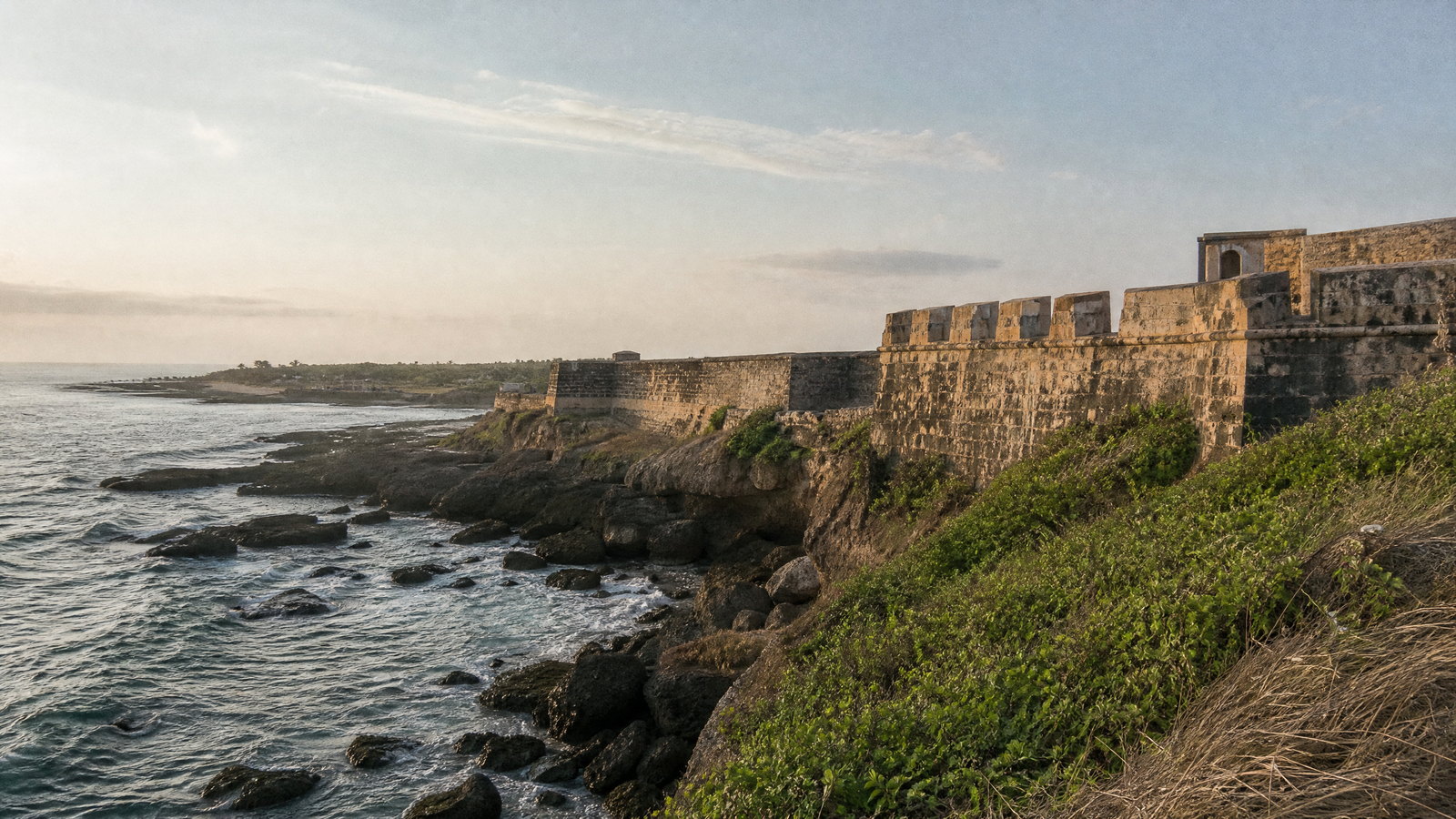
Diu Fort is the island’s dominant historic landmark, a sixteenth-century Portuguese defensive complex facing the Arabian Sea. Sea walls, bastions, passages and wide views show why Diu mattered as a maritime outpost. Bright stone, wind, heat and uneven ground are as much part of the experience as the architecture. Unlike Daman’s estuary forts, it faces open sea; nearby churches and town streets make it part of a broader heritage circuit. Allow time to read setting as well as structure. Its distinct value becomes clearer through patient observation, sound judgment, and respect for local rhythms.
Why this place matters
Go to Diu Fort for the territory’s clearest union of architecture and open-sea geography. Its scale rewards interest in defensive design, coastal history and views through arches and bastions. It anchors a day with St. Paul’s Church and town streets, while Fudam later offers a wetland counterpoint. Morning and late afternoon are kinder for light and temperature. The site works best at a slow pace, noticing how walls frame harbour and coast. Its distinct value becomes clearer through patient observation, sound judgment, and respect for local rhythms.
historic church · Diu town, Diu Island
St. Paul’s Church
St. Paul’s Church is one of Diu’s major surviving churches and an important expression of Portuguese-era religious architecture. Its articulated façade and interior woodwork merit a pause, but its devotional setting remains primary. After the exposed fort, the church offers a quieter architectural experience and shows how trade, empire, faith and town life left different traces on Diu. Its detail rewards close looking rather than a fast exterior photograph. Its distinct value becomes clearer through patient observation, sound judgment, and respect for local rhythms.
Why this place matters
Choose St. Paul’s for architectural texture and a reflective counterbalance to Diu Fort. It suits visitors interested in Baroque-influenced form, craftsmanship and the different histories held by an active religious building. It fits a town walk, although heat and uneven surfaces should set the pace. Visit outside services where possible, dress respectfully and give prayer or maintenance priority over sightseeing. It makes a short Diu stay feel culturally complete without a long transfer. Its distinct value becomes clearer through patient observation, sound judgment, and respect for local rhythms.
limestone rock formation · Near Diu Fort, Diu Island
Naida Caves
Naida Caves is a network of cut and naturally weathered limestone passages near Diu Fort. Openings, pillars, roots and filtered sunlight distinguish it from the island’s walls and beaches, but it is not a polished underground attraction. Its appeal rests on irregular surfaces, natural light and coastal geology beside the historic town. Visit in firm footwear and turn back where access is limited. Rain, maintenance, crowding and daylight strongly shape the experience. Its distinct value becomes clearer through patient observation, sound judgment, and respect for local rhythms.
Why this place matters
Visit Naida for Diu’s geological texture and a brief change of pace after monumental architecture. The formations frame light for careful photography, and their proximity to the fort makes a coherent half-day about stone, extraction and coastal history. It rewards slow walkers more than visitors who need smooth, predictable access. Choose cooler daylight hours, carry water and avoid narrow or dim sections. Its condition-dependent character is central to the experience. Its distinct value becomes clearer through patient observation, sound judgment, and respect for local rhythms.
protected wetland · Fudam, Diu Island
Fudam Bird Sanctuary
Fudam Bird Sanctuary is a protected tidal-marsh and mudflat habitat on Diu, notified in 2006. Mangroves, intertidal ground and shallow wetland support resident and migratory birds, including waders, waterfowl, herons, plovers and at times flamingos. It corrects the idea of Diu as only fort and beach. Observation infrastructure supports respectful viewing, but wildlife presence is seasonal and never assured; tide, wind, rain and disturbance influence what is visible. Its distinct value becomes clearer through patient observation, sound judgment, and respect for local rhythms.
Why this place matters
Choose Fudam for Diu’s ecological story rather than another shore walk. Cooler months may add migratory diversity to resident birdlife, and the site rewards patient observation rather than fast sightseeing. With the fort, it contrasts an engineered maritime frontier and a living tidal margin. Bring binoculars if possible, use the viewing structures and allow quiet time instead of following birds. A short visit adds conservation perspective to an island itinerary. Its distinct value becomes clearer through patient observation, sound judgment, and respect for local rhythms.
coastal Hindu shrine · Near Fudam, Diu Island
Gangeshwar Temple
Gangeshwar Temple is a coastal Hindu shrine among Diu’s rocky shores, known for Shiva lingams that meet the sea at high tide. Devotion and geology overlap here: wave movement, salt spray and uneven rock are the physical conditions of a sacred shoreline. It adds Hindu pilgrimage context to the island’s layered religious heritage alongside fort and church. Expect a natural shore, not a barrier-free promenade or predictable water display. Its distinct value becomes clearer through patient observation, sound judgment, and respect for local rhythms.
Why this place matters
Go for Diu’s religious diversity and a tide-shaped shrine landscape. The temple is most meaningful when approached quietly, with worshippers and sea conditions taking precedence. Pair it with Fudam for a coast-and-wetland day or Naida for a landscape route. A respectful wide photograph is preferable to blocking devotees or entering wave zones. The site gives Diu an intimate, specific dimension that the grand fort cannot provide. Its distinct value becomes clearer through patient observation, sound judgment, and respect for local rhythms.
island beach · Nagoa, Diu Island
Nagoa Beach
Nagoa Beach is Diu’s best-known sandy crescent, on the island’s western side amid sand, sea and palms. It complements the historic core with open horizon and leisure space after forts, churches, caves and rocky shrines. Surf, tide, weather, crowding and authorized water use vary, while intense sun makes midday less comfortable. The enduring attraction is the shore itself, even on days when swimming is unwise. Its distinct value becomes clearer through patient observation, sound judgment, and respect for local rhythms.
Why this place matters
Choose Nagoa for a spacious coastal interval, particularly if you prefer an easy shore walk to another monument. First and last light soften heat and reveal the beach’s curve. It also makes Diu feel like a lived island, not only a heritage ensemble. Families and slower travellers can enjoy it if expectations remain weather-led: water activities are optional and authorized locally, while walking, shade and tide watching require no guarantee. Its distinct value becomes clearer through patient observation, sound judgment, and respect for local rhythms.
Season and pace
Choose a date window for the experience, then keep a fallback.
November–February is the broadest comfort window for forts, gardens, wetlands and beaches. October and March can be rewarding but warmth rises quickly and coastal sites offer little shade. April and May are often hot and humid; use early and late hours.
The southwest monsoon broadly runs from June into September. Inland scenery can be lush, but heavy rain, thunderstorms, slippery ground, rough sea and closures are real trade-offs.
Cooler months may add migratory interest at Fudam without guarantees. Tides matter at Gangeshwar; check forecast, tide information and local notices near departure.
Movement and planning
Distance on a map is not the same as usable travel time.
Moving through the region
Silvassa is the inland base. The district identifies Vapi as the nearest major railhead, with onward road travel; Silvassa also sits near the Mumbai–Delhi highway corridor. Daman and Diu lie in different directions, so combining all three needs a vehicle, hired transport or carefully checked public connections. Do not assume same-day feasibility from straight-line distance. Diu has an airport, but flight and ground arrangements change.
Moti Daman, Nani Daman and Diu town reward short walks, though sun, traffic, steps, uneven paving, fort walls and sand are common. Caves, shore temple and beaches are not reliably step-free.
Use one compact zone per day and arrange a return ride before rural, wildlife or wetland visits.
Building a workable route
Four to six days allows a well-paced first trip. Use Silvassa for the museum, Vanganga and an inland nature day at Dudhni or Satmalia. Give Daman a heritage-and-estuary day across Moti and Nani Daman. Give Diu two days: fort, church and town on one; Naida, Gangeshwar, Fudam or Nagoa on another.
Carry photo identification where it may be requested. Use grippy shoes on stone, dress modestly in worship spaces and carry a refillable bottle.
Hours, vehicle rules, flights, water activities and weather access change. Confirm details shortly before travel through the relevant local or official channel.
Travel responsibly
The regional context includes its limits.
Tidal marsh, reservoir, forest, coast and living neighbourhoods are sensitive edges. At Fudam, use designated viewing infrastructure, keep quiet and never approach birds, nests or roosts. At Satmalia and Vasona, follow staff directions, stay within permitted areas and never feed animals. At Dudhni and beaches, use only authorized water facilities and stop when weather, tide or staff advice changes.
Do not climb historic walls, enter closed rooms, carve stone or fly a drone without authorization. At Gangeshwar, give worshippers space and stay clear of waves. At Naida, avoid unstable edges and accept closures.
Buy locally made work transparently and ask before photographing artisans, families or homes. Refuse wildlife-derived objects. Carry waste out and report unsafe conditions or injured animals to the appropriate authority.
This is an evergreen regional guide. Weather, permits, closures, transport and local rules can change; confirm material conditions through the relevant local or official channel before travel.