West India · State · GJ
Gujarat
Gujarat rewards travellers who plan by landscape rather than checklist. Compact lanes and timber houses in historic Ahmedabad lie far from Harappan reservoirs on Khadir island, Jain temples above Palitana, rain-fed Dang hills and the tidal Gulf of Kachchh. The west is dry, saline and seasonal; the south is greener and wetter; Saurashtra combines pilgrimage coast with lion habitat. Gujarati is the principal language, while Kutchi, Kathiawadi, Surti and other varieties carry local identity. Crafts are skilled work embedded in communities and places. A first journey should choose one or two arcs—Ahmedabad–north Gujarat–Kutch, or Saurashtra’s coast and wildlife—rather than attempt the state. Winter is usually easiest window, but tides, monsoon closures, religious calendars, wildlife rules and heat require current local confirmation.
Regional notebook
Begin with the shape of the region.
Gujarat is several contrasting regions. Ahmedabad and Gandhinagar offer a practical urban arrival and layered Sultanate, Jain, Hindu and modern histories. North Gujarat concentrates water architecture and Solanki-era temples. Kachchh combines seasonal salt marsh, arid-island archaeology and craft-rich settlements, with substantial distances. Saurashtra joins pilgrimage coast, dry forests and older cities. East Gujarat rises toward Pavagadh, while the Dang and Saputara introduce wetter Sahyadri hills. Choose built heritage, dryland ecology and craft, coastal faith landscapes or uplands, rather than attempting every region.
Landscape
Geography changes the journey.
Gujarat faces the Arabian Sea and includes the Gulf of Kachchh, Gulf of Khambhat, Kachchh and Saurashtra peninsulas, plains, salt marshes and eastern-southern uplands. The Great and Little Ranns are seasonal salt marshes, not conventional deserts: monsoon water and mud later dry into salt-encrusted terrain. Khadir, home to Dholavira, is arid. Pavagadh rises above plains, while Saputara lies near 1,000 metres in the Sahyadri range. Tides shape Jamnagar’s intertidal habitats. Heat, remoteness and uneven surfaces matter more than altitude on most routes.
Living culture
Arrive as a guest, not an audience.
Gujarat’s culture is plural, urban and rural, devotional and commercial, shaped by movement across coast, desert and inland trade routes. Ahmedabad’s pols express a civic fabric shared among several traditions. Jain pilgrimage shapes Palitana, while Dwarka and Pavagadh are active Hindu sacred landscapes. Garba is a Navaratri ritual and communal practice, not a costume opportunity. Crafts are place-specific: Patan is known for double-ikat Patola; Kachchh for Ajrakh, embroidery, leatherwork, bells and Rogan painting. Ask before photographing people, homes, workshops or worship; value skill and time when buying directly.
Curated regional atlas
Places that reveal different parts of Gujarat
This is a selective, geographically varied starting point rather than an exhaustive list. Use it to choose a coherent route, not to compress every place into one trip.
Historic urban ensemble · Old city, Ahmedabad district
Historic City of Ahmedabad
Historic Ahmedabad is a living walled-city landscape on the Sabarmati’s eastern side, founded in the fifteenth century and shaped by successive communities. Its dense pol neighbourhoods are more than picturesque lanes: gated streets, timber houses, courtyards, bird feeders, wells and religious institutions reveal a fine-grained way of organising climate and community. Sultanate mosques, tombs, Jain and Hindu temples, gates and markets sit within a working city, not a sealed monument precinct. Allow time to notice street scale, carved wood and transitions between shared and private space.
Why this place matters
This is Gujarat’s strongest introduction to urban complexity: Islamic-era monuments, Jain and Hindu traditions, timber work and civic neighbourhood life coexist in a walkable historic fabric. It counterpoints the state’s open landscapes and makes shade, courtyards, wells and community streets tangible. Go slowly rather than treating the old city as façades. Early morning can reveal quieter rhythms, while local interpretation adds context about residents and conservation. Respect that many lanes remain homes and workplaces. It also provides a grounded base for understanding Gujarat’s mercantile and multicultural history before travelling into its rural regions.
Stepwell and archaeological monument · Patan, Patan district
Rani-ki-Vav
Rani-ki-Vav is an eleventh-century stepwell on the Saraswati river’s historic bank at Patan. Conceived as an inverted temple, its stairs, pavilions, tank and deep well combine water engineering with a vast sculptural programme. More than five hundred principal sculptures and many smaller figures animate a structure built at the height of Maru-Gurjara craftsmanship. The monument is powerful because ornament is inseparable from its original function as a subterranean water system. It rewards attention to proportion, stonework and water’s cultural meaning.
Why this place matters
Rani-ki-Vav makes Gujarat’s water heritage legible in one extraordinary form. Unlike a freestanding temple, it asks visitors to read architecture vertically and see water as sacred, civic and technical. Its panels reward close looking, while the composition shows why stepwells were sophisticated infrastructure. Pair it with Patan’s weaving traditions or Modhera to trace a wider Solanki-era landscape. The enclosed descent and sun on the terrace make a morning visit more satisfying than a rushed afternoon stop. Together, those layers make it an unusually complete introduction to how craft, belief and groundwater once structured public space.
Temple complex and archaeological monument · Modhera, Mehsana district
Modhera Sun Temple
Modhera’s eleventh-century Sun Temple stands by the Pushpavati river setting in north Gujarat. Built during the Chaulukya period, the complex is read in sequence: the rectangular Suryakund with many shrines, the carved assembly hall and the sanctuary beyond. The surviving stone architecture retains an exceptional dialogue between ritual, sculpture, geometry and water. Although the original image is absent, the complex conveys intentional movement from reservoir to gathering space to sacred core. Changing sunlight reveals carved surfaces and spatial relationships. The sequence makes the site legible even without specialist knowledge of iconography.
Why this place matters
Modhera clearly connects Gujarat’s temple and water architecture. The Suryakund provides a visual anchor, while the mandapa rewards close attention to pillars and iconography. It pairs naturally with Rani-ki-Vav, yet the experience is different: this landscape is outward-facing and luminous rather than subterranean. Travellers interested in architecture, religious art or the Chaulukya period will find ample substance. Allow time to circle the complex, not simply photograph the reservoir from one viewpoint. Its measured layout also offers a useful way to compare open ceremonial architecture with the enclosed depth of Patan’s stepwell.
Archaeological park and living pilgrimage landscape · Panchmahal district
Champaner-Pavagadh Archaeological Park
Champaner-Pavagadh gathers prehistoric traces, medieval fortifications, water installations, mosques, palaces, settlement remains and a living hill shrine around Pavagadh. The volcanic hill rises above the plains, making topography central to the site. Champaner was a sixteenth-century regional capital, while Pavagadh carries older Hindu fort and temple associations. Much remains unexcavated, so the experience is fragments, views and continuing religious movement rather than one complete monument. The Jama Masjid and Kalika Mata pilgrimage belong to different rhythms of the wider landscape.
Why this place matters
Few Gujarat sites show cultural layering as clearly. Hindu and Islamic architecture, hill fortification, water management, agriculture and pilgrimage meet in one dramatic setting. It suits travellers who prefer landscape-scale heritage to a museum-like monument. The hill, stairs and crowds make the shrine physically and logistically different from lower archaeological areas, so choose your emphasis in advance. A full day separates quiet architectural observation at Champaner from the devotional intensity of Pavagadh. The result is an unusual opportunity to compare capital-city planning, defence, sacred practice and ecological setting in a single day.
Harappan archaeological site · Khadir island, Kachchh district
Dholavira: a Harappan City
Dholavira is a preserved Harappan urban site on arid Khadir island in Kachchh. Occupied from about 3000 to 1500 BCE, it preserves a fortified city, ceremonial ground, residential areas, workshop evidence, cemetery and intricate reservoirs and drainage. Its setting is essential: two seasonal streams supplied scarce water, and engineering shows long adaptation to dryland conditions. Stone fortifications and water structures make the urban plan unusually legible. Dholavira is not a quick add-on to salt-flat travel; its remoteness is part of the encounter.
Why this place matters
Dholavira offers a compelling lesson in early urban planning and water management. Read a Bronze Age city through reservoirs, gateways, streets and precincts, not isolated artefacts. Its distance from major cities creates scale and silence, but needs commitment. Go for the relationship between archaeology and landscape: the seasonal scarcity that shaped ancient life still informs travel logistics. The visit rewards interest in engineering, climate adaptation and the Harappan world. Its reservoirs make the site especially resonant for travellers considering how cities endure in water-scarce settings.
Seasonal salt-marsh and craft landscape · Kachchh district, including the Dhordo and Banni fringe
Great Rann of Kachchh and Banni Fringe
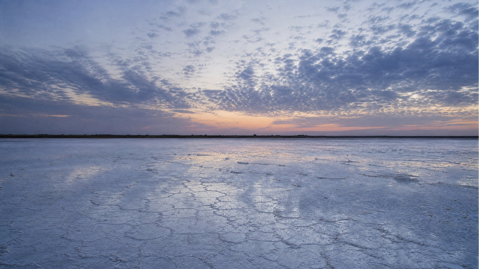
The Great Rann of Kachchh is a vast seasonal salt-marsh system where cracked earth, shallow monsoon water, salt crust, scrub and distant horizons replace a conventional desert. Once connected to the Arabian Sea, it transforms with rainfall and evaporation. Around its edges, Banni and other settlements sustain embroidery, tie-dye, leatherwork, pottery, bell metal and Rogan painting. The place is ecological and cultural: a spectacular open landscape whose apparent emptiness should not obscure the knowledge and livelihoods rooted around it. Its edges also show why seasonal landscapes demand careful, low-impact travel.
Why this place matters
Go for spatial scale, changing light and the connection between a demanding dryland environment and regional craft. The Rann is visually arresting, but gains value when visitors learn how a seasonal wetland becomes salt-encrusted ground, notice bird habitat and approach craft contexts respectfully. It suits landscape photographers and travellers seeking Kachchh beyond a single event. Pair it with Bhuj or Dholavira only with full transfer time; these are not neighbouring city sights. Its seasonal transformation is a reminder that the landscape should be observed, not consumed or crossed indiscriminately.
Wildlife sanctuary and seasonal salt-marsh · Little Rann of Kachchh, centred on the Dhrangadhra side
Little Rann of Kachchh Wild Ass Sanctuary
The Little Rann of Kachchh is a low-lying salt-marsh landscape protected largely as the Wild Ass Sanctuary. It supports Indian wild ass alongside chinkara, nilgai, wolves, waterfowl and other dryland and wetland species. Seasonal transformation defines it: rainwater spreads across the Rann, then recedes into salt, mud and grassland mosaics. Wildlife is dispersed across a huge habitat, so the experience is patient observation and open country rather than guaranteed encounters. Ecological value lies in the overlap of saline plain, seasonal water and grassland.
Why this place matters
This is Gujarat’s distinctive inland wildlife landscape for travellers who value habitat as much as species. The Indian wild ass is the signature animal, but birds, horizons and the changing surface matter equally. It complements the Great Rann without duplicating it: the focus here is protected ecology and responsible observation. A naturalist-led visit can interpret seasonal signs and avoid disturbance. Expect a different pace from Gir; sightings are never owed, and quiet expanse is the experience. This is a good choice for learning why conservation rules matter in habitats that look empty but are ecologically active.
Seasonal wetland and bird sanctuary · Ahmedabad and Surendranagar districts
Nal Sarovar Bird Sanctuary
Nal Sarovar is a protected shallow wetland across Ahmedabad and Surendranagar districts. Seasonal waters support flamingos, pelicans, ducks, coots, waders, storks, herons and other waterfowl, giving it a different character from the dry Ranns. Its appeal is seasonal abundance and wide sky, not built heritage. Water level, migration patterns, wind and visitor timing strongly shape sightings. For patient birdwatchers, its value lies in observing a working wetland without treating birds as a performance or a boat ride as an end in itself.
Why this place matters
Nal Sarovar is an accessible entry into Gujarat’s wetland ecology and a counterweight to salt country. It suits birders, families seeking a quiet nature day and anyone curious about migratory habitat. Dawn can be rewarding, but species presence is naturally variable and should never be guaranteed. Pair it with Ahmedabad for an urban-and-wetland contrast, or use it between north Gujarat heritage sites. Bring binoculars and allow time for stillness. It is equally useful as a reminder that migration, water and seasonal variation cannot be reduced to a fixed itinerary.
Marine national park and intertidal ecosystem · Jamnagar coast, Gulf of Kachchh
Marine National Park, Gulf of Kachchh
India’s first marine national park occupies an archipelago and intertidal zone in the Gulf of Kachchh near Jamnagar. Its habitats include coral reefs, mangroves, rocky shore, mudflat, creek, estuary, sandy strand and saline grassland. Low tide can reveal invertebrates and shore ecology hidden by water, while mangroves and reefs support fish, birds and other life. This is a fragile ecosystem, not an aquarium: tides govern timing, weather influences crossings, and island or shore access is controlled. Careful timing and restraint are essential to appreciating this diversity without damaging it.
Why this place matters
The marine park adds a coastal ecological dimension often missed in Gujarat itineraries. It is a rare chance to understand an intertidal system through changing waterline, mangrove roots, coral habitat and migratory birds. Here the tide becomes the itinerary. Go with a conservation-first mindset and accept that access may change for safety or protection. Pair it with Jamnagar bird habitats or Dwarka, but do not rush it into a same-day drive without checking tide timing. It also reveals why visitor choices must follow ecological timing rather than demand access at every moment.
Pilgrimage town and Arabian Sea coast · Devbhumi Dwarka district
Dwarka
Dwarka is an active coastal pilgrimage town centred on the Dwarkadhish, or Jagat Mandir, dedicated to Krishna. The five-storeyed limestone shrine, smaller temples, Gomti-side ritual spaces and Arabian Sea edge create a landscape of worship rather than a single building. District records describe Chalukya-style architecture, while the town’s significance is tied to Krishna traditions and wider coastal sacred geography. Beyt Dwarka extends this maritime setting with temples, shore and reef associations. The central experience is devotional movement, ritual timing and sea-facing urban life.
Why this place matters
Dwarka best shows how Gujarat’s coast and Hindu pilgrimage meet. Its value is not only the main shrine but the proximity of ghats, lanes, lesser temples, beach and island horizon. Sacred architecture here is living: protocols, crowds, dress and daily worship shape access. Visit outside the busiest festival peaks for a calmer pace, or arrive patiently for devotional intensity. The coast remains weather-exposed, so build flexibility around sea and ferry conditions. The town is particularly revealing for visitors interested in the everyday intersection of pilgrimage, shore ecology and regional movement.
National park and wildlife sanctuary · Sasan Gir area, Gir Somnath, Junagadh and Amreli districts
Gir National Park and Wildlife Sanctuary
Gir is a forested, hilly protected landscape in Saurashtra and the last wild refuge of the Asiatic lion. Its wider sanctuary supports leopard, chital, sambar, nilgai, four-horned antelope, chinkara, hyena, crocodiles and rich birdlife alongside pastoral histories. Lion sightings dominate expectations, yet Gir is better approached as a dry forest ecosystem with complex conservation and human stories. Regulated safari access protects a habitat that is not a zoo. Terrain, vegetation, season and patience shape each visit. Seeing the wider habitat helps avoid reducing a complex landscape to a single animal.
Why this place matters
Gir offers an important encounter with the ecological setting behind Asiatic lion recovery, plus a broader Saurashtrian dry forest. Value tracks, birds, deer, trees and silence alongside a flagship species. Its pastoral context adds depth but deserves sensitive interpretation. Go in the cooler season, build flexibility and use only authorised access. Pairing Gir with Somnath or Junagadh works logistically, but do not schedule a long drive around a fixed safari window. Doing so produces a more ethical and rewarding experience of one of India’s most important wildlife landscapes.
Jain pilgrimage landscape · Palitana, Bhavnagar district
Palitana and Shatrunjaya Hill
Shatrunjaya Hill rises above Palitana as a major Jain pilgrimage landscape. Its summit and slopes hold hundreds of shrines arranged in temple enclosures, formed and rebuilt across centuries. The long staircase is central: pilgrims move through changing views, marble and stone architecture, and a focused atmosphere of worship. The site is associated with Adinath or Rishabha, the first Tirthankara, and remains active rather than purely historical. Palitana town below supports continuous ritual life, especially during important Jain calendar periods. The hill’s built density and physical ascent make the sacred geography unusually palpable.
Why this place matters
Palitana offers architectural spectacle, but its deeper value is pilgrimage as physical practice, collective memory and living faith. The climb makes sacred topography tangible, while the dense complex shows continuity of patronage and craftsmanship. It suits those interested in Jain art and religious landscapes, provided they approach with patience and respect. Start early on a cool day, leaving time for rest and quiet observation. Festival dates can transform capacity and rhythm. That approach preserves the site’s devotional character while making space for careful observation of its art and setting.
Hill town, forested highland and tribal cultural region · Dang district, Sahyadri range
Saputara and the Dang Highlands
Saputara and the Dang highlands form Gujarat’s greener, cooler counterpoint to Kachchh and Saurashtra. Set at about 1,000 metres in the Sahyadri range, the area includes hills, streams, lake views, forest cover and villages shaped by Dangi cultural life. Rains transform slopes and vegetation, while winter brings clearer hill weather. Nearby protected forests and waterfalls make the region more than a viewpoint circuit. Its distinctive value is humid uplands, rain-fed landscape and community histories rather than salt, coast or monumental stone.
Why this place matters
Saputara resets travellers who have spent time in hot, dry or urban Gujarat. Elevation can ease temperatures, while hills make weather visible in cloud, vegetation and water. Go beyond viewpoints by learning about Dang cultural and ecological context, without intrusive village visits or treating tribal identity as display. Winter suits clear walks; rains bring intense greenery but wet roads and disrupted plans. Allow the landscape, rather than a checklist, to set the pace. It is also a useful contrast to the state’s dry regions, demonstrating Gujarat’s substantial climatic and ecological range.
Season and pace
Choose a date window for the experience, then keep a fallback.
October through March is usually cooler and drier for city walks, monuments, salt country, birding and wildlife. April to June is demanding: state records note maximums of about 49°C, making midday plans unsafe in exposed areas. The core southwest monsoon is June to September, with southern districts much wetter than western drylands. Rains green Saputara but can disrupt roads; salt landscapes may be waterlogged and Gir has a regular monsoon closure. Treat ranges as guidance and check conditions before travel.
Movement and planning
Distance on a map is not the same as usable travel time.
Moving through the region
Ahmedabad is the practical broad gateway, with rail and air links and onward roads; other cities suit focused routes. Public transport links towns, but a vehicle with an experienced driver or carefully timed buses are often better for rural stops. Kachchh, the Ranns, Dholavira and the Gulf of Kachchh need generous road time, fuel planning and no night driving. Historic Ahmedabad suits short walks, while Palitana requires a stair climb. Wetland, forest and marine visits can have fixed entry points, limited capacity, tide-based timing or permits. Confirm timetables, roads and entry procedures locally.
Building a workable route
Plan in geographic clusters. A north-and-Kutch route can combine Ahmedabad, Patan, Modhera, Dholavira and the Great Rann, but is road-intensive. A Saurashtra route can join Dwarka, the Gulf of Kachchh, Palitana and Gir, with realistic transfer days. Pavagadh fits Vadodara-side travel; Saputara needs a separate south Gujarat arc. Start early at exposed sites, carry water, sun protection, modest shrine clothing and suitable shoes. Assess accessibility site by site: old-city lanes, stepwells, hill temples and intertidal walks pose different barriers. Confirm changing arrangements before departure.
Travel responsibly
The regional context includes its limits.
Treat protected habitats and active sacred spaces as places with their own rules. Use authorised access, keep distance from wildlife and never feed, touch, chase or block animals. Coral, mangroves, salt-marsh vegetation and nesting areas are easily damaged; remove nothing. At monuments, do not climb or lean on carvings. At Jain and Hindu sites, dress respectfully and follow local directions on food, leather and photography. Heat, rain and tides are safety boundaries. Carry waste until proper disposal, reduce single-use plastic, conserve water in dry districts and use local interpretation. Confirm changing conditions locally.
This is an evergreen regional guide. Weather, permits, closures, transport and local rules can change; confirm material conditions through the relevant local or official channel before travel.