West India · State · MH
Maharashtra
Maharashtra is a western Indian state where the Arabian Sea, rain-catching Sahyadris, basalt Deccan plateau and eastern dry forests create markedly different journeys. Mumbai supplies a port-city lens; Chhatrapati Sambhajinagar anchors major rock-cut heritage; the Konkan offers coast and pilgrimage; Nashik and Pune open devotional and Maratha-era histories; Vidarbha shifts the focus to forest and wetland. The trade-off is distance: coast, caves, cities and reserves are best treated as separate circuits. Mumbai is the administrative capital. Marathi is the principal local language, while Hindi and English are widely useful in many visitor settings. Respectful planning means treating pilgrimage, neighborhoods, protected habitats and monsoon landscapes as places with their own rhythms, not as backdrops.
Regional notebook
Begin with the shape of the region.
Maharashtra is several journeys within one state. The Konkan combines fishing landscapes, beaches, sea forts and Ganesha pilgrimage; the Sahyadris supply forts and seasonal flower plateaux; the Deccan interior holds cave complexes and religious routes; Vidarbha offers dry forest and wetlands. Choose one or two geographic clusters rather than treating Mumbai, the caves, the Konkan and eastern reserves as day trips from one base.
Mumbai is the administrative capital and most connected arrival point; Chhatrapati Sambhajinagar is practical for Ajanta and Ellora. The state’s UNESCO properties and Western Ghats landscapes are significant, not frictionless: protected sites may use seasonal, timed or capacity-based management. Pair Mumbai with Elephanta, Ajanta with Ellora, Raigad with the Konkan, or Kaas with another nature stop. Leave time for rain, heat, festival crowds and changes in local operations.
Landscape
Geography changes the journey.
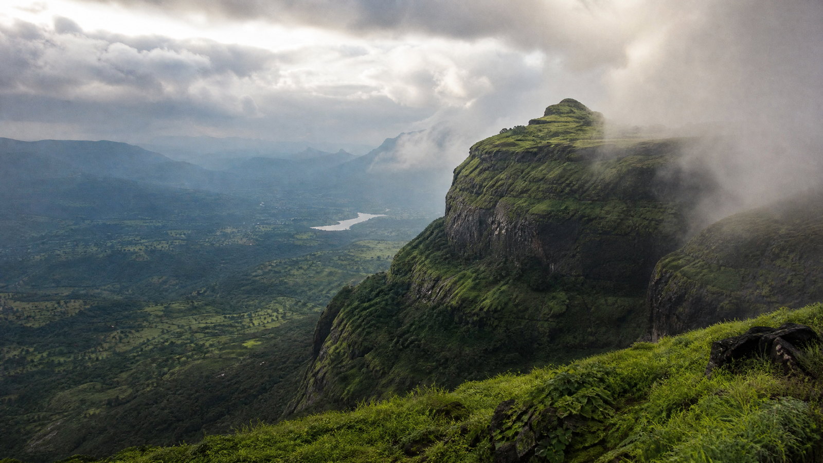
Maharashtra spans western and central peninsular India, with an Arabian Sea coast and a broad interior of Deccan basalt. The Sahyadris rise close to the coast and intercept southwest monsoon moisture. Their western face feeds a lush Konkan, while leeward plateau districts can be much drier.
This contrast explains the travel map. Basalt cliffs enabled rock excavation at Ajanta and Ellora; escarpments supported hill forts; Kaas’ thin soils support brief flowering; Lonar holds a saline crater wetland; and eastern Tadoba is dry deciduous forest.
Living culture
Arrive as a guest, not an audience.
Marathi public life gives the state a strong linguistic and literary identity, while mobility across the Arabian Sea and Deccan has shaped a layered culture. Mumbai’s port-city fabric sits beside coastal communities; cave complexes preserve Buddhist, Hindu and Jain patronage; Raigad evokes the Maratha polity; Trimbakeshwar is active pilgrimage.
Ganesh Chaturthi, Gudi Padwa, Wari traditions, temple fairs and the Nashik–Trimbakeshwar Kumbh cycle can change movement patterns and crowd levels. Warli visual traditions, Paithani weaving, Lavani and Tamasha offer further entry points. Arrange craft or performance encounters with consent and fair payment. Follow local dress and behavior norms at temples, shrines, memorials and neighborhoods.
Curated regional atlas
Places that reveal different parts of Maharashtra
This is a selective, geographically varied starting point rather than an exhaustive list. Use it to choose a coherent route, not to compress every place into one trip.
historic urban ensemble · Fort, Oval Maidan and Marine Drive precincts, Mumbai
Victorian Gothic and Art Deco Ensembles of Mumbai
This living heritage landscape frames Oval Maidan with nineteenth-century Victorian Gothic public buildings and twentieth-century Art Deco development reaching toward the seafront. It records Mumbai’s transformation from fortified trading outpost to major mercantile city. Balconies and verandas demonstrate how imported forms were adapted to a tropical climate. The ensemble remains civic, residential and cultural space, so the experience combines façades, shade, sea air and daily city movement rather than a sealed museum district. It is a compact introduction to architecture, planning and modern urban history.
Why this place matters
Go for the contrast no single landmark supplies: Gothic massing, Indo-Deco detail, open maidan and seafront together explain several phases of Mumbai’s modernization. The area rewards slow looking rather than a checklist. It is a grounded first introduction to the city before markets, museums or harbor trips. Design, urbanism and adaptive-reuse interests are especially well served. Morning and late afternoon are generally more comfortable, but its value lies in everyday use, not in a single perfect view. It rewards attentive urban observation.
rock-cut cave complex and island heritage site · Gharapuri Island, Uran taluka, Raigad district
Elephanta Caves
On Gharapuri Island in Mumbai Harbor, Elephanta is a Shaiva rock-cut complex centered on Cave 1, its pillared hall and immense reliefs, including three-faced Sadashiva. Two hillocks, a narrow valley and archaeological remains make the island approach part of the experience. The caves broadly date to the mid-fifth to sixth centuries and represent an important western Indian development in rock-cut architecture. The island provides a change of scale from Mumbai, but its coastal setting also makes careful conservation and weather-aware planning important.
Why this place matters
Go to experience sculpture as architecture: figures organize entrances, recesses, light and movement inside carved basalt. Elephanta makes a compelling counterpoint to Mumbai’s later urban heritage, revealing older religious and maritime histories in the same harbor region. It suits visitors who can manage a marine crossing and stepped approach, and who value observation over rushing. Its rock surfaces and coastal environment are fragile, so the most rewarding visit is careful, unhurried and conservation-minded. Harbor archaeology adds further quiet context too.
Buddhist rock-cut cave complex · Ajanta valley, near Chhatrapati Sambhajinagar
Ajanta Caves
Ajanta’s thirty caves curve around a horseshoe-shaped basalt cliff above the Waghora valley. The complex developed in two major phases, from the second to first centuries BCE and again in the fifth to sixth centuries CE, producing sanctuaries, monastic halls, murals and sculpture. Its strength lies in the relationship among painted interiors, carved architecture and a secluded seasonal landscape once suited to monastic retreat. The paintings remain in their original dim rock-cut setting. Visitor pressure in painted caves is a recognized conservation concern.
Why this place matters
Go for a major encounter with Buddhist painting and monastic architecture. Ajanta makes chronology tangible through early austere spaces, later image-centered practice, unfinished excavations and narrative murals. The valley setting explains why this location could support retreat and study. Visitors who adjust to interior light, read interpretation and linger in a few caves gain more than those trying to photograph every surface. Treat it as a full cultural day rather than a quick attachment to Ellora. Conservation makes restraint meaningful.
multi-faith rock-cut cave complex · Verul, near Chhatrapati Sambhajinagar
Ellora Caves
Ellora extends along a basalt escarpment and brings Buddhist, Hindu and Jain monuments into an extraordinary shared sequence. Its thirty-four principal caves date broadly from the sixth to twelfth centuries; Cave 16, Kailasa, is the celebrated monolithic excavation. Basalt geology is visible as well as art: ancient builders selected Deccan Trap layers, and monsoon water still animates nearby channels. Ellora joins geological process, technical skill and religious history. Its long, stepped landscape needs patient exploration rather than a rapid monument circuit.
Why this place matters
Go for scale and coexistence. Ellora lets visitors move through distinct architectural and devotional traditions in one landscape without reducing them to one style. Kailasa demonstrates the possibilities of carving from a cliff, while Buddhist halls and Jain caves broaden the narrative. The escarpment itself makes basalt physically legible as material, setting and constraint. A full day is justified for art, construction and religious-history interests; with less time, select a few groups thoughtfully. Its spatial sequence remains unusually clear today.
hill fort and Maratha historic landscape · near Mahad, Raigad district
Raigad Fort
Raigad rises above the Konkan–Deccan transition as a hill-fort landscape associated with Chhatrapati Shivaji Maharaj and the Maratha state. Known earlier as Rairi, it was renovated and made the Maratha capital in 1674. The plateau preserves administrative, residential, sacred and water-management remains, while its elevation explains strategic control of the surrounding country. Views, steps, reservoirs and exposed ridges convey how terrain shaped political power. Monsoon vegetation is beautiful but changes footing, visibility and safe movement. Its water systems also reward close attention.
Why this place matters
Go to understand Maratha political history through terrain rather than objects behind glass. Raigad’s height and defenses show why it was formidable; court, temple and water structures suggest how a mountain capital functioned. It suits travelers who enjoy historical landscapes and can manage sustained steps. Read it as a capital, not only a viewpoint, and pair it with a Konkan stay rather than an overlong transfer. Scenic drama comes with real physical effort and weather exposure. The effort is real.
historic urban precinct · central Pune, Pune district
Shaniwar Wada and Historic Pune
Shaniwar Wada is the fortified remnant of the Peshwas’ eighteenth-century seat in central Pune. Built for Bajirao I in 1736, the palace once rose thirteen storeys; an 1828 fire left major walls, gateways and traces of internal spaces. Its fabric is a useful start for historic Pune, where streets, temples, educational institutions and food traditions continue around an important political centre. The massive entrance and defensive details communicate power, while the lost palace makes interpretation essential. It is an urban historical marker, not an intact residence.
Why this place matters
Go for a concise introduction to Peshwa-era Pune and the ways a city remembers a vanished palace. The powerful enclosure, named gates and incomplete interiors invite questions about fire, redevelopment and changing civic use. It fits a walk through old-city streets and cultural institutions, making it practical without an out-of-town excursion. Raigad reads as mountain power; Pune reveals courtly administration and urban continuity. A measured early or late visit works better than a heat- and crowd-heavy rush. Pause to interpret the enclosure.
pilgrimage town and mountain foothill landscape · Trimbak, Nashik district
Trimbakeshwar and Brahmagiri Foothills
Trimbakeshwar is a living Shaiva pilgrimage town at the foot of Brahmagiri, near the Godavari source landscape. The temple is one of the twelve Jyotirlingas; its present structure was built by Peshwa Balaji Bajirao on an older site. Water places, ritual rhythms, Varkari associations and the mountain backdrop make this a cultural landscape, not simply a sanctuary. Scale changes during observances and the Nashik–Trimbakeshwar Kumbh cycle. Visitors should share space with worshippers and treat ritual practice as primary. Local guidance helps orient first-time visitors.
Why this place matters
Go for an active pilgrimage environment linking sacred geography, the Godavari headwaters and Marathi devotional history. It offers a contrast with archaeological caves: worship, queues and commerce make tradition visibly present. Brahmagiri adds a strong setting, but weather and seasonal controls should determine whether any mountain element is sensible. Travelers interested in religious landscapes gain most by moving slowly, following local guidance and allowing time for the town rather than treating the temple as a quick stop from Nashik. Respectful patience matters.
Ramsar wetland and bird sanctuary · Niphad area, Nashik district
Nandur Madhmeshwar Bird Sanctuary
Nandur Madhmeshwar is a wetland mosaic of reservoir water, marsh, riparian vegetation and Deccan Plateau farmland around a weir at the Godavari–Kadwa confluence. Maharashtra’s first Ramsar site, it supports resident and migratory birds. Its value lies in ecological process: seasonal water, aquatic plants, quiet margins and bird movement create a changing landscape. Towers and interpretation can orient a visit, but observation should remain patient and low-impact. It makes a slower nature counterweight to Nashik’s pilgrimage and city attractions. Seasonal change is central.
Why this place matters
Go to see how a water-control structure and river confluence became significant wetland habitat. Winter can bring richer birding, yet the appeal is reading marsh, water level and migration without needing a dramatic sighting. Nandur Madhmeshwar broadens a Maharashtra route beyond forts and monuments and explains why wetland conservation matters in a seasonally dry interior. It is not a zoo: sightings, boating and access are never assured. Quiet, early observation is the appropriate pace. Habitat health is the central measure.
seasonal wildflower plateau · near Satara, Satara district
Kaas Plateau
Kaas, or Kaas Pathar, is a high basalt plateau near Satara known for a short rainfall-led flowering season. Thin soils and seasonal moisture support diverse flora, including orchids and insect-eating plants. The floral effect is not permanent and should not be expected on a fixed calendar: bloom timing, colour and species respond to rain. Wide views, wet grasslands and small-scale plants reward close attention. Its protected status makes staying on designated paths essential, especially when the landscape is at its most fragile and popular.
Why this place matters
Go for a seasonal encounter with Western Ghats ecology rather than a conventional hill-station break. Kaas can make plant diversity visible at landscape scale, but its most interesting details are often tiny: ephemeral flowers, basalt pools, insects and grass textures. It suits photographers and naturalists willing to accept uncertain bloom and crowds. Pair it with a nearby base instead of a rushed city return. Capacity controls and careful footfall are part of the site’s conservation story, not inconveniences. Flexible weather planning is essential.
tiger reserve and dry deciduous forest · Chandrapur district, Vidarbha
Tadoba–Andhari Tiger Reserve
Tadoba–Andhari is a protected Chandrapur forest landscape where teak and bamboo, grassland and lakes support tigers alongside leopard, dhole, sloth bear, birds and smaller species. It represents eastern Maharashtra’s dry deciduous ecology, far from the state’s coast-and-Ghats image. Its appeal is a functioning habitat: tracks, calls, water edges, butterflies and changing forest light can matter on a quiet drive. Managed visitor zones and vehicles put habitat welfare first, requiring visitors to follow rules and accept ecological limits. Conservation is the central visitor frame.
Why this place matters
Go to experience Vidarbha forest systems and to build a route beyond monuments and beaches. Tadoba has varied habitat and potential for many forest species, but no ethical visit should be measured by a tiger sighting. Early starts, patient listening and long pauses are more rewarding than a hurried search. Access is regulated because habitat welfare comes first. Two drives can deepen the experience, while heat, dust, rain, route changes and wildlife unpredictability remain part of the reality. Respect uncertainty throughout.
meteorite-impact crater and Ramsar wetland · Lonar, Buldhana district
Lonar Crater Lake
Lonar is an impact-crater lake set into Deccan basalt in Buldhana district. Its saline, alkaline water body and forested rim make it both a geological feature and a wetland ecosystem; it is recognized as a Ramsar site and national geo-heritage monument. The crater is best understood from viewpoints and by noticing the transition from dry plateau to enclosed basin. Temples and cultural remains around the rim add another layer, but water chemistry and habitat deserve equal attention. It rewards a deliberate visit, not a quick photo halt.
Why this place matters
Go for the meeting of planetary-impact geology, basalt landscape and wetland ecology. The rim, circular depression, lake and vegetation make a deep-time event physically legible within a present conservation setting. Lonar is a strong counterpoint to Maharashtra’s sea coast, showing how water landscapes are shaped by different forces. It suits geology, birdlife and quiet-heritage interests. Distance and heat exposure are the trade-off, so give it time and avoid making a long road journey into an exhausted midday visit. A calm pace reveals more.
coastal pilgrimage village and beach landscape · Ratnagiri district, Konkan
Ganpatipule
Ganpatipule combines a Konkan beach, low green hills and an active Ganesh pilgrimage centre. Its self-manifested temple faces the Arabian Sea, while coconut-growing and coastal setting create a quieter scale than Mumbai’s waterfront. Temple rhythms, local food, walks and changing sea conditions share the same narrow coast. Dry months are more approachable, but monsoon brings dramatic green hills and stronger waves. Treat the beach as a natural shoreline, not a controlled pool, and the temple as a place of worship first.
Why this place matters
Go for a concentrated Konkan experience where pilgrimage, coast and village life meet. A temple visit can be followed by a coastal walk, regional food and time to notice how the Sahyadris approach the sea. It is a gentle partner to a Raigad or Ratnagiri route. Seasonal choice matters: dry months are easier for lingering outdoors, while monsoon is scenic but less suited to sea activity. Slow travel, respectful dress near the temple and caution around waves are essential. Respect local coastal rhythms.
Season and pace
Choose a date window for the experience, then keep a fallback.
November–February is the most dependable statewide window: coastal humidity eases, cities are more walkable, and migratory birds are more likely at wetlands. March–June can bring severe inland and eastern heat; start early and carry water.
June–September monsoon timing and intensity fluctuate. It makes the Ghats vivid and can trigger Kaas’ rainfall-dependent bloom, but raises risks from landslides, lightning, flooding, rough seas and poor visibility. The Western Ghats and Konkan are landslide-susceptible during heavy rain. Treat monsoon as a landscape season, not a promise of easy trekking, swimming or intercity travel. Check current weather and local safety notices before and during travel.
Movement and planning
Distance on a map is not the same as usable travel time.
Moving through the region
Mumbai, Pune, Nagpur and Chhatrapati Sambhajinagar are major transport nodes, but the last segment to caves, forts, wetlands, coast villages and reserve gates is often by road. Build transfer time into every route, especially across the Ghats or along the coast.
Compact heritage districts can be walked, but traffic, heat and uneven pavement matter. Forts, caves and plateaux add steps and irregular stone. Elephanta includes a marine transfer. Wheelchair access, toilets, vehicle entry and first-aid arrangements vary; confirm them with the relevant local or official channel before relying on them.
Building a workable route
Choose a hub and purpose. Mumbai plus Elephanta needs two to three unhurried days; Chhatrapati Sambhajinagar plus Ajanta and Ellora usually needs three; Konkan–Raigad needs a weather buffer; and Nashik, Nandur Madhmeshwar or Tadoba are separate extensions.
Carry rain protection in wet months, sun protection and water in dry months, and slip-resistant footwear for forts, caves and Kaas. Modest adaptable clothing helps at religious sites. Confirm current timings, capacity controls, transport, path condition, weather warnings and any required authorization through the relevant local or official channel. Keep enough flexibility to replace an unsafe mountain, marine or forest outing with a city or museum day.
Travel responsibly
The regional context includes its limits.
Painted caves, rock-cut monuments, flower plateaux, wetlands and tiger reserves are vulnerable places. Stay on marked routes, never touch carvings or paintings, and do not climb walls for photographs. At Kaas, do not pick flowers; at wetlands and Tadoba, keep quiet, avoid playback, feeding and flash, and accept that wildlife may not appear.
Heed sea and weather warnings, especially in the monsoon. At pilgrimage sites, do not obstruct worship and photograph people only with permission. Choose locally rooted guides, crafts and meals where possible, pay agreed rates transparently and minimize disposable plastic. During heavy rain, heat alerts or landslide notices, delay rather than improvise.
This is an evergreen regional guide. Weather, permits, closures, transport and local rules can change; confirm material conditions through the relevant local or official channel before travel.