Northeast India · State · AR
Arunachal Pradesh
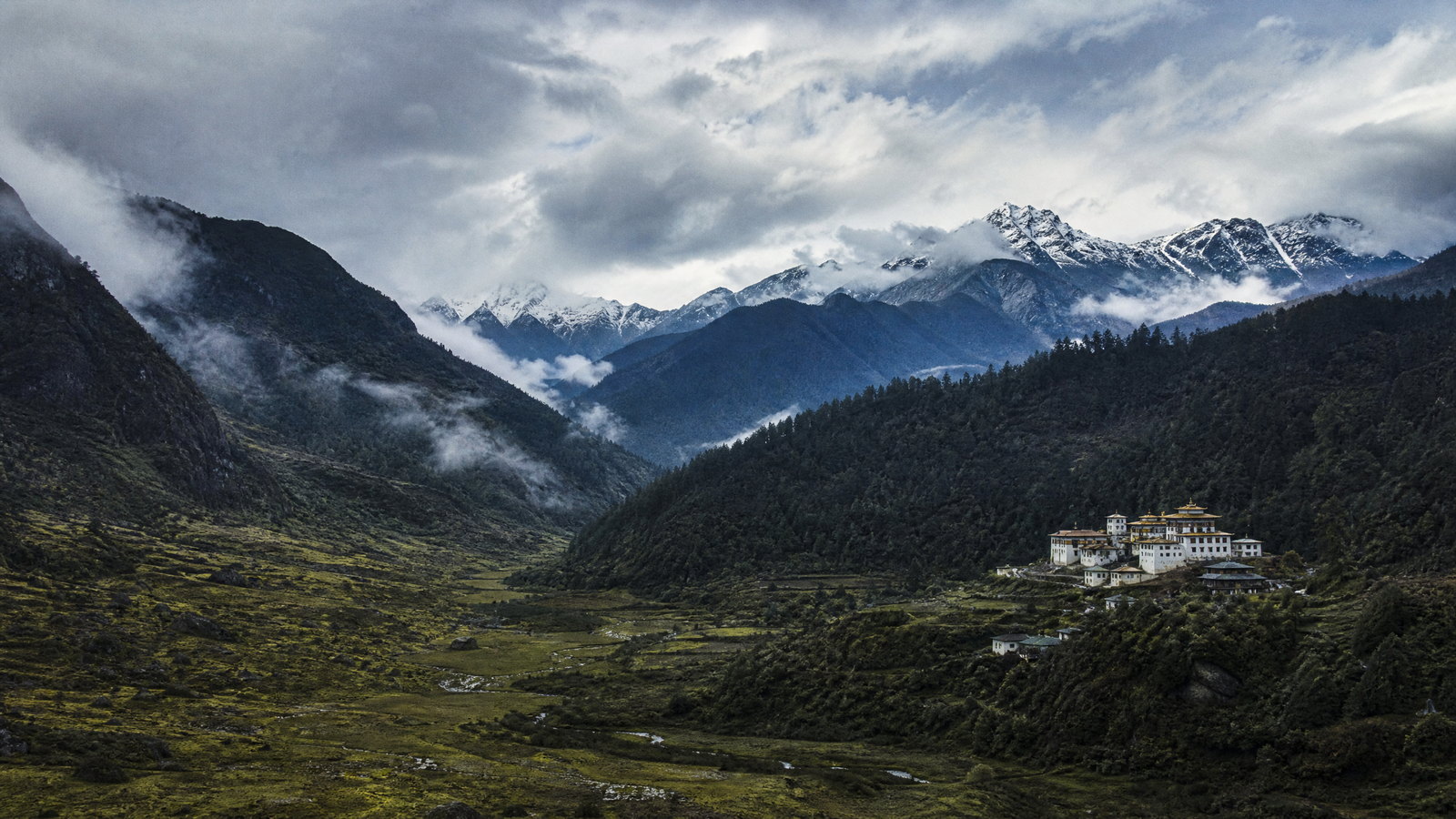
Arunachal Pradesh is a vast eastern Himalayan state where itineraries are shaped less by straight-line distance than by river valleys, mountain weather and respectful access to many living cultures. Itanagar provides the most practical urban start, while the west layers Monpa Buddhist settlements, high passes and alpine lakes around Tawang. Central valleys pair Apatani wet-rice landscapes at Ziro with Galo and Adi river country around Aalo and Pasighat. Farther east, Tai Khamti Buddhist places, Idu Mishmi landscapes and exceptionally biodiverse forests shift the experience again. The best journeys choose one or two corridors rather than attempting the whole state, keep buffer days, and treat villages, monasteries, fields and protected habitats as places with their own rhythms rather than scenic backdrops.
Regional notebook
Begin with the shape of the region.
Arunachal Pradesh rewards slow, corridor-based travel. From humid foothills adjoining Assam to high Himalayan borderlands, Tawang, Ziro, the Siang basin and Namdapha are not interchangeable day trips. A first visit works best as a western route through Dirang and Tawang, a central route through Itanagar and Ziro, or an eastern route through Namsai, Roing and Namdapha. Each reveals a meaningful cross-section without treating long drives as incidental. Itanagar is the capital and practical gateway, but the state’s character emerges in its valleys, fields, monasteries, riverside towns and forest margins. There is no coast or island component; mountains, river systems, cultivated uplands and tropical-to-alpine forests define the travel environment.
Landscape
Geography changes the journey.
The state lies at India’s northeastern tip, meeting Bhutan, Tibet and Myanmar, with the Assam plains to the south. Sharp elevation changes create lower riverine settlements and evergreen forest, middle-elevation plateaus and agricultural valleys, then temperate woodland, passes and snow country toward the northern frontier. The Siang, Subansiri, Kameng, Dibang, Lohit and Noa-Dihing systems shape both settlement and movement. A road that looks short on a map can involve multiple bends, a pass, rain exposure and a full day of travel. High places require conservative pacing, warm layers and an honest appraisal of altitude tolerance.
Living culture
Arrive as a guest, not an audience.
Arunachal Pradesh is not one cultural zone. Indigenous communities sustain distinct languages, village institutions, agricultural knowledge, weaving, bamboo and cane work, food traditions and ceremonial calendars. Ziro’s Apatani landscape links settlement, irrigation, rice-fish cultivation and forest stewardship. In the west, Tawang and Dirang carry strong Monpa Buddhist traditions; in the east, Namsai has a Tai Khamti Buddhist presence, while Idu Mishmi country frames Roing and the Dibang approach. Donyi-Polo traditions matter in several central and eastern communities. English and Hindi can help in towns, but they do not replace local languages or etiquette. Ask before photographing people, ritual spaces, homes, crops or craft processes.
Curated regional atlas
Places that reveal different parts of Arunachal Pradesh
This is a selective, geographically varied starting point rather than an exhaustive list. Use it to choose a coherent route, not to compress every place into one trip.
capital city and archaeological landscape · Itanagar, Papum Pare district
Itanagar
Itanagar is Arunachal Pradesh’s capital and the logical place to understand the state before branching into mountain corridors. In the Himalayan foothills, it combines administrative functions with cultural orientation: Ita Fort evokes the region’s medieval built heritage, while the state museum context helps visitors read textiles, craft traditions and everyday material culture across a highly diverse state. The nearby forest-fringed Ganga Lake area gives the city a gentler natural counterpoint. Itanagar is not a substitute for village landscapes, but it is the best place to organise documents, calibrate expectations and build a regional itinerary around more than scenery.
Why this place matters
Go first if you want a practical gateway rather than an instant escape into remote country. Itanagar helps connect archaeology, museum-based context, Buddhist and Indigenous spiritual traditions, and the realities of a fast-growing hill capital. The city also makes a sensible base for travellers who need more predictable services, shorter transfers or a lower-altitude start before moving west or north. Its value is interpretive: seeing the capital before Ziro, Tawang or the Siang Valley makes it easier to appreciate how varied those places are. Allow time for an unhurried museum visit rather than trying to compress it between onward vehicles.
high-altitude mountain town and Buddhist cultural centre · Tawang district
Tawang
Tawang is a high Himalayan town near the Tibet and Bhutan frontiers, set around 3,500 metres above sea level. Its cultural centre of gravity is Tawang Monastery, founded in 1680-81 and central to Monpa religious and social life. The town’s wider setting includes the Tawang Chu valley, glacial lakes and sharply changing weather, making the journey as important as the destination. Tawang works best when approached as a living Buddhist landscape rather than a quick monument stop. Its scale, cold and remoteness create a powerful contrast with the lowland corridors of the state.
Why this place matters
Choose Tawang for the rare combination of a major monastery, Monpa cultural context and high Himalayan geography. The monastery’s courtyard, assembly spaces, library tradition, murals and sacred image make it far more than an architectural viewpoint, while the surrounding town offers time to slow down and acclimatise. The route’s lakes, ridges and snow landscapes add visual drama, but are conditional on weather and road status. Travellers interested only in photography may find the pace demanding; those willing to spend two or three nights can understand the place more respectfully. Modest clothing, quiet conduct and awareness of prayer and ritual timings are essential.
high mountain pass and glacial lake landscape · Tawang-West Kameng corridor
Sela Pass and Sela Lake
Sela Pass is the high gateway on the road between West Kameng and Tawang, rising to about 14,000 feet. Its open terrain, snow, wind and lake views are a deliberate contrast to the forested lower approaches. Sela Lake is part of a wider constellation of glacial lakes around Tawang that can freeze in winter and support migratory birds in warmer months. This is a transit landscape with real environmental exposure, not a place for lingering casually in severe weather. The pass demonstrates why western Arunachal travel is governed by altitude and conditions as much as distance.
Why this place matters
Go if the western circuit’s high-Himalayan transition is itself an objective. The pass gives a legible sense of the Sela range dividing West Kameng from Tawang, with a scale and austerity that city and valley destinations cannot provide. It is especially valuable for travellers who want to understand the route to Tawang rather than treat it as a transfer. The trade-off is comfort and certainty: cold, wind, snow, low oxygen and sudden operational changes can reduce stopping time. A short, cautious visit paired with time in lower Dirang or longer Tawang is usually more rewarding than rushing through.
mountain town, agricultural valley and Buddhist cultural landscape · West Kameng district
Dirang and Sangti Valley
Dirang sits at roughly 1,497 metres on the Bomdila-Tawang corridor and offers a temperate, lower-altitude pause before the Sela ascent. Stone-built settlement character, Kalachakra Gompa, orchards, hot-spring area and the nearby Sangti Valley give it several ways to be experienced beyond an overnight halt. Sangti’s cultivated valley and winter bird context make it a quieter counterweight to the higher drama of Tawang. The National Research Centre on Yak also locates the area within a wider highland pastoral setting, though visits depend on permission. Dirang is best read as a working valley with multiple communities, not a resort landscape.
Why this place matters
Choose Dirang to make the western route more humane. It helps travellers acclimatise gradually and replaces a pass-focused itinerary with a closer look at agriculture, settlement architecture and Monpa Buddhist practice. Its village scale and valley setting allow slower walks and a less exposed climate than Tawang, while Sangti introduces seasonal birdlife and open fields. It is a good option for travellers who prefer cultural landscape and gentle mountain scenery to a high-altitude push. The core trade-off is that it is less monumental than Tawang; its interest comes from texture, local pace and the ability to linger.
living cultural landscape and plateau town · Lower Subansiri district
Ziro Valley
Ziro Valley is a cultivated plateau in the lower eastern Himalayas and the homeland of the Apatani community. It is recognised on India’s Tentative List for its living cultural landscape, where settlements, bamboo and pine gardens, surrounding forests, irrigation channels and wet-rice fields form an interdependent system. A defining practice is rice-fish cultivation, with fish raised in paddy fields and millet on raised bunds. The value lies not in a single attraction but in an agricultural landscape shaped by long-term local knowledge, village institutions and watershed care. Ziro’s gentler topography makes careful observation more important than rushing between viewpoints.
Why this place matters
Go to encounter a cultural landscape where farming, water management, craft knowledge and social practice are visible together. Ziro offers a different kind of mountain travel from Tawang: less about altitude and more about how people have made a valley productive without separating culture from ecology. It rewards visitors who walk quietly on permitted paths, spend time in the town and villages with consent, and learn the basic logic of the fields before taking photographs. It is also a useful choice for travellers seeking moderate elevation. Avoid framing residents as relics; the landscape is lived in, changing and subject to local rules.
protected forest and biodiversity landscape · Near Ziro, Lower Subansiri district
Talle Valley Wildlife Sanctuary
Talle Valley Wildlife Sanctuary lies northeast of Ziro and shifts the emphasis from cultivated plateau to forested uplands. The sanctuary and adjoining reserved forest include subtropical and alpine elements, with rivers flowing through the wider landscape and habitats associated with species such as clouded leopard. Its botanical interest includes a bamboo reported only from the valley. For visitors, Talle is not a conventional drive-through park: its appeal is the transition into a sensitive forest environment, quieter trail-based exploration and the contrast with the Apatani fields below. The sanctuary’s ecological value depends on staying within approved access arrangements and accepting that wildlife remains elusive.
Why this place matters
Choose Talle to complement Ziro’s cultural landscape with the watershed and forest systems that support the region’s ecological richness. It offers a more remote, wet and uneven experience than the valley, suited to travellers comfortable with walking and variable facilities. The reward is habitat texture rather than a guaranteed animal encounter: bamboo, forest layers, birds, streams and the sense of moving from settled country into upland conservation space. This is a stronger fit for low-impact natural history than for fast sightseeing. Going with locally authorised guidance can improve safety, interpretation and respect for access boundaries.
river-valley town and Galo cultural landscape · West Siang district
Aalo
Aalo, also known as Along, is the West Siang district headquarters at the meeting of the Sipu and Siyom river systems. Lower and warmer than the high western circuit, it is surrounded by hills, orange orchards and Galo villages, placing it in a distinctly river-valley version of Arunachal. The Siyom hanging bridge and Patum Bridge give tangible views of how water and mobility structure the area, while nearby settlements offer a context for Galo culture. Aalo functions as a practical town with basic amenities, but its strongest appeal is the wider valley rather than an urban core of formal sights.
Why this place matters
Go to exchange high passes for rivers, orchards, bridges and village-scale cultural context. Aalo makes sense on a central-western itinerary that continues toward Mechuka or connects Ziro and Pasighat, but it also deserves time on its own terms. It is especially useful for travellers interested in the Galo area and in seeing how a district town relates to surrounding valleys. The trade-off is logistical: it is not close to the major gateways, and rain can change driving conditions. Plan a slower arrival, then use daylight for short local explorations rather than trying to combine it with a long onward road day.
remote high valley and multi-community cultural landscape · Shi Yomi district
Mechuka Valley
Mechuka is a remote valley at about 6,000 feet in Shi Yomi district, around 180 kilometres from Aalo by a mountainous approach. The Siyom, locally called Yargyap Chu in the valley, runs beneath snow-capped peaks and open slopes. Memba, Ramo, Bokar and Libo communities form an important part of its cultural setting. Its name is commonly explained through local terms for medicinal water and ice, but visitors should not turn that story into a medical claim. Mechuka’s attraction is its combination of broad alpine valley, river, settlement diversity and deep sense of distance from the state’s main urban corridors.
Why this place matters
Choose Mechuka if remoteness, high-valley scale and time for a single destination matter more than fitting many sites into one trip. Compared with Tawang, it is less centred on one large monastery and more on a dispersed valley environment shaped by several communities and the river. The journey is part of the commitment, requiring a generous road buffer and comfort with limited services. Its visual calm can tempt travellers to overlook access limits; the better approach is to stay longer, ask about locally appropriate walks and cultural spaces, and accept changes in weather or road conditions without improvising into sensitive areas.
river town and Adi cultural landscape · Pasighat, East Siang district
Pasighat and the Siang Valley
Pasighat, the East Siang district headquarters, sits at about 155 metres beside the powerful Siang River. It offers a lowland-facing counterpoint to the state’s high Himalayan destinations: broad river views, forested slopes, falls, riverside spaces and bridges share the landscape with a working district town. The Siang and locally significant hanging bridges explain why this is a place of water, crossing and changing flows rather than a static scenic stop. Nearby Donyi-Polo religious context and textile activity add cultural layers. Pasighat is a useful base for understanding the Adi region while remaining alert to river safety and seasonal conditions.
Why this place matters
Go for a river-valley itinerary where town life, Adi cultural context and the scale of the Siang matter as much as mountain panoramas. Pasighat is easier to pair with Aalo or Upper Siang travel than with Tawang, and its low elevation can suit travellers who prefer to avoid high-altitude exposure. The experience is strongest when it includes time by the river, a respectful local cultural visit where welcomed, and a measured look at bridges and craft. Water levels and current are not recreational cues to ignore; river activities should only occur through authorised, conditions-aware arrangements.
national park, tiger reserve and rainforest-to-alpine conservation landscape · Changlang district, approached via Miao
Namdapha National Park and Tiger Reserve
Namdapha is one of India’s most ecologically dramatic protected landscapes, covering roughly 1,985 square kilometres and rising from about 200 to 4,500 metres. The Noa-Dihing River moves through dense forest, bamboo and undergrowth, while the broad elevational span links lowland evergreen habitats to snow-bound upper reaches. Official tourism material highlights its unusual association with four large cats, alongside rich plant, butterfly and aquatic diversity. Its scale is precisely why it should not be reduced to a wildlife checklist: much of the park is remote, habitat is sensitive, and animal sightings cannot be predicted. Miao is the practical cultural and logistical approach point.
Why this place matters
Choose Namdapha for conservation-led travel rather than a rapid safari-style expectation. The park gives an exceptional lesson in eastern Himalayan and Indo-Burmese ecological transition: river, rainforest, bamboo, elevation and species diversity coexist across a huge range. It suits birders, naturalists and prepared walkers who accept long approaches, forest humidity and a low probability of seeing charismatic mammals. It also rewards time in Miao, where a forest museum and local craft context help frame the visit. The trade-off is strictness: authorised entry, guidance, trail scope and overnight arrangements are essential, and conservation takes precedence over itinerary ambition.
river-valley town, archaeological site and wildlife sanctuary · Lower Dibang Valley district
Roing, Bhismaknagar and Mehao Wildlife Sanctuary
Roing occupies a valley beside the Dibang River and offers one of Arunachal’s clearest combinations of Idu Mishmi cultural context, archaeology and protected nature. Nearby Bhismaknagar preserves excavated burnt-brick hill-fort ruins dated by state tourism material to the twelfth century, alongside traditions associated with King Bhismaka and Rukmini. Mehao Wildlife Sanctuary ranges from around 400 to 3,368 metres and contains Mehao Lake, forest and a wide diversity of fauna. This compact cluster is valuable because it moves from a district town to historical remains and forest without pretending those landscapes are the same. Each needs different levels of care and access preparation.
Why this place matters
Go if you want a layered eastern itinerary rather than only high mountains or rainforest. Bhismaknagar adds a tangible archaeological dimension to a state often approached exclusively through nature and living cultures, while Mehao shows how steeply biodiversity changes with altitude. Roing itself can provide orientation before proceeding toward Mayudia or deeper Dibang country. The place works for travellers prepared to travel slowly and distinguish between historical interpretation, local oral traditions and ecological observation. Do not build a visit around wildlife sightings or assume that lake and sanctuary access are constant; both natural conditions and authorised entry procedures matter.
Buddhist pilgrimage and Tai Khamti cultural landscape · Namsai district
Namsai and the Golden Pagoda
Namsai lies in the eastern lowlands where forest, plains and mountain edges meet, offering a different visual and cultural register from the Tibetan-influenced west. The Golden Pagoda and other Buddhist viharas form an important focus within the Tai Khamti settlement area, locally called Chong. The wider district is associated with a varied ethnic mosaic, handloom and handicraft traditions, and routes toward Lohit and Anjaw. Namsai is best approached as a lived Buddhist and craft landscape rather than a single photogenic structure. Its lower elevation and more open setting can make it a useful beginning or recovery point within an eastern Arunachal circuit.
Why this place matters
Choose Namsai to understand that Buddhist Arunachal is regionally diverse: the Tai Khamti context, vihara setting and lower-valley geography are distinct from Tawang’s Monpa Himalayan world. It is a good fit for visitors who value pilgrimage architecture, quiet observation, local craft traditions and a less altitude-dependent itinerary. It also pairs naturally with eastern journeys toward Tezu, Roing or Namdapha, subject to road planning. The key trade-off is depth over speed. Spend time noticing the religious setting and surrounding community life, dress respectfully, and avoid entering ritual or private spaces without clear invitation.
Season and pace
Choose a date window for the experience, then keep a fallback.
October through April is generally the most dependable window for lower and middle-altitude circuits, with clearer periods and easier walking. Conditions are never uniform: Tawang, Sela and other high places can be intensely cold, snowy or temporarily inaccessible in winter. Spring brings fresh growth but variable mountain weather. Pre-monsoon heat and humidity affect lower valleys more than high country. From roughly June to September, heavy rain makes the landscape vivid while increasing landslide, flash-flood and road-closure risk; state planning notes that monsoon disruption can cut off districts. Check current conditions rather than relying on a fixed seasonal promise.
Movement and planning
Distance on a map is not the same as usable travel time.
Moving through the region
Reach the Itanagar area through air and rail connections followed by road travel, or overland from Assam. State transport connects many district headquarters, but frequency, capacity and weather resilience vary; shared vehicles and locally arranged road transport are often more practical beyond main corridors. Flying or taking a train to the capital does not solve onward logistics to Tawang, Mechuka, Ziro, Roing or Namdapha. Begin drives early and avoid same-day long-distance connections. Network coverage, fuel, cash access and vehicle repair options thin outside towns. Travellers with limited mobility should favour Itanagar, Namsai, selected parts of Ziro, Dirang and Pasighat, treating passes, uneven heritage sites and forest approaches as potentially inaccessible.
Building a workable route
Choose a coherent route and reserve recovery time instead of assembling a checklist across the state. A western circuit suits monasteries, high lakes and Himalayan landscape; Ziro suits cultural landscape; the Siang corridor suits river-valley towns; eastern circuits suit Tai Khamti Buddhist places, Idu Mishmi country and rainforest conservation. Permission requirements, identity documents and restrictions can differ by traveller nationality and area. Confirm them, road advisories, sanctuary entry, monastery expectations, transport departures and accommodation through the relevant local or official channel shortly before departure. Carry offline copies of documents, basic medical supplies, rain protection and warm layers. Do not plan high passes immediately after arriving from low elevation.
Travel responsibly
The regional context includes its limits.
Travel here has limits. Do not enter border, military, restricted or forest areas beyond authorised visitor access, and never treat a map route as permission. In wildlife landscapes, stay on approved routes, keep distance, do not play sounds or feed animals, and accept that sightings are never owed. In rice valleys, avoid walking across bunds, fields or irrigation channels unless welcomed. Ask before photographing people, homes, rituals, crops or craft processes. Reduce single-use waste, keep rivers free of soaps and litter, and use local waste systems. During rain alerts or road closures, defer to local safety guidance rather than attempting a detour.
This is an evergreen regional guide. Weather, permits, closures, transport and local rules can change; confirm material conditions through the relevant local or official channel before travel.