Islands · Union territory · AN
Andaman and Nicobar Islands
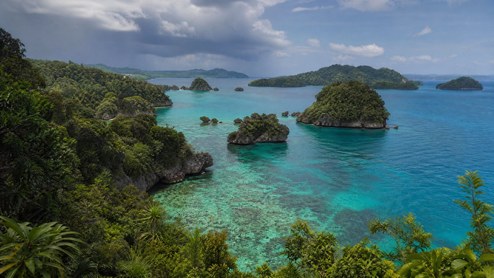
Andaman and Nicobar Islands is India’s far-eastern island union territory, a long chain of forested islands, reefs, mangroves and beaches between the Bay of Bengal and the Andaman Sea. Sri Vijaya Puram is the logistical and historical gateway, while ferries open up very different experiences: coral-fringed Swaraj Dweep, small agricultural Shaheed Dweep, the forested north around Diglipur, and the much more regulated Nicobar group. The attraction is not simply a beach circuit. Colonial incarceration, freedom-movement memory, living multilingual communities and globally significant ecosystems sit alongside one another. Some islands, reserves and tribal areas are not visitor attractions. A thoughtful plan concentrates on places open to the public, keeps buffer days, and treats reef, forest, shoreline and community boundaries as part of the experience.
Regional notebook
Begin with the shape of the region.
This union territory is best understood as an archipelago of contrasts rather than one resort destination. Sri Vijaya Puram concentrates flights, harbour services, public institutions and independence-era history. Eastward, Swaraj Dweep and Shaheed Dweep offer the most straightforward reef-and-beach combination; northward, the scale shifts to rainforest, mangrove creeks and the islands’ highest ridge. Great Nicobar is ecologically and culturally distinct, with access that is much more controlled. Choose a relaxed itinerary in a few places rather than a rushed checklist. Build around the gateway, then choose one marine circuit and, if time permits, one forested or northern counterpoint.
Landscape
Geography changes the journey.
The Andaman group lies north of the Ten Degree Channel and the Nicobar group south of it, separating the Andaman Sea from the Indian Ocean. The territory’s official profile records 836 islands, islets and rocky outcrops, but only a small minority are inhabited. Terrain is not uniformly flat: evergreen forest, low hills, creek systems, mangroves, littoral edges and coral reefs occur in close proximity. Saddle Peak rises to 732 metres in North Andaman; Great Nicobar combines coastal plains with wet evergreen mountains, including Mount Thullier.
Living culture
Arrive as a guest, not an audience.
Island life reflects Indigenous homelands, penal-settlement history, post-colonial migration and maritime livelihoods. Bengali is the most widely spoken language in the administration’s profile, alongside Hindi, Tamil, Telugu, Malayalam and Andaman Creole Hindi; Hindi and English are official. Nicobarese and several Indigenous languages belong to cultural worlds that should not be reduced to visitor entertainment. The territory is also an important memory landscape of India’s freedom movement, most powerfully at Cellular Jail and the former colonial headquarters on Netaji Subhas Chandra Bose Dweep. Observe, listen and ask before photographing people, worship or work.
Curated regional atlas
Places that reveal different parts of Andaman and Nicobar Islands
This is a selective, geographically varied starting point rather than an exhaustive list. Use it to choose a coherent route, not to compress every place into one trip.
Capital city and harbour gateway · South Andaman Island, South Andaman district
Sri Vijaya Puram
Sri Vijaya Puram is the capital, air-and-sea gateway and most useful orientation point for the archipelago. Formerly called Port Blair, it brings together the airport, harbour, administration, museums, markets and the territory’s central freedom-movement sites. Its value is practical as well as historical: this is where travellers can absorb a delayed arrival, organise onward logistics and understand why the islands are more than a beach destination. The waterfront setting, short urban journeys and nearby memorial landscape make it a sensible base before ferries rather than a place to rush through.
Why this place matters
Choose Sri Vijaya Puram to connect the islands’ civic present with the colonial and freedom-struggle history that shaped modern travel narratives. It is the strongest choice for first and last nights because most onward movements begin here, but it also offers a useful contrast to the quieter islands: working harbour, multilingual town life and accessible historical interpretation. The city suits travellers who want context before reefs, or who need an itinerary that can absorb weather disruption. It is not a substitute for a forest or island stay, yet it makes the rest of the route more legible and less fragile.
Colonial prison memorial and museum · Atlanta Point, Sri Vijaya Puram, South Andaman Island
Cellular Jail National Memorial
Cellular Jail is the archipelago’s essential historical site: a three-storeyed colonial prison completed in 1906, designed around cellular confinement and later dedicated as a national memorial. Its remaining radial wings, cells and interpretive spaces confront the violence of transportation and imprisonment endured by many freedom fighters. The site demands slow attention rather than a quick photograph. Museum, gallery and evening interpretation have helped make the history accessible, but the architecture itself is the strongest document: surveillance geometry, isolation and the material setting of the so-called Kala Pani.
Why this place matters
Go to place the islands within India’s independence history and to balance coastal leisure with serious historical understanding. The memorial is particularly rewarding near the start of a trip, before later place names and commemorations acquire their fuller meaning. It is also one of the most accessible major sites in the capital, suitable for travellers not taking a long boat excursion. Expect emotional weight rather than spectacle. A paced visit leaves time to read the interpretation and reflect on the prison’s coercive purpose, instead of treating it as a background to an island holiday.
Historic island and colonial-ruins landscape · Near Sri Vijaya Puram, South Andaman district
Netaji Subhas Chandra Bose Dweep
Netaji Subhas Chandra Bose Dweep, formerly Ross Island, sits a short boat ride from the capital and preserves the atmospheric remnants of the British administrative headquarters in the Andamans. Ruined offices, residences, church structures and other colonial fabric are gradually reclaimed by tropical vegetation, making the island an unusually direct encounter between imperial infrastructure and a humid island ecology. A small interpretive component and shoreline views add context, but the principal experience is walking through a compact historical landscape where decay is part of the evidence rather than a decorative effect.
Why this place matters
Visit for an architectural counterpoint to Cellular Jail. The prison explains incarceration; this island exposes the administrative world that supported it, while vegetation visibly unsettles the permanence once claimed by colonial buildings. Its proximity to Sri Vijaya Puram makes it a manageable half-day excursion for travellers who want history without sacrificing several days to transit. The experience works best for those comfortable with uneven outdoor paths and a boat-dependent visit. It is a much stronger choice for historical atmosphere and island views than for swimming or a long wilderness walk.
Coral-fringed island and beach landscape · Ritchie’s Archipelago, east of South Andaman
Swaraj Dweep
Swaraj Dweep, earlier known as Havelock Island, is the Andamans’ best-known public island circuit, about 39 kilometres northeast of Sri Vijaya Puram. Within roughly 113 square kilometres it combines tropical forest, white-sand beaches, mangrove edges and coral-associated waters. Radhanagar, Elephant and quieter east-coast beaches provide different textures, but the larger draw is the chance to pair shore time with guided reef experiences. Despite its popularity, the island is not a single beach: travel between coves, forested stretches and the jetty takes time, and marine conditions define what is sensible on any day.
Why this place matters
Choose Swaraj Dweep when a first island stay needs a broad mix of beach, reef, forest edge and practical services. It is the strongest place to slow down after the capital rather than attempting multiple short stops. Families and first-time sea visitors can find approachable shore-based choices, while confident swimmers may prefer supervised marine activities when conditions permit. The trade-off is popularity and a more developed visitor landscape than on northern islands. Go for a balanced coastal base, not for an expectation of secluded conditions at every major beach.
Agricultural island and coastal landscape · Ritchie’s Archipelago, east of South Andaman
Shaheed Dweep
Shaheed Dweep, formerly Neil Island, is a small, low-key island around 37 kilometres from Sri Vijaya Puram, known for fertile plots, beaches, shallow reef settings and exposed rock formations. Its agricultural role as the islands’ vegetable bowl is a useful corrective to the postcard image: fields and settlement sit close to Bharatpur, Laxmanpur and Sitapur coasts. At low tide, the natural rock bridge and intertidal textures can be viewed with care. The scale supports unhurried cycling or short road journeys, provided visitors respect heat, tide and the fragility of shoreline life.
Why this place matters
Choose Shaheed Dweep for a softer-paced complement to Swaraj Dweep. It offers more of an island-village and cultivation landscape, together with sunrise, sunset and tide-dependent coastal observation. One or two nights makes sense for travellers who prefer small-scale exploration over a dense activity schedule. The trade-off is limited redundancy: weather, ferry changes and a restricted range of services have a larger effect here than in the capital. Go for the rhythm of beach, field and tide, not for nonstop water sport or an assumption that every shore is safe to enter.
Marine national park and mangrove-island reserve · Wandoor, South Andaman Island
Mahatma Gandhi Marine National Park
Mahatma Gandhi Marine National Park at Wandoor is a protected seascape rather than a generic beach outing. Established in 1983, it covers 281.50 square kilometres, including extensive territorial waters, and incorporates 15 islands with sandy strands, mangrove creeks and tropical forest. Its reefs and associated waters support fishes, molluscs, turtles, birds and other marine life. Public visits, where allowed, are managed around authorised boats and selected islands such as Jolly Buoy or Red Skin, so the attraction is a conservation-framed marine day rather than open-ended island access.
Why this place matters
Go when you want a reef-and-mangrove experience with a clear protected-area context. Wandoor is a good alternative to building an entire trip around resort beaches: the journey, boat ride and designated visit make ecological boundaries visible. It is especially valuable for visitors interested in coral habitats and marine interpretation who are ready to accept that the experience may be altered by weather, restoration needs or seasonal management. The trade-off is flexibility. This is not the right place to demand a particular island, landing or underwater activity on a fixed date.
Coastal forest and biological park · South Andaman Island, south-west of Sri Vijaya Puram
Chidiyatapu
Chidiyatapu is a coastal forest area near Sri Vijaya Puram where a biological park, reserve-forest surroundings, shore views and bird-focused observation create a compact nature counterpoint to the city. The biological park was developed with wildlife education, interpretation, conservation breeding and research as stated objectives, not merely recreation. The wider setting of wooded slopes and coast makes it useful for a short visit when a full marine-park day is not possible. Its appeal lies in patient looking: bird calls, forest atmosphere and changing evening light, rather than a promise of close wildlife encounters.
Why this place matters
Choose Chidiyatapu for a lower-logistics nature day from the capital, especially if you want a conservation lens or have limited time before a flight or ferry. It demonstrates that Andaman biodiversity is terrestrial and coastal as well as underwater. The site can work for families, birders and travellers seeking shade, but paths, gradients, weather and insect exposure should be considered. The trade-off is that wildlife sightings are never guaranteed and the biological park is not a substitute for seeing animals undisturbed in a large protected forest. Go for interpretation and habitat awareness.
Mangrove creek and karst landscape · Middle Andaman, North and Middle Andaman district
Baratang Island
Baratang Island is a geological and wetland counterpoint to the east-coast beach circuit. Reached from Sri Vijaya Puram by the Andaman Trunk Road, a controlled transit through the Jarawa Tribal Reserve, a short vehicle ferry and local transfer, it is known for mangrove creeks, limestone caves and mud volcanoes. Archaeological evidence also points to long habitation, while settlement history includes Ranchi, Bengali and other mainland communities. The day’s defining feature is not speed but procedure: a long sequence of road, checkpoint, ferry, creek and walk through an environmentally sensitive landscape.
Why this place matters
Go for mangrove texture and unusual geology, not for a casual shortcut into the islands’ interior. The limestone and mud-volcano features offer a different scale of wonder from reefs, while a creek journey reveals the relationship of brackish water, forest and tidal movement. Baratang is a good choice for travellers who can begin early and remain patient with regulated transit. Its major ethical boundary is decisive: passing through the Jarawa reserve never grants a right to stop, photograph, film or interact with Jarawa people. The value is the regulated landscape beyond, not human observation.
Mountain national park and rainforest landscape · Near Diglipur, North Andaman Island
Saddle Peak National Park
Saddle Peak National Park provides the archipelago’s clearest mountain-and-rainforest experience. Near Diglipur in North Andaman, the park protects distinctive terrestrial flora and fauna around Saddle Peak, which rises to 732 metres, the highest point in the Andaman Islands. The northern setting differs markedly from the capital and reef circuit: forest cover, a longer road approach and a more remote pace are central to the visit. Diglipur’s oranges, rice, forest setting and marine connections give the surrounding landscape a productive as well as scenic identity. This is humid tropical hill walking, not high-altitude trekking.
Why this place matters
Choose Saddle Peak to understand vertical relief in an archipelago often represented only by beaches. A forest route and, when conditions allow, elevated views reward travellers willing to devote time to North Andaman rather than treating it as a day trip from the capital. The place works especially well alongside Ross and Smith Islands, creating a land-and-sea northern circuit. The trade-off is physical effort, rain-slick surfaces and a substantially longer approach than South Andaman attractions. Go prepared for humidity, insects and changing trail conditions, with no assumption that summit visibility or wildlife sightings will occur.
Twin-island sanctuary and sandbar coast · Off Aerial Bay near Diglipur, North Andaman Island
Ross and Smith Islands
Ross and Smith Islands form a visually distinctive northern-Andaman pair joined by a natural sandbar that appears and disappears with the tide. Tropical forest, clear shallow water and coral-associated habitat frame the changing strip of sand, while the surrounding protected setting includes turtle-nesting significance. Reached by boat from the Aerial Bay side of Diglipur, the islands are a rewarding endpoint to a North Andaman circuit rather than a quick add-on to a southern itinerary. The sandbar is a tidal landform, not a fixed walkway, and that variability is central to the site’s character.
Why this place matters
Go for one of the clearest examples of how tide reshapes the visitor experience in the islands. The pair offers a gentle visual drama—two wooded forms briefly joined by sand—while still requiring attention to conservation rules and boat logistics. It complements Saddle Peak particularly well because the combination shows North Andaman’s forested relief and marine edge in two days. The trade-off is commitment: the long approach to Diglipur, weather sensitivity and regulated access make this less convenient than the capital’s nearby beaches. Choose it for a northern landscape, not for guaranteed sandbar conditions.
Active volcanic island and restricted seascape · Andaman Sea, north-east of Sri Vijaya Puram
Barren Island
Barren Island is South Asia’s only active volcano, an uninhabited, ash-and-cone island approximately 138 kilometres north-east of Sri Vijaya Puram. Its stark volcanic forms, sparse visible vegetation and surrounding blue water make a powerful contrast with the forested islands nearby. Recorded activity, including an eruption in 2017, means this is first a dynamic geological site and only secondarily a visitor subject. The attraction is distant observation of an active volcanic landscape from a properly authorised vessel when such viewing is permitted; it is not an island landing, beach day or self-directed expedition.
Why this place matters
Choose Barren Island only if a volcanic seascape is a priority and you are content with an uncertain, observation-led outing. The journey conveys the scale and isolation of the Andaman Sea and offers a rare chance to see a living geological process in India. It appeals to photographers, earth-science enthusiasts and experienced ocean travellers more than to those seeking predictable recreation. The trade-off is substantial: weather, sea state, official controls and volcanic safety can cancel or constrain operations. A responsible itinerary treats a successful distant view as a bonus, not as a guaranteed programme item.
Rainforest national park and biosphere-reserve landscape · Great Nicobar Island, Nicobar district
Campbell Bay National Park
Campbell Bay National Park occupies part of Great Nicobar’s northern protected landscape, within the wider Great Nicobar Biosphere Reserve. The park is associated with tropical evergreen forest, tree ferns, ground orchids and fauna including crab-eating macaque, Nicobar pigeon, megapode and giant robber crab. Great Nicobar itself is India’s southernmost large island and a markedly different world from the popular Andaman circuit: mountain ranges, coastal plains, high biodiversity and Indigenous homelands exist within a tightly managed access context. Campbell Bay should be approached as a conservation landscape, not a remote novelty to be consumed quickly.
Why this place matters
Consider Campbell Bay only for a longer, conservation-minded itinerary that can accommodate controlled access and ocean-route uncertainty. It offers the territory’s deepest rainforest-and-biosphere-reserve perspective, with a chance to appreciate why Great Nicobar carries exceptional ecological weight. The intellectual reward is high, but so is the planning burden: long travel time, permits, local transport limits and changing rules make it unsuitable as a casual extension of a beach holiday. Go for habitat, landscape and responsible observation, never for contact with protected communities or entry into areas not specifically open to visitors.
Season and pace
Choose a date window for the experience, then keep a fallback.
Heat and humidity are present throughout the year, so ‘winter’ means comparatively comfortable tropical conditions rather than cold weather. The more reliable broad travel period is November through April, when sea conditions are often kinder for ferries, reef visits and walks; March to May can be hotter. Rain and wind become more disruptive from roughly June into October, though timing and intensity vary by island and year. The meteorological service issues local observations, warnings and marine-relevant forecasts, and these matter more than a calendar label. A sunny morning does not guarantee calm water later in the day.
Movement and planning
Distance on a map is not the same as usable travel time.
Moving through the region
Sri Vijaya Puram is reached principally by air and functions as the departure point for most public-facing island itineraries. Inter-island movement depends on scheduled ferries and, on some routes, limited aviation; a road network serves parts of the connected Andaman chain. Road journeys to Baratang pass through a protected tribal reserve under tightly controlled transit rules, while northern sites need significant overland time. Step-free access, shaded waiting areas, onboard facilities and medical capability vary sharply by route and site. Travellers with limited mobility should confirm transfer and boarding arrangements in advance and avoid stacking same-day connections.
Building a workable route
Arrive with a buffer before any fixed onward commitment, particularly when a ferry, park boat or weather-sensitive activity matters. Use Sri Vijaya Puram for arrival recovery and history, then choose a coherent circuit: Swaraj Dweep and Shaheed Dweep for coast and reefs; Wandoor for a managed marine park; or Diglipur for Saddle Peak and Ross and Smith. Baratang works best as an early, rule-bound day focused on geology and mangroves, not on the tribal reserve transit. Confirm current sailing, park, tide, trail, health and access information through the relevant local or official channel shortly before each move.
Travel responsibly
The regional context includes its limits.
The islands’ beauty is inseparable from ecological limits and community protections. Do not collect coral, shells or living material; do not touch reefs, feed wildlife, leave litter, or assume a clear lagoon is safe for unsupervised swimming. Follow tide, guide and boat instructions without exception. Protected tribal reserves are not cultural encounters: no stopping, photography, filming, contact or observation attempts are appropriate, and North Sentinel Island is entirely off limits. Use refillable water, keep noise low near birds and turtle beaches, and stay on designated paths. Barren Island, reserve interiors and protected beaches require particular restraint. Respect closures as conservation or safety decisions, not inconveniences, and confirm current rules with the relevant local or official channel.
This is an evergreen regional guide. Weather, permits, closures, transport and local rules can change; confirm material conditions through the relevant local or official channel before travel.