Northeast India · State · SK
Sikkim
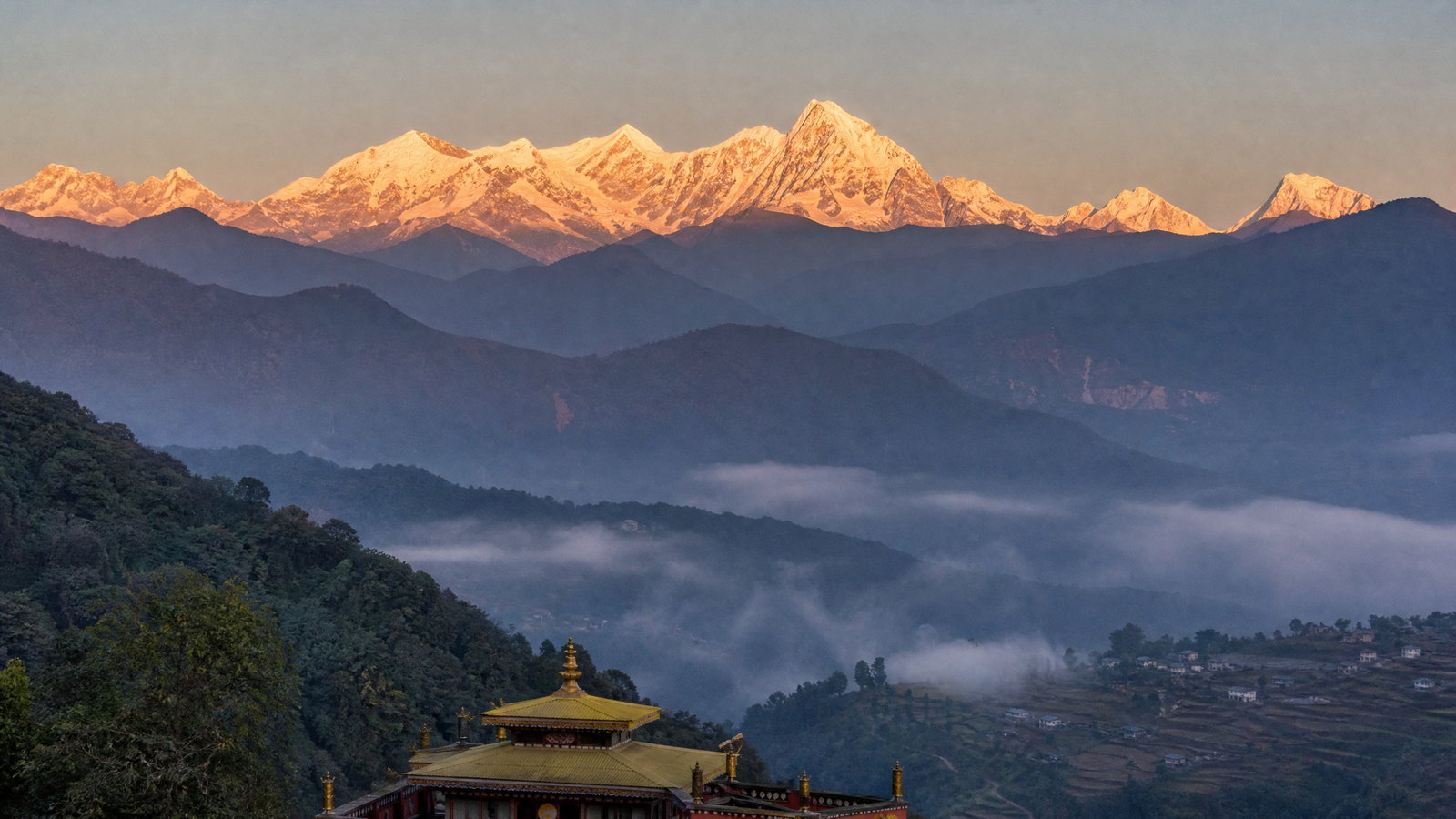
Sikkim is a compact Eastern Himalayan state whose short distances conceal exceptional changes in altitude, climate and culture. Gangtok supplies the most practical urban base, while the east reaches glacial lakes and a tightly regulated border pass, the west holds the kingdom’s early capitals and monasteries, the south offers gentler hill landscapes, and the north turns alpine. Khangchendzonga is not simply a view: its mountains, lakes, forests and stories form a living sacred geography for many communities. This is a destination for travellers who can accept weather-led adjustments, slow mountain journeys and careful preparation. A well-paced visit combines a town, one monastic or historic circuit, and one highland or forest landscape rather than trying to traverse every district quickly. Clear autumn light and spring flowering are attractive broad windows, but road conditions, permits, snow, rainfall and local observances always shape the actual journey.
Regional notebook
Begin with the shape of the region.
Sikkim rewards a selective, altitude-aware itinerary rather than a checklist. Gangtok combines transport links, museums, monasteries and city life. East Sikkim’s Tsomgo Lake and Nathula Pass are dramatic but controlled high-country excursions; they require tolerance for early starts, cold and changing access. West Sikkim is strongest for royal history, Nyingma heritage and slower landscapes around Yuksom, Pelling and Khecheopalri. Northern valleys offer the greatest alpine drama, flowering meadows and deep gorges, but are more exposed to closures. South Sikkim provides a useful contrast: Namchi’s pilgrimage landscape and hill views are generally less demanding physically. The state looks compact on a map, yet mountain roads, weather and formal access rules govern the realistic pace. Build around two or three areas, retain uncommitted time, and treat a missed highland visit as a sound safety decision.
Landscape
Geography changes the journey.
Within roughly 7,096 square kilometres, Sikkim rises from subtropical valleys through temperate forest to alpine terrain and snowbound high country. The Teesta and Rangeet drain steep, deeply cut valleys; mountain chains form its boundaries with Nepal, Bhutan and the Tibetan Autonomous Region of China. Khangchendzonga, at 8,586 metres, dominates the western skyline and sacred landscape. Its national park spans lower forest, glaciers, lakes and summit terrain. This compression explains both rich views and difficult travel. A warm valley morning can become a cold, cloudy mountain afternoon. Roads cross active slopes and river corridors, while high places bring low oxygen, wind and snow. There is no coast: water-based experiences centre on rivers, springs and Himalayan lakes, where ecological and sacred boundaries matter.
Living culture
Arrive as a guest, not an audience.
Sikkim is culturally plural, shaped by Lepcha, Bhutia and Nepali communities alongside many others, each with languages, oral traditions, foodways, music and festivals. Nepali is widely heard; Sikkimese (Bhutia), Lepcha, English, Limbu and other state languages also belong to the public linguistic landscape. Buddhism is central to many historic places, but the state is not reducible to one faith or community. Monasteries remain ritual institutions, and Hindu, Buddhist and local sacred associations meet at Khecheopalri Lake. Khangchendzonga is understood as Mayel Lyang in Lepcha tradition and as a hidden sacred land in Tibetan Buddhism. Festivals can enrich a visit, but never presume access to rituals. Dress modestly, ask before photographing people or ceremonies, and let local custom set the tone.
Curated regional atlas
Places that reveal different parts of Sikkim
This is a selective, geographically varied starting point rather than an exhaustive list. Use it to choose a coherent route, not to compress every place into one trip.
capital city · Gangtok District, eastern Sikkim
Gangtok
Gangtok is Sikkim’s capital, principal administrative and business centre, and the most useful first base for understanding the state’s contemporary rhythm. Built across a steep ridge above the Teesta valley, it combines dense hillside neighbourhoods, promenading streets, institutions, monasteries and views that appear or disappear with cloud. It is not a quiet mountain village, but its services, transport links and range of cultural stops make it a sensible counterweight to remote travel. Use the city as a place to acclimatise gently, orient yourself to local conditions and explore at walking pace between outward journeys.
Why this place matters
Choose Gangtok for a grounded introduction before moving toward high lakes, forest trails or western heritage. The city gives decision value rather than only scenery: it is where weather changes, permit procedures and road status are easiest to clarify, and where a traveller can add an indoor cultural day if cloud blocks the mountains. Its ridge setting also makes short walks visually rewarding, though gradients are unavoidable. Gangtok suits first-time visitors, mixed-interest groups and anyone who prefers a reliable service base. It is less suitable as the sole expression of Sikkim’s rural, alpine or forest character.
Buddhist monastery · Rumtek, Gangtok District, eastern Sikkim
Rumtek Monastery
Rumtek Monastery stands on the hills opposite Gangtok amid village fields and forested slopes. It is the largest monastery in Sikkim and a major centre of the Karma Kagyu tradition, associated with the Gyalwa Karmapa. The complex’s Tibetan architectural language, courtyards and religious art make it an important living religious destination, not merely a viewpoint. The journey from Gangtok also reveals a different east Sikkim texture: paddy landscapes and settled hills rather than the city ridge. Visitors should approach it with the attention due to a functioning monastic community.
Why this place matters
Rumtek adds depth to a Gangtok stay by connecting the city to Sikkim’s monastic networks and agricultural hillside landscape. It is particularly valuable for travellers who want to look beyond quick photo stops and understand how architecture, teaching, ritual and settlement coexist. The surrounding terrain can be green and misty in the rains, or show golden paddy later in the year. It offers a less physically demanding cultural excursion than a high-altitude day, although access still involves slopes and steps. It does not substitute for remote monastic heritage in west Sikkim; its strength is its active eastern setting.
high-altitude glacial lake · Gangtok District, eastern Sikkim
Tsomgo Lake
Tsomgo Lake, also known as Changu, is a high-altitude lake on the eastern route beyond Gangtok. Snow, bare slopes and rapidly shifting cloud give it a very different character from the temperate city below. The lake holds sacred significance for Sikkimese communities and should be treated as more than a scenic stop. Its location on a controlled mountain axis makes the journey part of the experience: the road rises through changing vegetation into cold, exposed terrain. Conditions can turn severe, especially outside the main mild-weather windows, and the lake may be frozen or snowbound in winter.
Why this place matters
Tsomgo is the clearest single-day illustration of Sikkim’s vertical geography: within hours of Gangtok, a traveller moves from urban ridges to an alpine lake basin. It suits visitors seeking mountain scale without a multi-day trek, and pairs naturally with an east-Sikkim plan. The trade-off is that it can feel busy and is governed by weather, road status and protected-area procedures. Choose it for landscape, elevation and the cultural weight of a sacred lake, not for guaranteed clear reflections or snow. Travellers prone to altitude symptoms should take the ascent seriously and avoid rushing onward simply to add another stop.
historic mountain pass · Gangtok District, eastern Sikkim
Nathula Pass
Nathula Pass is a historic Himalayan corridor on the India–China border, reached on the same broad axis as Tsomgo Lake but at a markedly higher, more exposed elevation. It belongs to a network of passes that once connected Sikkim and Tibet and is now a sensitive border landscape. The appeal is geographic and historical: wind-scoured terrain, a sense of the high frontier and the route’s place in regional exchange. It is not an open-ended mountain roam. Official rules, identity checks, day-specific access, weather and security considerations determine whether a visit is possible.
Why this place matters
For travellers already interested in Sikkim’s borderland geography, Nathula turns the eastern excursion from a lake visit into a lesson in Himalayan history, altitude and contemporary boundaries. Its high setting can be memorable when conditions are clear, yet it should not be treated as an essential item at the expense of health or a flexible schedule. The pass is more demanding than Tsomgo Lake because cold, wind and low oxygen are intensified. It suits prepared domestic visitors able to meet current requirements; other travellers should not assume access. A cancelled pass day can still leave a rewarding Tsomgo or Gangtok itinerary.
historic town and sacred landscape · Gyalshing District, western Sikkim
Yuksom and Norbugang
Yuksom is the historic first capital of the Kingdom of Sikkim and a crucial western anchor for both heritage and mountain travel. In 1642, Phuntsog Namgyal was consecrated here as the first Chogyal at Norbugang, where the throne and chorten remain key reference points in Sikkim’s political and sacred history. The town sits amid wooded hills at a lower altitude than the great park routes and is also a recognised starting area for treks toward Khangchendzonga. Its significance lies in the meeting of dynasty, pilgrimage, village life and mountain access.
Why this place matters
Yuksom is the best choice for visitors who want Sikkim’s early history to lead the itinerary rather than follow it. It makes a thoughtful base for the Norbugang site, Dubdi-area heritage and the western park approach, while offering a slower rhythm than Gangtok. The town demonstrates why the state’s mountain landscape is culturally layered: a coronation site can also be a pilgrimage point and a practical trailhead. Choose Yuksom for two nights or more if walking, history or park preparation matter. Do not treat it as a quick detour from Pelling if road conditions or a trek schedule require deliberate pacing.
UNESCO mixed World Heritage national park · Western and northern Sikkim
Khangchendzonga National Park
Khangchendzonga National Park is the ecological and spiritual core of Sikkim’s high Himalaya. Inscribed as a mixed World Heritage property, it spans an extraordinary elevation range from lower forest through steep valleys, glaciers and alpine terrain to the Khangchendzonga massif. Its natural values include rich eastern Himalayan habitat, while its lakes, mountains and stories carry sacred meaning for Lepcha communities and Tibetan Buddhists. The park cannot be understood as a conventional drive-through attraction. Its scale, remoteness and protective purpose require time, appropriate routes and respect for management rules.
Why this place matters
Choose the park for a serious encounter with the entwined natural and cultural meaning of Sikkim, not for a single guaranteed wildlife sighting or summit view. It offers forests, Himalayan ecology, glacier-fed landscapes and a sacred geography that explains much of the state’s identity. Yuksom is a useful western context, but routes within and around the park differ widely in duration and difficulty. The reward of a longer, permitted walk is immersion; the trade-off is exposure to weather, altitude and logistical uncertainty. Visitors with limited time can still learn from its buffer landscapes without attempting demanding high routes.
archaeological royal capital · Near Pelling, Gyalshing District, western Sikkim
Rabdentse Ruins
Rabdentse preserves the forest-framed remains of Sikkim’s second royal capital, occupied from 1670 to 1814 before political conflict and the transfer of the capital changed its role. Palace foundations, chortens, a stone throne and other excavated features reveal a courtly landscape rather than an intact palace. The site is protected as a monument of national importance, and its pathway through woodland makes the approach part of the historical reading. Khangchendzonga views can add drama when clear, but the ruins’ real power is the way archaeology, Buddhist memorial forms and western Sikkim’s forest meet.
Why this place matters
Rabdentse is indispensable for understanding the sequence from Yuksom’s founding to the later Sikkimese kingdom. It gives a tangible counterpoint to monasteries: here political authority, public ritual space and royal privacy can be read through surviving ground plans. The walk makes it more rewarding for visitors willing to move slowly and look closely, rather than those seeking an entirely step-free monument. Pair it with Pemayangtse for a coherent heritage day or use it to deepen a Pelling stay. Mist can be atmospheric, while clear weather improves mountain views; neither condition is essential to the site’s historical value.
Buddhist monastery · Near Pelling, Gyalshing District, western Sikkim
Pemayangtse Monastery
Pemayangtse Monastery is among Sikkim’s oldest and most influential Buddhist institutions. Established at its present location in 1705 after an earlier shrine foundation, it is associated with the Nyingma tradition and the heritage of Guru Padmasambhava. Its three-storey structure holds painted interiors, religious images, manuscripts and a celebrated layered wooden representation of the heavenly palace. The monastery’s importance is both artistic and institutional: it has shaped linked monastic traditions in Sikkim and remains a place of religious practice. Its Pelling-area location makes it an accessible entry into the western sacred landscape.
Why this place matters
Visit Pemayangtse for a concentrated encounter with Sikkimese Buddhist art, lineage and historic architecture. It rewards careful attention to the details of the prayer hall rather than hurried photography, and it makes a powerful pairing with Rabdentse’s royal archaeology nearby. For travellers unable to undertake long forest walks or high treks, it offers cultural depth without the physical exposure of the park. The trade-off is that the experience depends on respectful behaviour within a living monastery, not unrestricted access to every room or ritual. Festival dates and ceremonial activity can add meaning but should never be treated as staged entertainment.
sacred lake and pilgrimage landscape · Khecheopalri, Gyalshing District, western Sikkim
Khecheopalri Lake
Khecheopalri Lake is a forest-ringed sacred lake in west Sikkim, revered in both Buddhist and Hindu traditions. Also known by a name interpreted as the heaven of Padmasambhava, it is associated with Guru Padmasambhava, Tara and local pilgrimage beliefs. Its quiet water and wooded setting are inseparable from rules that protect the place from ordinary recreation. The lake is part of a wider western circuit linking monasteries, royal history and mountain landscapes. It is a place to listen and observe, not an arena for water sports or loud leisure.
Why this place matters
Khecheopalri offers the most direct experience of Sikkim’s idea of a living sacred natural feature. Visitors seeking an alternative to grand altitude and monumental architecture will find its scale more intimate but no less meaningful. The surrounding forest, birdlife and prayer activity make it a strong slow-travel stop between Pelling and Yuksom. Its main trade-off is deliberate restriction: swimming, fishing, boating and other recreation are prohibited, which is precisely part of the site’s importance. Choose it for contemplation, ecological respect and cultural connection; do not choose it expecting a conventional lakeside activity day or unrestricted photography.
rhododendron sanctuary and hiking landscape · Hilley–Barsey, Soreng District, southwestern Sikkim
Barsey Rhododendron Sanctuary
Barsey Rhododendron Sanctuary protects a ridge landscape in southwestern Sikkim where rhododendron, pine, magnolia and oak forest frame walks toward the Singalila range. The customary approach from Hilley is a roughly five-kilometre hike, making Barsey a more immersive nature stop than a roadside viewpoint. In peak bloom, usually around March and April, the flowers and Khangchendzonga views can be spectacular; outside that interval, the appeal shifts to forest texture, birdlife and a quieter mountain atmosphere. As a protected sanctuary, it is a place for low-impact walking, not flower collecting.
Why this place matters
Barsey is a strong choice for travellers wanting a manageable Himalayan walk with botanical focus rather than extreme altitude. It broadens a Sikkim itinerary beyond monasteries and high lakes while connecting visitors to the state’s protected-area network. Spring is the obvious visual peak, but it also brings demand and variable mountain weather. In autumn, flowering is not the focus, yet clearer ridge views may compensate. The journey is best for people comfortable walking on natural surfaces and adapting to cloud. It is not the right choice for a drive-up scenic stop or for anyone unwilling to obtain current sanctuary clearance.
alpine valley and protected landscape · Lachung area, Mangan District, northern Sikkim
Yumthang Valley and Shingba Rhododendron Sanctuary
Yumthang is northern Sikkim’s celebrated high valley, where broad alpine meadows, river channels and snowy walls create a landscape distinct from the forested west and settled south. It lies near Shingba Rhododendron Sanctuary, one of the state’s protected areas, and spring is known for flowering slopes. The north’s appeal is scale and ecological contrast, but the valley is not a simple seasonal guarantee: snow, rain, road disruption and protected-area controls can alter the journey. A visit is most rewarding when treated as a fragile alpine environment rather than a fast photographic excursion.
Why this place matters
Yumthang is the right northern choice for travellers drawn to alpine meadow landscapes and the transition between rhododendron habitat and snow country. It offers a powerful contrast to Gangtok’s city slopes or Pelling’s monastic heritage, especially when approached over several days with Lachung as a practical staging point. The trade-off is substantial: northern roads are vulnerable to weather events and the elevation can be demanding. Flowering varies from year to year, so a visit should not be built around a fixed bloom claim. Choose it for the valley’s broader geography, not a promise of a particular colour or snow scene.
pilgrimage hill and cultural landmark · Near Namchi, Namchi District, southern Sikkim
Samdruptse
Samdruptse rises below Tendong Hill near Namchi and is marked by a 135-foot statue of Guru Padmasambhava. The hilltop is a southern Sikkim pilgrimage and cultural landmark, with wide views across Namchi, neighbouring hills and, in favourable conditions, the Khangchendzonga range. Its importance rests in religious devotion as much as its visual scale. Samdruptse offers a useful geographical contrast to the harder northern itinerary: the south’s hill landscapes are lower, more settled and suited to a slower cultural day. It is best experienced with the composure appropriate to a worship setting.
Why this place matters
Add Samdruptse to balance a Sikkim trip weighted toward Buddhist monasteries in the west or dramatic highlands in the north. It brings the Padmasambhava tradition into a contemporary landmark setting and gives perspective over the southern hills without a high-altitude expedition. Namchi also makes it a convenient stop when connecting the south and west, though road time still needs realistic allowance. The site suits travellers with limited time, families and those seeking a less strenuous spiritual landscape. It should not be framed only as a giant statue: the meaning, hilltop setting and respectful visitor conduct are central to why it matters.
Season and pace
Choose a date window for the experience, then keep a fallback.
Spring, broadly March to May, is versatile for rhododendrons, orchids and moderate sightseeing, though high elevations can retain snow and cloud can obscure peaks. Autumn, broadly October to mid-December, often gives crisper views and is the clearest general choice for heritage-and-landscape travel. From May into early October, heavy monsoon rain is widespread, especially in the south and east; waterfalls and green forests are compelling, but landslides, road delays and flight disruption are real trade-offs. Winter can restrict high terrain while lower towns remain manageable. The same month behaves differently in Gangtok, western ridges and the north. Treat ranges as guides, not promises: check forecasts, rainfall bulletins, road notices and destination status through the relevant official or local channel shortly before departure and during travel.
Movement and planning
Distance on a map is not the same as usable travel time.
Moving through the region
Pakyong is Sikkim’s airport; Bagdogra and the railheads at New Jalpaiguri and Siliguri in neighbouring West Bengal remain important gateways. Road travel is the essential connector, with Gangtok usually the main hub. Read distances in hours, not kilometres: hairpins, fog, rain and slope work can reshape a day. Shared and hired vehicles serve many settled routes, but self-driving confidence does not remove mountain-road risk. Air services and helicopters can be weather dependent. Plan daylight transfers, avoid immovable connections after mountain drives, and retain water, warm layers and motion-sickness support if useful. High-altitude excursions need gradual pacing. Most viewpoints and historic centres involve slopes, steps or uneven paths; visitors with limited mobility should ask locally about the least demanding current approach.
Building a workable route
Use a base-and-spoke plan: Gangtok for urban and eastern outings, Pelling or Yuksom for western heritage and park approaches, and Namchi for the south. Add the north only when access status and time buffer allow. Border, sanctuary and protected-area routes have formal permissions, document rules, nationality conditions or operator requirements that differ by location. Nathula is not a routine international-border stop. Confirm current eligibility, documents, route opening, transport procedure and any guide requirement through the relevant official or local channel before finalising onward travel. Carry the identity documents required for your circumstances and keep copies secure. For multi-day hiking, use authorised local arrangements and treat park instructions as binding. Choose realistic overnight stops over long out-and-back drives. An extra day is especially valuable in the wet season and in northern or eastern highlands.
Travel responsibly
The regional context includes its limits.
Sikkim’s scenery is inseparable from fragile slopes, living waters, sacred sites and protected habitats. Use marked paths, take litter away, and do not remove flowers, stones or religious objects. Do not feed, approach or pursue wildlife; a rare sighting never justifies leaving a safe route. At lakes and monasteries, keep voices low, respect restricted areas and follow photography directions. Swimming, fishing and boating are prohibited at Khecheopalri Lake. Refill a reusable bottle where safe water is available and minimise single-use packaging. High-altitude locations are not fitness tests: descend or seek help if illness becomes serious. Landslides, earthquakes, flash floods, avalanches and glacial-lake hazards are regional risks. Follow closures immediately, never bypass a checkpoint or barrier, and retain itinerary room for safety-led changes.
This is an evergreen regional guide. Weather, permits, closures, transport and local rules can change; confirm material conditions through the relevant local or official channel before travel.