Field Notes
Rowe Creek area closures have lifted: how to read an Oregon fire-area reopening without assuming normal access
Emergency closures have lifted in the Rowe Creek, Shingle, Henry and Coyote fire areas, but repair crews, post-fire hazards and Stage 1 restrictions still call for a deliberately limited return.
Emergency closures lifted — public entry allowed, while repair work, post-fire hazards and Stage 1 restrictions continue.
Status at reference time — 12 September 2026, 08:56 PDT: Emergency closures lifted. Public entry was reported as allowed within the affected fire perimeters, while repair work, post-fire hazards and Stage 1 fire restrictions continued on relevant federal lands. A limited access update, not an all-clear for the area, the wider Ochoco landscape or central Oregon.
The reopening in one careful sentence
The emergency closure lift changes a significant part of the decision: people may again enter the fire areas associated with the Rowe Creek Complex, Shingle, Henry and Coyote fires. It does not mean that every outing, road, trail, campground or activity has returned to ordinary conditions. The useful reading is narrower: an emergency restriction that had kept the public out of the affected federal fire areas has been lifted, but the landscape remains a working recovery area with separate rules and hazards.
That distinction matters because a closure and a normal recreation day answer different questions. A closure tells people they may not enter a defined area. Its removal restores the possibility of entry; it does not certify a route, a facility, a campsite, a surface condition or a particular activity. A visitor choosing to return still needs to make a current, site-specific decision.
The latest incident update used for this report is timestamped 12 September 2026, 08:56 PDT. It states that the access restriction for the Rowe Creek Complex, Shingle and Coyote fire areas had been lifted and that public entry within the fire perimeters was allowed. A prior notice also named Henry; check the current order or map for the exact place.
| Question | Status at reference time | Do not infer |
|---|---|---|
| Entry to named fire areas | Emergency closure lifted | Every road or site is open |
| Fire use | Stage 1 remained in effect | Every campground qualifies for an exception |
| Wiley Flat Campground | Separately closed | The complex-wide lift applies there |
What “closure lifted” actually changes
Entry is allowed; a recommendation is not implied
At the reference time, the reported change was from emergency exclusion to permitted public entry inside the relevant fire perimeters. That resolves one essential threshold for a potential visit: the blanket emergency closure is no longer the reason to stay out. It does not answer whether a particular plan is suitable that day.
For example, an open fire perimeter is not evidence that a familiar road has a predictable surface, that a trail has been inspected, or that a developed site has reopened. Those are separate, changeable questions. The responsible approach is to treat entry permission as the first gate, then test the rest of the plan against the specific road, trail, campground or parcel involved.
Keep the scope small and named
This report concerns the named Rowe Creek Complex, Shingle, Henry and Coyote fire areas and the federal lands affected by the emergency closure notices. It does not establish that the whole Ochoco National Forest, the whole Crooked River National Grassland, all public land around the fires or all of central Oregon is open. Nor does it establish a through-route or a safe detour.
A named perimeter is a legal and operational boundary, not a shorthand for a region. Visitors should resist replacing that boundary with a larger conclusion such as “the forest is open.” That can lead someone to overlook a separate alert, a temporary work zone or a facility closure that has nothing to do with the lift of the complex-wide emergency restriction.
What remains: repair work in a working landscape
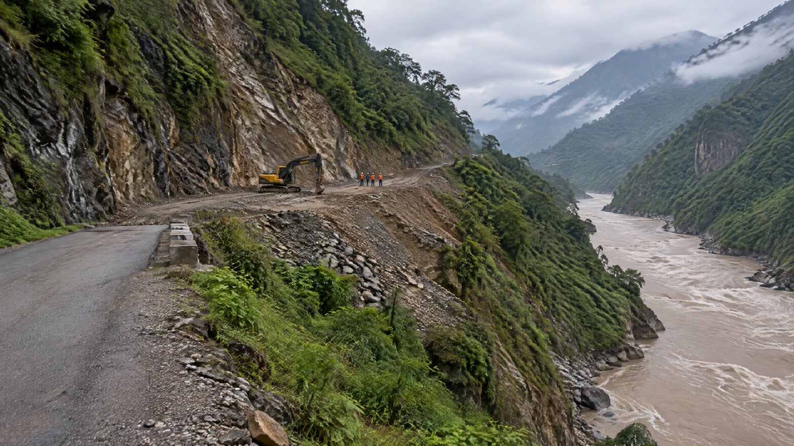
The fire response has shifted from exclusion and suppression activity to repair in many places, but repair is still active work. The incident update describes crews completing a shaded fuel break southeast of the Rowe Creek Complex and using bulldozers and excavators to flatten berms and scatter debris along control lines. Other repair activity is intended to return disturbed ground toward natural conditions and reduce soil and water impacts.
These are not cosmetic tasks. A berm or control line can be part of the response footprint, and work to reshape it can involve heavy equipment, changing ground conditions and intermittent access constraints. Where crews are working, visitors should slow down, give equipment and workers room, and accept that an intended stop may no longer be appropriate. Stopping to watch, parking where movement is needed or attempting to pass through an active work area adds pressure to a recovery operation.
Yielding space is a travel decision
“Yield space” is more than a courtesy in this setting. It means building a plan that can end early without becoming a problem. A group that depends on one narrow access point, one fixed meal stop or a single late return time has little room to respond if equipment is working ahead or a section becomes unsuitable. A reversible plan uses a broad destination idea rather than a promise of a precise route.
That kind of flexibility belongs in the itinerary before leaving home. The practice behind designing rest days can be useful here: capacity is not wasted time when it lets a group leave a work area calmly, take a slower alternative or turn around before fatigue turns a minor change into a poor decision.
Post-fire hazards remain after the closure ends
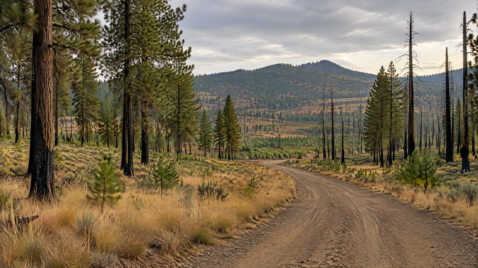
A fire perimeter can look quiet while still holding real, uneven risks. At the reference time, the incident information identified weakened or falling trees, ash pits, burning material in the fire interior, unstable logs and rocks, and visible smoke from interior burning. Wind was specifically identified as a condition that can strain weakened trees and could fan embers into unburned fuel.
These points should be read as reasons for caution, not as a catalogue of spectacle. The practical consequence is that a visitor should not assume a familiar surface or forest edge behaves as it did before the fire. A standing tree can be compromised without looking obviously different from a distance. A log, bank or patch of ash can be less stable than it appears. Interior burning and smoke are signs to retain distance and awareness, not subjects for closer inspection.
Weather changes the margin
Dry and windy conditions can narrow the margin for a casual outdoor plan. Rain can also change footing, visibility and the character of disturbed ground. Do not use a closure lift as a substitute for checking the day’s conditions and deciding in advance what will make the group leave. The broader planning principles in the autumn mountain weather guide are relevant even when the destination is not a high summit: a weather check is most useful when it changes a decision before exposure rises.
Visible smoke is not, by itself, a map of where it is safe to go or a guarantee of renewed fire activity. It is a cue to remain alert, avoid drifting toward an interior burn area and reassess whether the purpose of the outing still justifies being there.
Stage 1 is a separate rule, not a footnote
Status at reference time — 12 September 2026, 08:56 PDT: Stage 1 fire restrictions remained in effect on the relevant federal lands. The incident update says these restrictions prohibit activities such as campfires and warming fires, with an exception stated for designated developed campgrounds. The current forest alert inventory also listed Stage 1 restrictions, including limits on open fires, wood stoves and charcoal briquette fires outside specified designated developed campgrounds.
This is distinct from the lifted emergency closures. One rule addresses whether the public may enter the fire areas; the other regulates activities that can create another ignition. The first rule changing does not erase the second. A person who can legally enter public land may still be prohibited from lighting a campfire or warming fire at the chosen location.
The exception is narrow and should not be stretched. It does not say every developed campground is open, that every campground is a designated exception, or that dispersed camping has the same allowance. It also does not turn a campground listing into confirmation of current operating conditions. Treat the restriction as a separate check, tied to the exact place and day.
Site-specific limits can outlast a complex-wide lift
The current forest alert inventory separately listed Wiley Flat Campground as closed because of hazards and hazardous conditions associated with the Wiley Flat fire. Its closure covers developed sites, roads, trails and facilities within the campground boundary. That separate alert illustrates the central lesson of this reopening: a broad lift and a local closure can coexist without contradiction.
A campground, road or trail has its own status. Do not infer that a site is open because the Rowe Creek-area emergency closures lifted; likewise, do not infer that a site alert describes every nearby location. Before leaving, compare the exact destination with the current responsible land-manager order and map, then check for current forest alerts. This report does not verify the condition or availability of any other named facility, road or trail.
Avoid turning recovery into a route challenge
A current map is a decision tool, not an invitation to find a way around a work area. If a route appears uncertain, it is better to choose a different day or a different destination than to improvise across disturbed ground, pass barriers or look for an unofficial bypass. The wildfire and smoke travel decision framework offers a useful sequence: establish authority, assess access, consider exposure, and ask whether the trip still has a responsible purpose.
A low-impact return decision sequence
A careful visit after a closure lift begins with a modest objective: observe the rules, avoid interfering with repair and retain the ability to leave. The following checklist is designed for that purpose. It is not a route plan and cannot replace a current local order.
Practical checklist
- [ ] Confirm the exact place. Match the intended road, trailhead, campground or parcel to the current responsible land-manager order and map; do not rely on the name of the wider fire area.
- [ ] Read separate alerts. Check for site-specific closures or hazardous-condition notices, including alerts that remain active after the emergency lift.
- [ ] Treat Stage 1 as an independent rule. Plan no campfire or warming fire unless the exact location is a designated developed-campground exception and is currently open.
- [ ] Choose a reversible day. Carry enough time, fuel, water and energy to turn around without forcing a late exit or an improvised overnight stay.
- [ ] Set a weather and hazard stop rule. Decide beforehand to leave if wind strengthens, smoke increases, repair activity blocks the intended access, or the terrain no longer feels reliable.
- [ ] Give crews a wide berth. Do not enter work areas, stop beside active equipment, fly a drone, or seek a closer view of burned ground or interior smoke.
- [ ] Leave the landscape lighter. Pack out everything, respect closures and private-property boundaries, and avoid adding noise, traffic or demand to a community and workforce in recovery.
The checklist is intentionally conservative because the closure lift does not remove uncertainty. A plan that is easy to shorten is generally more responsible than one that depends on reaching a particular site. For a wider guide to that conduct, see community respect and visitor etiquette.
Accessibility, hunting-season and group planning
The reported hazards and repair conditions have different consequences for different visitors. Uneven or recently disturbed ground, a long wait near equipment, windblown dust or smoke, and a change in access can be harder for people managing limited mobility, fatigue, respiratory sensitivity, medication timing or a need for predictable facilities. A group should make those needs part of the go/no-go decision, rather than expecting one member to absorb the risk after arrival.
For mixed-ability groups, identify an exit option before setting out and avoid a plan that requires everyone to continue at the same pace. Bring the supplies that make an early return uneventful. If hunting-season activity is part of the wider setting, additional movement, vehicles and visitors can make space and visibility even more important; the closure lift does not grant priority over workers, other lawful users or recovery operations.
No single article can measure a site’s accessibility after a fire. The most honest choice is to keep the destination flexible and decline an outing when a safe, low-stress exit is not clear.
Verification note: a status report, not a standing permission slip
Publication-day verification — 12 September 2026, approximately 12:02 PDT: The closure-lift bulletin, the 08:56 PDT incident update and the official forest alert inventory were reopened for this report. They supported the stated emergency closure lift, continuing repair and hazard language, continuing Stage 1 restrictions, and the separately listed Wiley Flat Campground closure at that check.
Conditions, orders and local work can change after that time. Recheck the current responsible land-manager information immediately before a long drive, any visit to a remote site or an overnight plan. If the current order, map or alert conflicts with this dated report, the current direction governs. For related, time-stamped coverage, visit Field Notes.