When to Go
Autumn in the Mountains: Clear Skies, Shorter Days, Faster Changes
A clear autumn morning can conceal a short usable-light window, colder exposed ground and conditions that change by height; use a smaller, flexible plan with defined margins.
Expanded evergreen planning guide
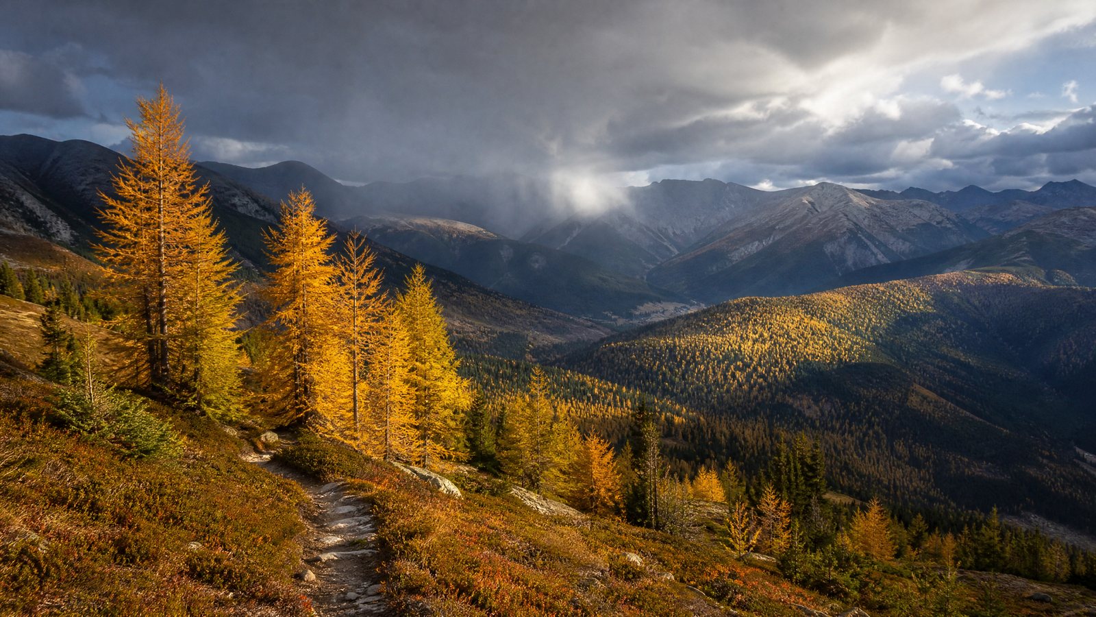
Autumn mountain travel works best as a conditional outing, not a summit appointment. Clear air and quieter paths can be appealing, yet the season can compress usable light, expand the temperature range between valley and ridge, and bring wet ground, early ice or a faster weather change. Choose an objective whose difficulty can shrink without spoiling the day.
Match the route to the least favourable credible condition, rather than to the most attractive forecast symbol. This guide is for walkers and hikers choosing a day outing on marked or familiar mountain terrain. It is not a substitute for local safety advice, professional instruction, or technical competence on snow, ice, steep ground or complex navigation. For a broader approach to travelling with time to adapt, see RAAHCHAL’s slow-travel collection.
The autumn mountain problem is a margin problem
A margin is capacity left over after the plan: time before darkness, warmth after a stop, energy for a slower descent, navigation attention if cloud arrives, and access flexibility. Autumn makes each margin more valuable because modest problems can combine. Wind slows walking and cools exposed skin; rain makes rock, roots and leaves slippery; cloud can remove landmarks; and a delay can move a descent into poor light.
Mountain conditions are also vertical. A town forecast may describe the valley while the route crosses colder, windier, cloudier ground. Aspect—the compass direction a slope faces—affects sunlight and surface condition; a shaded slope can hold frost or snow longer than an open slope nearby. It does not replace a current local report.
Avoid plans that require every favourable detail to occur. A modest out-and-back to a viewpoint, a lower loop with clear junctions, or a path with a natural turnback point can be a strong autumn choice. A long ridge needing dry rock, a precise weather gap and a late return has less resilience. The difference is fit, not ambition.
Build a usable-light budget, not a daylight fantasy
Sunrise and sunset are useful only when tied to the exact date and place. They do not describe how bright a forest, gully, cloud-covered slope or late descent will feel. The usable-light window is when the group can move and navigate confidently on its actual terrain; it is usually shorter than the printed interval between sunrise and sunset.
Work backwards from a conservative return time, leaving a buffer for slower footing, layers, route checks and retreat. Then set the outward limit. Carry a reliable light source for an unexpected delay, but plan to finish before it is needed. Enlarge the buffer for indistinct junctions, steep descent, dense trees or remote ground rather than treating twilight as normal walking time.
Make time visible to the whole group
Before setting out, agree a review time, a turnaround time and a latest comfortable return. At review, ask whether pace, weather and energy still support the plan. At turnaround, everyone turns regardless of how near the objective appears. The return time protects the final margin. Keeping the decisions separate avoids postponing all of them until the view is almost reached.
For example, a pair may choose a lake on a broad trail, with a signed junction as the automatic turnback point. If cloud lowers first, they return or take the shorter loop. This is more robust than a route whose only satisfying ending is a distant summit. The same logic complements a rest-day approach to travel: recovering time is part of a good plan.
Read the mountain forecast as a vertical picture
A specialist mountain forecast separates conditions by height and time. Read wind speed and gusts, temperature and apparent temperature, precipitation type and timing, cloud, visibility, freezing level, hazards, and confidence together. No one line gives permission for a route. A table generally represents typical exposed conditions; terrain can change them locally.
Apparent temperature reflects how cold conditions feel, often accounting for wind. A mild-looking air temperature can be uncomfortable when movement stops on an exposed ridge. Freezing level is the approximate height above which snow may settle or ground may be frozen. It does not make every metre below ice-free or every metre above identical: shade, overnight cooling and aspect can change the surface underfoot.
Cloud needs an operational reading. Low cloud is not merely a missed panorama; it can remove the landmarks that make a route simple. If the group would have to navigate by contour, bearing or terrain interpretation without confident skills, choose lower, clearer or more waymarked ground. Visibility is clarity through air outside cloud; once inside it, navigation is a different task.
Treat confidence as route information
Forecast confidence describes uncertainty, such as a front’s timing or position. It should change route selection. High confidence in calm, dry conditions can justify a more committing objective only if light, surface, access and capability also fit. Lower confidence calls for close exits, straightforward navigation and a shorter return. How far ahead weather is useful offers a companion way to think about a forecast’s changing value before departure.
Wind can alter balance on uneven ground, make a stop cold and create stronger conditions at ridges or gaps than at a sheltered start. Persistent rain can reduce visibility, soak layers, slow footing and raise water at crossings. A route reasonable in one condition may not be when several coincide.
Use the MARGIN test before choosing the objective
Use this article-specific MARGIN test on the evening before and again before departure. A “no” on any non-negotiable item means choosing the easier alternative or avoiding that terrain. It turns scattered information into a route decision.
| MARGIN question | What a sound answer looks like | If the answer is uncertain or no |
|---|---|---|
| M — Map and route | The group understands junctions, descent, terrain and a shorter option. | Choose a clearly waymarked lower route or defer. |
| A — Altitude and exposure | Forecast conditions by height fit the group’s skills, clothing and footing. | Avoid high, exposed, icy or wind-prone ground. |
| R — Return light | The expected return leaves a meaningful usable-light buffer. | Reduce distance, start earlier if appropriate, or select another day. |
| G — Group capacity | The slowest member can travel, pause and retreat warmly and confidently. | Scale the route to that person, not the strongest walker. |
| I — Information is current | Local official channels show the approach and route are open and compatible with the plan. | Do not assume an older description still applies. |
| N — Non-negotiable triggers | Turnback conditions and communication are agreed before the start. | Name them now; if agreement is missing, choose a simpler outing. |
This framework suits independent walkers who can adjust aims and carry navigation, clothing and food. It is less suitable when the only acceptable experience depends on a fixed high objective, narrow access window or complex route beyond present skills. Change the outing instead: a valley walk, lower woodland path or time in a mountain community can preserve seasonal interest without pretending conditions are optional.
Design a route that can turn around cleanly
Turning around is easier when designed into the route. Choose an objective with a point where return is simple: a bridge before a crossing, junction before exposed ground, viewpoint below cloud-prone terrain, or lake before the route steepens. Name a Plan B needing fewer assumptions than a complicated detour.
Set triggers before walking in language the group can apply: cloud below navigation comfort, unreliable-feeling gusts, repeated slips, water covering a crossing, a closure, a cold member, or pace consuming the light buffer. Their purpose is to remove negotiation when fatigue and attachment make judgment worse.
Use a simple sequence: continue only while conditions and margins match the plan; shorten when one weakens; return at a non-negotiable trigger. An early return on dry, familiar ground is easier than a late retreat after visibility, warmth and confidence decline.
Navigate for the condition you may meet
Carry tools that do not depend on one phone. A paper map, compass and offline mapping device can complement each other, but only familiar tools help. Protect electronics from rain and cold, conserve battery, and make sure another person understands the route and alternative.
Navigation complexity is a trade-off, not a badge of experience. A path easy in sun can become demanding when cloud removes references or rain obscures tread. New mountain walkers, families and people with limited tolerance for uneven ground may be better served by a short, well-signed route with frequent places to stop or reverse. Experience does not remove the need for light, weather and surface margins.
Dress and pack for stopping as well as moving
Layering is an active system, not simply wearing more. Start with a moisture-managing base, add insulation for pauses, and use an outer layer that resists wind and rain. Adjust before sweat builds; wet clothing cools quickly when pace slows. Keep insulation and spare socks dry. A warm hat and gloves matter when wind or rain arrives.
Hypothermia—dangerously low body temperature—can occur in cool conditions when rain, sweat or cold water chills a person. As temperature falls, thinking and movement can be affected, weakening self-assessment. Watch for someone unusually cold, tired, clumsy, confused or unable to warm up. Move toward shelter, add dry insulation, remove wet clothing if safe, and seek urgent local emergency help for suspected hypothermia.
Footwear should match the surface, not the photograph. A treaded, closed shoe or boot may help on wet leaves, mud and uneven trail, but it does not make ice, steep wet rock or a swollen crossing routine. Carry food and water plus a reserve: hunger, fatigue and a slow return reduce warmth and judgment. A small first-aid kit, whistle, emergency shelter and light source may suit remote routes; know their limits and use.
Let wet ground, ice and water reset the plan
Autumn surfaces often change more than their appearance suggests. Leaf cover can hide roots, holes or slick rock. Mud can slow every step and widen a path when people walk around it. Frost can form in shade even after a pleasant start. Early snow can conceal the trail and cover ice rather than remove it. None of these conditions has a universal equipment answer because consequences depend on gradient, runout, skill and the ability to retreat.
A runout is the terrain below a slip or fall: a gentle grassy slope has different consequences from rocks, water or a drop. If a short icy stretch sits above serious ground, turning around may be the only sensible choice for a non-specialist group. Traction aids are not a substitute for assessed conditions, sound footwear, balance or the ability to use them. Do not step onto snow, ice or steep ground simply because others have left prints.
Treat water crossings as live decisions. Rain can alter depth, speed and the stability of stones or bridges. A crossing that was ordinary on a route description may not be suitable now. Do not improvise a crossing around a closure, and do not let the far side become a reason to continue when a retreat is safer. Current local trail information is particularly important after rain, wind or an early cold spell.
Access, closures and care for the mountain are part of the route
An approach road, transit connection, car park, gate, seasonal facility, bridge, trail section or protected area rule can change independently of the weather forecast. Official reports from mountain managers repeatedly make this point: a current condition report is a guide, not a promise that conditions will be identical by arrival. Confirm the relevant local or official channel close to departure and respect a closure, barrier or reroute without looking for a way around it.
The route should also work for the place. Stay on designated paths and use a stated diversion only when local guidance directs it. On fragile alpine ground, stepping off trail can damage vegetation that recovers slowly. On muddy paths, widening the tread can create further erosion. Leave what is there, carry out waste, make room on narrow sections, and keep noise modest. These practices are particularly important in autumn, when wet ground and seasonal wildlife or conservation measures may limit where people can go.
Accessibility needs a similarly specific approach. “Easy” is not a complete description for someone using mobility equipment, managing a sensory need, recovering from illness, travelling with a child, or avoiding exposed edges. Ask the local manager about the actual surface, gradient, width, barriers, accessible facilities and current disruptions. A lower, accessible route may offer a better autumn day than a nominally short mountain trail whose surface or weather leaves little room for adjustment. The principles in walkable-neighbourhood travel planning transfer well: identify the conditions that make movement workable for the person who will actually be moving.
Make the group plan explicit before reception fades
Tell a responsible person the route, start point, intended alternative, expected return and when to raise concern. Share enough detail to distinguish a late finish from a serious problem. Within the group, decide who carries navigation, who has emergency contact details, and how the group will remain together when pace differs. Do this while communication is easy rather than assuming mobile reception will appear when needed.
The slowest or least comfortable person sets the scope. That does not diminish the stronger walker’s experience; it prevents pressure from turning a shared day into a private endurance test. Children may cool rapidly when stopped and may not describe cold or fatigue clearly. A group that includes them benefits from shorter stages, warm breaks, simple junctions and a quick return option. This is consistent with the broader pacing advice in slow travel with children.
If thunder is heard, leave exposed outdoor terrain and move to a genuinely safe enclosed shelter or hard-topped vehicle when available. There is no safe place outside while thunderstorms are nearby. Do not use a lone tree, open shelter or ridge as a substitute. A forecast that includes thunderstorms should therefore change the day before the group reaches exposed ground, not after.
What this guide cannot tell you: current confirmation
This page provides durable planning principles. It cannot state whether a particular trail is open, whether snow or ice is present, where cloud will sit, whether a crossing is passable, when a local transport service runs, or what warnings apply on a specific day. Those facts change with location, elevation, weather, maintenance, conservation action and emergency response.
Confirm these items through the relevant local or official channel on the evening before and again before leaving:
- the mountain forecast at the route’s elevations, including wind, gusts, cloud, precipitation, freezing level, hazards and confidence;
- local warnings, fire or smoke conditions where relevant, and any thunderstorm risk;
- trail, road, bridge, transport and facility status, plus protected-area restrictions;
- recent surface information on snow, ice, mud, falling trees and water crossings;
- sunrise, sunset and the group’s usable-light return buffer; and
- how the group will contact emergency services in that area if needed.
Use this compact check as a decision aid, not a source of false certainty. It is entirely reasonable to reach the trailhead and choose the lower alternative after observing stronger wind, colder air or less visibility than expected. That is good field judgment.
Conclusion: make the smaller plan the successful plan
A sound autumn mountain day finishes with warmth, light and attention in reserve. Begin with a height-aware forecast and local status check, then apply the MARGIN test to choose an aim that can become shorter without becoming disappointing. Protect the return with a time limit, carry what the stop as well as the walk requires, and turn back when the agreed trigger appears.
Clear skies remain worth enjoying, but they are only one part of the decision. When the day is designed for changing light, wind, surface and access, the mountain does not have to behave perfectly for the outing to be worthwhile. For related seasonal choices, explore RAAHCHAL’s seasonal journal.