Slow Travel
How to Choose a Walkable Neighbourhood Before You Arrive
Choose a neighbourhood for ordinary life on foot, not proximity alone: test daily needs, route continuity, terrain, transit, heat, accessibility and the evening return.
Expanded evergreen planning guide
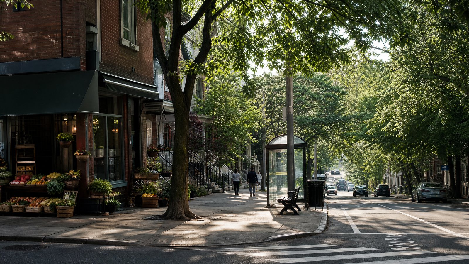
A walkable neighbourhood is not simply one with cafés, landmarks or a favourable distance label. It is a place where the trips you will repeat can happen on foot with tolerable effort, legible routes and workable timing: breakfast, water, transit, a midday pause and a return after dinner. For slow travel, this everyday competence matters more than proximity to an attraction. It gives the day room to change without turning each errand into a transport problem.
Walkability has no universal score that settles a travel decision. It depends on the person, trip purpose, street conditions and time of day. A steep historic lane may suit a fit traveller with a day bag and frustrate someone with a rolling case, a toddler, fatigue or a mobility device. This guide treats it as a fit assessment, not a verdict on a neighbourhood. It develops the wider ideas in RAAHCHAL’s slow-travel collection for the precise task of choosing a base.
Define the walking your stay requires
Name the three or four walks that would make the stay easier. “I like to walk” is too broad. List a morning food run, transit connection, low-effort lunch, evening return or place to sit when weather turns. Include the usual load: groceries, luggage, a pushchair, a cane, or a small bag.
Connected routes and nearby everyday destinations work together. A shop is useful only if its approach is usable; a smooth pavement helps little if necessities lie elsewhere. Ask not “Can I walk here once?” but “Can I complete the ordinary loop tomorrow without disproportionate effort?” A spacious trip built around one city over seven days can reduce the pressure to cover distance. A transit-heavy itinerary makes pedestrian access to a stop more important than one lively street.
Begin with an ordinary-day circuit
Use an imagined circuit, not a list of sights. Leave after waking, obtain breakfast and water, locate a simple food shop or pharmacy if relevant, and return. Add a second circuit from the door to the stop you would use most. This is not a universal distance rule. It reveals where a short trip becomes difficult.
Describe the circuit in sequence: exit, pavement, crossing, destination, reverse route. “Central,” “minutes from everything,” and “near transport” leave the decisive part unanswered. Seek detail on steps, fast roads, underpasses, awkward junctions and midday exposure.
Choose three essentials, not ten attractions
Choose essentials for your routine. They may be a food shop, transit stop and casual meal; or a pharmacy, bench and early breakfast. A family may put a calm crossing, snack stop and short nap return first. Someone working remotely may value a low-friction coffee stop and errand route over nightlife.
Look for enough fallback, not every amenity. If breakfast is closed, can the morning proceed without a major detour? If groceries are uphill, is the loaded return realistic? A less celebrated district can be an excellent base when it handles small disruptions. The principle also supports slow travel on a budget: routine ease can limit effort-driven choices without making price claims.
Test two time windows
Run the circuit for morning and for the likely return time. Morning exposes opening patterns, school traffic and deliveries. The later test exposes darkness, shuttered shops and a different transit approach. Treat unstated hours as unknown. Markets may be morning-only and residential streets may become quiet early; ask which essential opens earliest, closes first and has a continuous walking route.
Read the route, not the pin
A straight-line marker conceals the journey. Route continuity means that the walking path stays connected and usable from origin to destination instead of ending at a carriageway, stairway, construction barrier or private entrance. A place opposite a destination can still be a poor base if the legal crossing is distant.
Check the exit, first pavement, crossing, bridge or rail line, final block and return. Pedestrian guidance identifies surface, width, obstructions, separation from moving traffic, lighting and signs as material to transit access. A traveller need not conduct an engineering audit, but should ask: can two people pass, can wheels move over the surface, is the path blocked, and is the crossing apparent?
Photographs and descriptions are evidence of a moment, not proof of a route. Value observations such as “pavement on both sides,” “one marked crossing,” “stairs at the final approach,” or “works at the corner.” If accounts conflict, mark the route unresolved.
Treat terrain as effort, not scenery
Words such as “hilltop,” “upper town,” “terraced,” “waterfront below,” “cobbled,” “laneway,” “ridge” and “pedestrian zone” should prompt questions, not automatic rejection. The issue is where a slope sits in the day and whether the return, often with bags or tired legs, remains manageable.
Dinner downhill can mean an uphill return. A car-free quarter can be calm yet awkward with luggage if its final approach has steps or uneven paving. Cobblestones may be tiring, wet-weather slippery and difficult for small wheels. A long shallow incline may suit one person more than a short steep stair route; the reverse can also hold. Ask for the location of the incline, number of steps, continuous pavement, handrails and an alternative route. Travellers with luggage, limited stamina, young children, reduced balance or wheeled equipment often need a flatter, smoother, direct base; others may willingly trade effort for quiet or views.
Map daily needs and pauses
A mixed-use neighbourhood combines homes with services such as food shops, meals, pharmacies, parks or transit. It can shorten routine trips, but does not mean every service fits your hours. Separate “nearby” from “available when needed.” A morning bakery does not solve a late-arrival meal; a restaurant street does not necessarily offer water, seating or groceries.
Build pauses into the test. A rest point is somewhere to sit, use a toilet where available, leave difficult weather, refill water where locally provided, or stop without pushing on. Benches, shade, public facilities, indoor intervals and low-effort meals can make a demanding route manageable. They matter most to people pacing fatigue or travelling with children.
Neighbourhoods are lived places, not visitor scenery. Keep doorways clear, keep voices appropriate to the street and do not use small shops or residential entrances as photo backdrops. For a related way to enter local routines respectfully, see market mornings and local routines.
Assess transit as a complete walking chain
Transit proximity works only when the whole connection works: door, path, crossing, stop or station, waiting area, vehicle, then the reverse sequence. Transport guidance treats paths, crossings and stop approaches as material alongside service. A close stop may still be divided by a missing pavement, multi-lane junction, rail barrier or steep final block.
For the likely stop, establish whether the approach is direct and the waiting place suits your needs. These can include a level surface, room to wait, shelter, seating, signs or a step-free entrance. A station icon does not show that every entrance is open, lifts are operating or platforms avoid stairs. Conversely, a simple stop on a continuous route may serve a slow-travel base well.
Match the threshold to the trip. A solo traveller may welcome several longer options. Someone needing step-free access, carrying a child or leaving early may need a short, predictable approach. If transit is the fallback in rain, heat or fatigue, examine the return especially closely. Train journeys versus short flights considers a wider transport choice; this decision still rests on the last walk.
Plan for thermal exposure and weather
Distance does not capture walking effort in heat, cold, rain or wind. Paved surfaces and dense buildings can retain heat, while trees and vegetation can shade surfaces and contribute cooling. Thus a short exposed crossing may feel more demanding than a longer route with shade and a pause. Heat can worsen existing health conditions, making exposure a central criterion for travellers with higher sensitivity.
Look for a pattern of protection: shade on the likely side of the street, awnings or arcades, a park route, covered waiting space, indoor pauses and a way to change plans. The trade-off is seasonal. A lane welcome in strong sun can feel damp, slippery or dark after rain; an exposed waterfront can be enjoyable in mild weather and punishing in wind. RAAHCHAL’s seasonal-travel collection places this local judgement within broader trip timing.
Make accessibility personal and explicit
Accessibility is part of walkability. A pedestrian access route is described in public-right-of-way guidance as a continuous, unobstructed route usable by pedestrians with disabilities. Its lived usefulness depends on surfaces, width, gradients, kerbs, crossings, doors, toilets, seating, sensory conditions and personal equipment or support needs. A formal standard, where it applies, cannot settle how comfortable a route will be for each person.
Ask the functional question. A wheelchair user may need step-free entrances, kerb-ramp, gradient and obstruction detail. A traveller with low vision may need legible wayfinding and predictable crossings. A person with chronic pain or fatigue may need seating, shade, short segments and reliable alternatives. A pushchair can meet many of the same surface and stair barriers.
Set personal non-negotiables
Write decision gates before comparing areas: “no stairs from door to transit,” “one seated pause on the food route,” “no long exposed crossing,” or “a practical return if energy drops.” Request facts—number of steps, lift status, surface type, legal crossing distance and level entrance—rather than a broad assurance. If a detail is unclear, do not convert “accessible area” into a promise that your exact route will suit. Slow travel with children applies the same reduction of needless transitions to family trips.
Judge the evening return and local rhythm
Lighting helps pedestrians see surroundings and trip hazards and can aid confidence at a crossing. It cannot certify personal safety, prevent every hazard or establish that lights will work tonight. Ask instead: “Can I recognise and walk this route after dark?” Conditions, works, crowds, maintenance and individual risk vary.
Inspect route edges: blank walls, uneven paving, unlit steps, underpasses, fast-traffic crossings, building works and poorly placed furniture. An evening return should be familiar before you rely on it in lower light. School arrivals, worship times, markets, deliveries, sporting events and nightlife also affect noise, pavement space and transit demand. None automatically disqualifies an area; match the pattern to your day. A lively evening may suit nearby meals and not a light sleeper or family seeking early rest. Designing rest days can provide recovery when terrain or climate raises daily effort.
Use the Five-Loop Fit Test before choosing
The Five-Loop Fit Test turns fragments of information into a decision without assigning neighbourhoods a league-table position. Mark each loop clear, needs confirmation or poor fit. “Clear” means the likely trip and trade-off are understood, not flawless. “Needs confirmation” means a missing detail could change the result. “Poor fit” means a known route conflicts with a non-negotiable.
| Loop | Question | Clear evidence | Warning sign | Who may set a higher bar |
|---|---|---|---|---|
| Essentials | Can I complete a morning and evening errand loop? | Food, water and a basic meal have usable routes and plausible timing. | Only attractions are described; hours or return route are unclear. | Families, late arrivals, people pacing energy. |
| Route continuity | Does the path remain walkable from door to destination? | Pavement, crossing and final approach have no concealed break. | Stairs, hostile junction, barriers or missing path interrupt it. | Wheelchair or pushchair users; travellers with luggage. |
| Terrain | What is the outward and return effort? | Slope, surface and steps are known, including loaded return. | “Historic” or “hilltop” replaces route detail. | People with balance, pain or stamina constraints. |
| Transit | Can I reach, wait for and return from the useful stop? | Stop approach and return are practical for your needs. | Nearby icon is the only evidence; access features are assumed. | Early departures, step-free travellers, bad-weather fallback users. |
| Conditions | Will weather or evening conditions alter the route? | Shade, shelter, pauses and lower-light legibility are considered. | Route is exposed, slippery, unfamiliar or uncertain after dark. | Heat-sensitive travellers, children, cautious walkers. |
Apply two decision gates
Essentials and route continuity are gates, not compensations. An attractive street cannot offset a daily food route you cannot use or a required crossing that conflicts with your needs. Then give any poor fit on a non-negotiable more weight than optional advantages. This avoids choosing by a single strong photograph or landmark.
Where candidates are close, favour fewer irreversible frictions: fewer compulsory steps, a clearer crossing, a protected heat route or a forgiving transit fallback. A quieter area with a complete ordinary circuit may support a more satisfying slow-travel week than a celebrated district that imposes a hard climb whenever you need something simple.
Confirm changing conditions, then walk lightly on day one
Terrain, street pattern, crossing positions, rail barriers and the broad destination mix are relatively durable. Public-transport routes and final services, closures, works, lift or escalator status, business hours, weather, heat alerts, air quality, daylight, events and temporary access restrictions are not. Confirm these close to travel through the relevant local or official channel. Do not rely on an old photograph, undated review or broad assurance.
On arrival, keep the first day light. Walk the essential circuit in daylight, identify a pause, note the practical crossing and try the transit approach before relying on it after dark. Streets are living systems; if the route differs materially from the evidence, change plans early rather than repeatedly forcing an unsuitable walk.
Compact arrival checklist
- Walk the food-and-water loop in daylight.
- Identify the legal crossing, not only the nearest visible route.
- Note steps, uneven surfaces, missing kerb ramps and temporary obstructions.
- Locate one low-effort pause for weather, fatigue or a child’s break.
- Test the door-to-transit chain and return approach.
- Learn the route back before lower light changes its appearance.
- Check current local notices for service, weather and access changes.
Choose the base that makes ordinary life easier
Choose the neighbourhood that lets your actual routine happen with the least avoidable friction, not the one that makes the boldest centrality claim. The right fit may be flat and practical, shaded and mixed-use, or farther out with a clear transit chain. It may also be a hillside quarter whose effort you understand and welcome. The distinction is informed trade-off rather than hidden difficulty.
Slow travel gains depth when errands, pauses and returns become part of a place rather than obstacles amid planned experiences. Apply the ordinary-day circuit, protect non-negotiables and confirm what can change. Then arrive with a light first day and let walking serve the trip’s rhythm rather than dictate it.